
smalltext*

Project idea
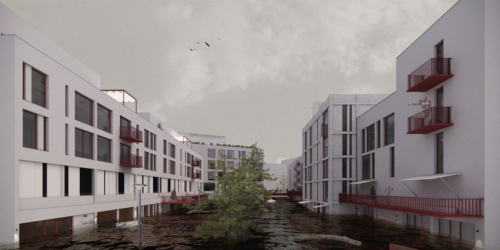
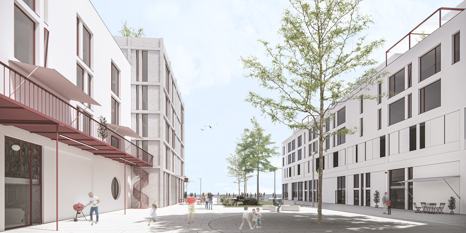
The project is a conceptual urban design that brings new housing typologies to a developing coastal area of Edinburgh, while establishing a critical precedent for other cities dealing with high flood risks and rising sea levels. The concept directly responds to the socio-economic disparities and high deprivation index within the Leith district. Instead of avoiding the problem, I deliberately adopt a hypothetical NASA scenario predicting a sea-level rise of over two meters. The architecture itself acts as a critical mirror to society; it fundamentally flips Balzac's classic imagery of Paris, where the poor occupied the top floors. By placing affordable housing on the lowest, flood-vulnerable levels, the project serves as a conceptual critique of gentrification, inequality, and human vulnerability in the face of inevitable environmental shifts.
Project description
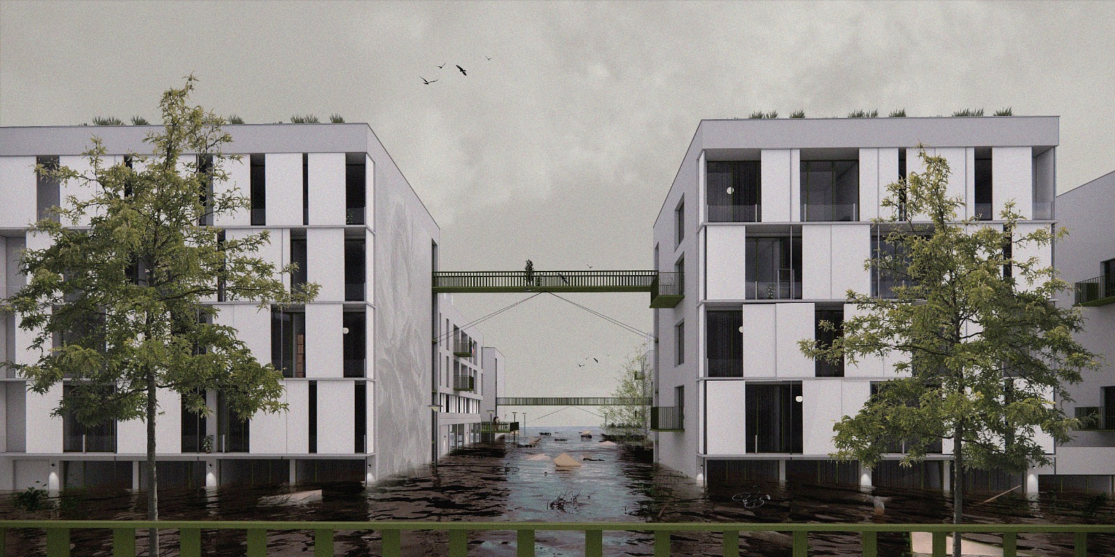
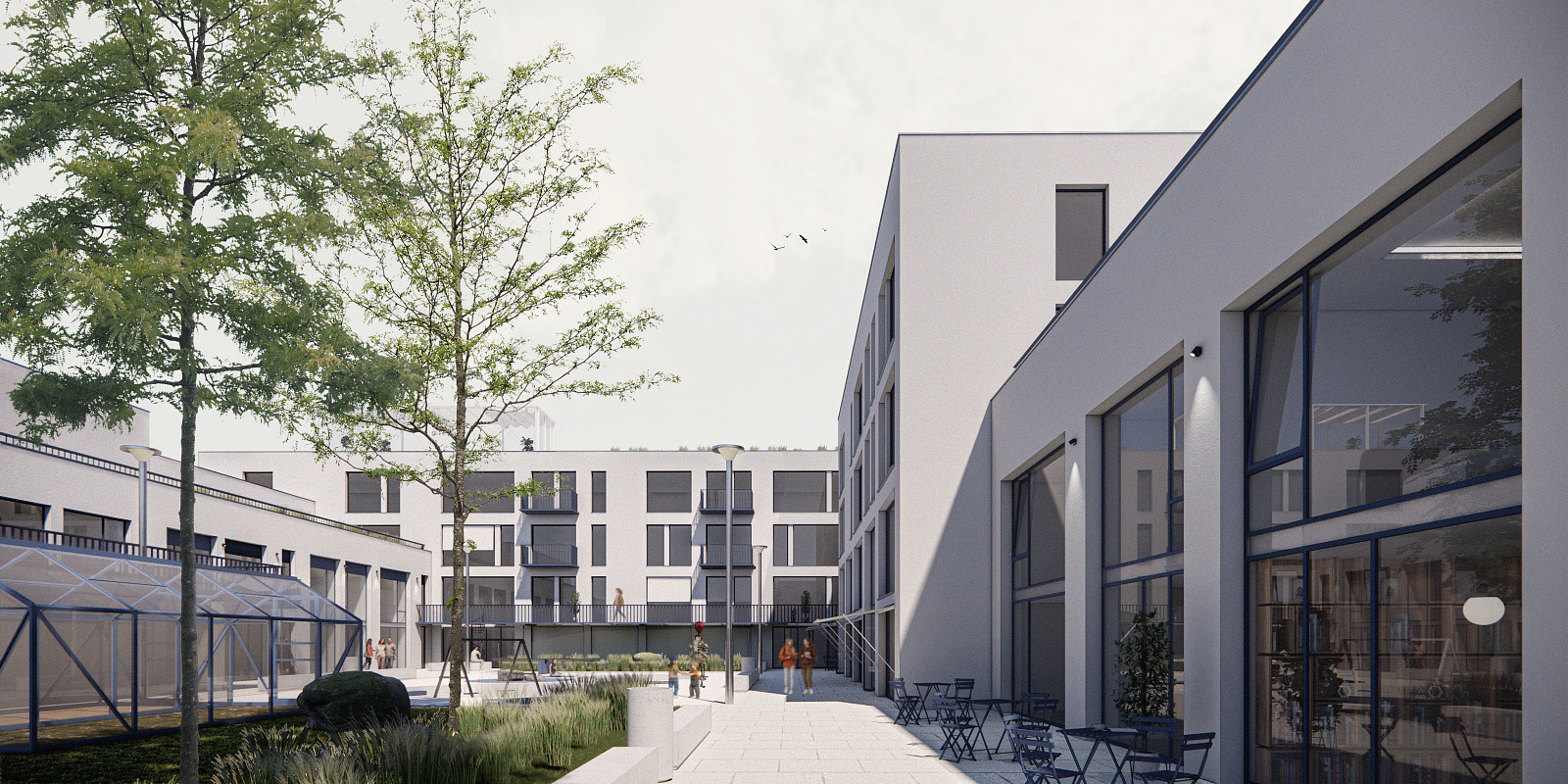
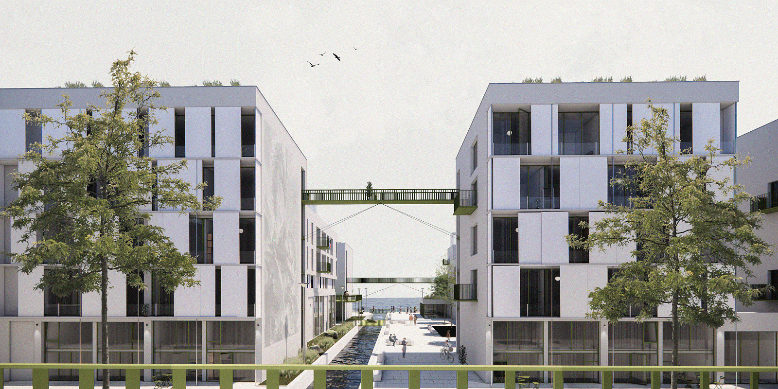
The design is situated in Western Harbour, a waterfront area in the northern part of Leith, Edinburgh. The site is uniquely embraced by the sea on three sides, yet well-integrated into the city's transport fabric through direct bus and tram links. Drawing from the existing urban grain, the resulting master plan introduces 6 to 7-story residential blocks featuring heavily elevated interior courtyards as a direct spatial reaction to the flood risks. Vertically, I have structured the blocks into three distinct zones: the first two floors are dedicated to affordable units, the third floor operates as an elevated infrastructural "buffer zone" for parking and primary access, and the upper floors host premium apartments. At the very center of the peninsula, I designed a major sunken park that doubles as an urban retention basin and houses a localized hydroelectric plant.
Technical information
The master plan is located in Western Harbour (Leith, Edinburgh) and comprises a grid of 6 to 7-story residential blocks engineered around a strict 2050 NASA flood model predicting a critical 2-meter storm-surge sea level rise. At the core of the infrastructure is a central park sunken 8 meters below the surrounding grade, structurally stabilized by a base construction mesh and lateral Larsen sheet piling to function as a large-scale retention basin. A small-scale hydroelectric power plant is integrated on the southern edge of this basin to harvest energy from captured floodwaters. To ensure safety, the architectural section isolates the lower two floors of affordable housing as sacrificial flood zones, shifting all primary vehicular and pedestrian circulation to an elevated 3rd-floor structural "buffer zone." This buffer level contains all residential parking and the single, winding access road that connects the entire peninsula back to the wider urban infrastructure, including the city bypass, bus line 11, and the local tram network.
Documentation
Copyright © 2026 INSPIRELI | All rights reserved. Use of this website signifies your agreement to the Terms of Use, Privacy Policy, and use of cookies.