Ujana Peremba: The Reticulated Hydro-Bioclimatic Pulse

Project idea
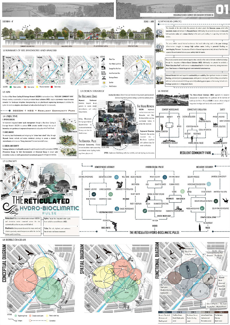
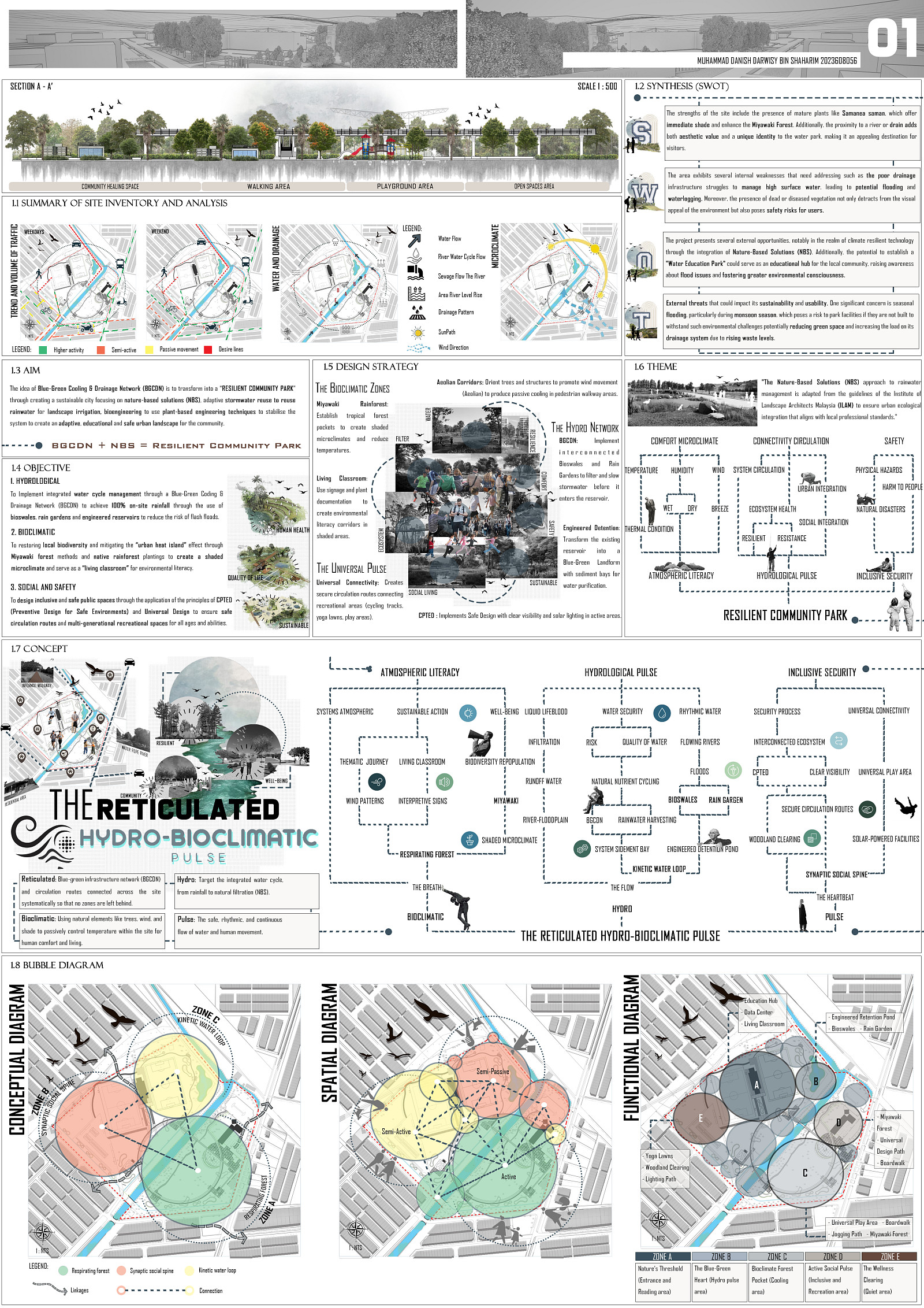
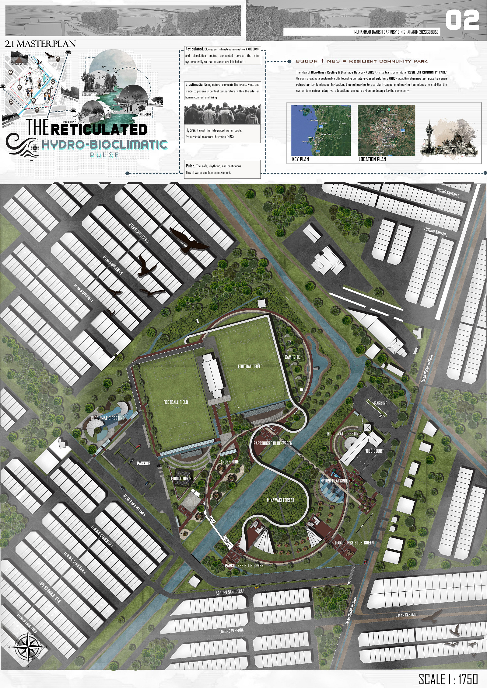
The core philosophy of this project is to convert a climate-vulnerable urban park into a highly adaptive “Resilient Community Park”. The design is inspired by the concept of “The Reticulated Hydro-Bioclimatic Pulse” and imagines a living infrastructure in which advanced water management (Hydro) and passive ecological cooling (Bioclimatic) function as a synchronised pulse to protect and empower the local community.
Given the rise of flash flood risks and Urban Heat Island (UHI) effects in cities, this project challenges the traditional division between grey infrastructure and public recreation. It shows that Nature-Based Solutions (NBS), such as ecological drainage and rapid afforestation, can be the very basis for an inclusive, secure and aesthetically pleasing communal space. Ujana Peremba is not just a park; it is a living, vital urban nexus that heals the fractured relationship between human homes and natural ecosystems.
Project description
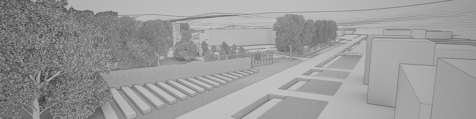
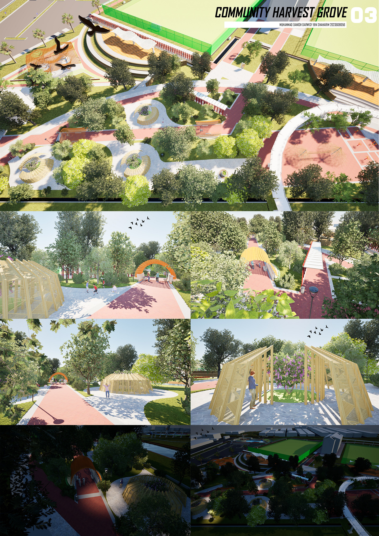
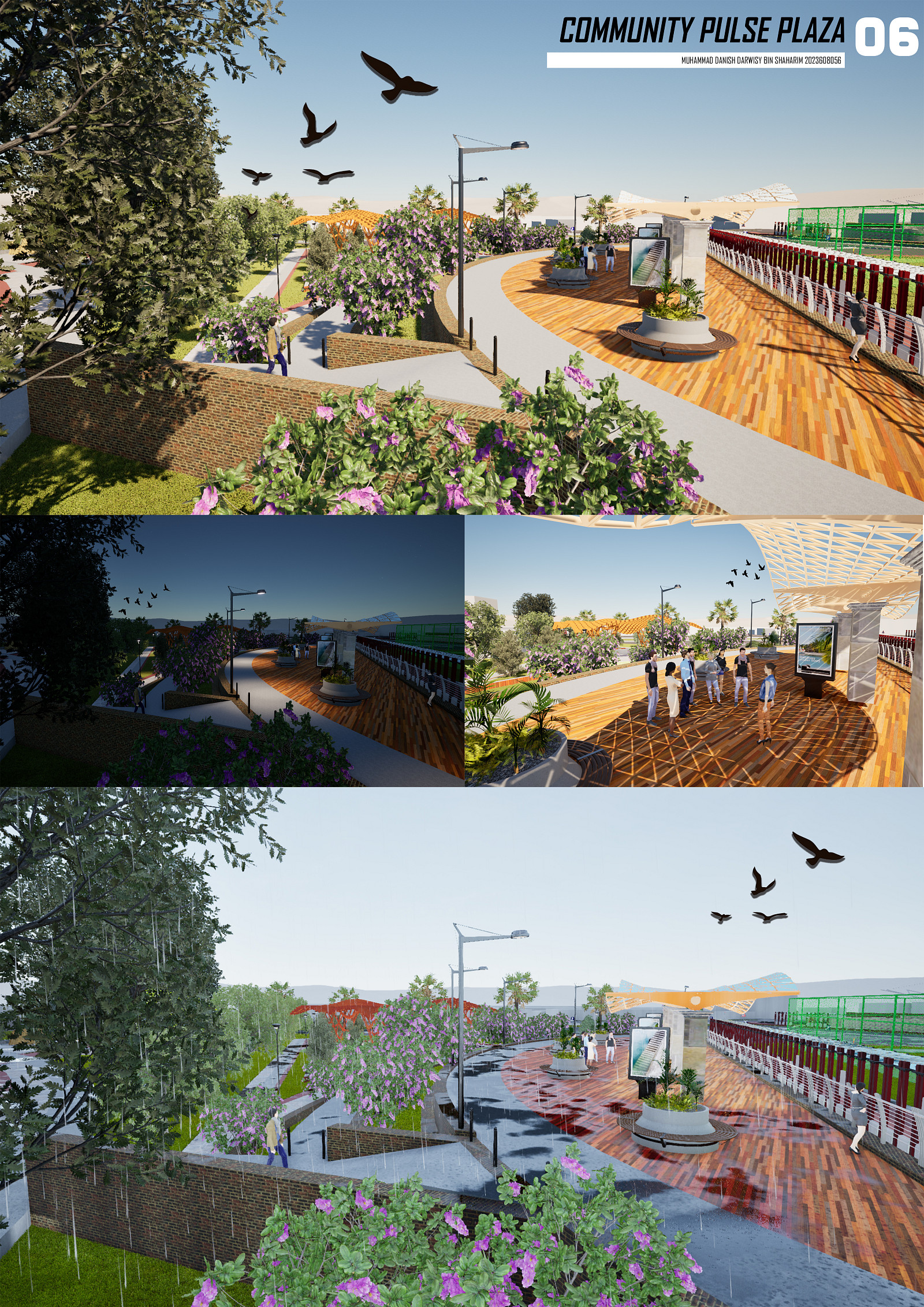
The spatial layout of Ujana Peremba is defined by fluid curvilinear forms and arc and tangent geometries that represent the organic flow of water and ecological growth. The design incorporates existing site anchors such as the community football pitch and local food court into a new Blue-Green network.
The site functions dynamically on three interconnected levels:
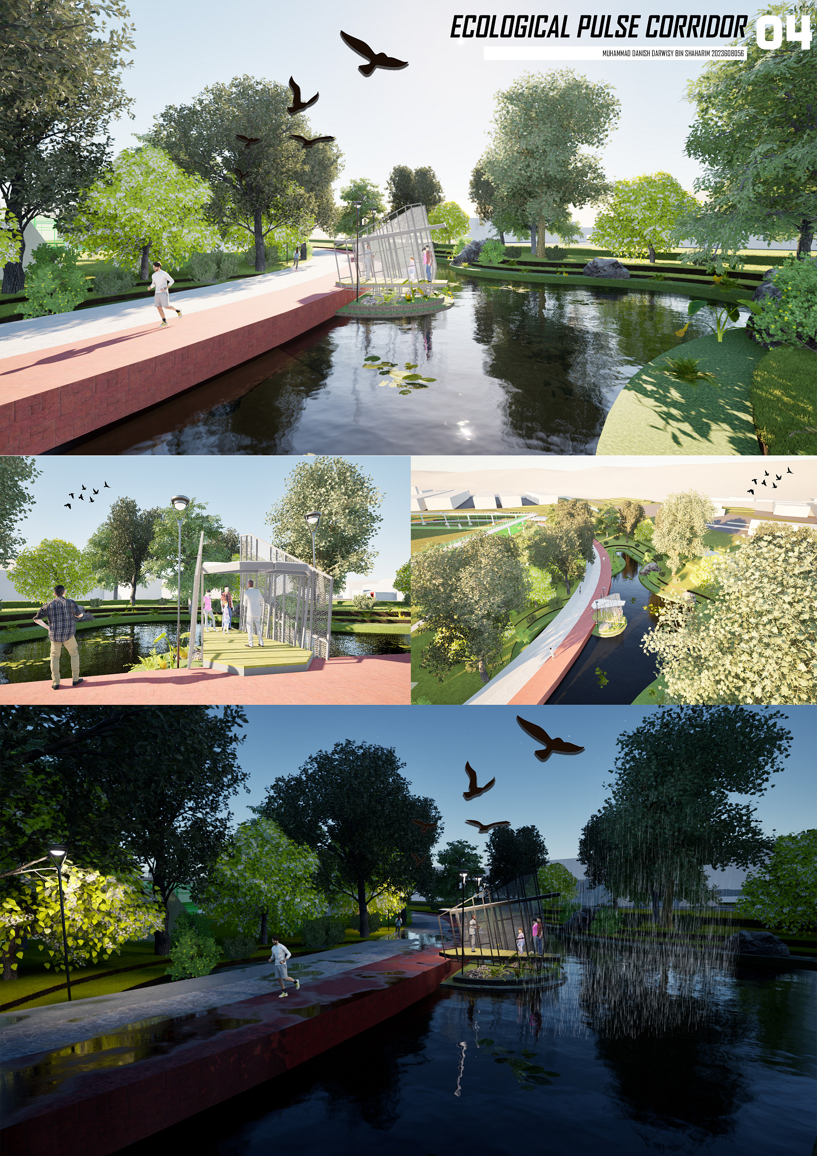
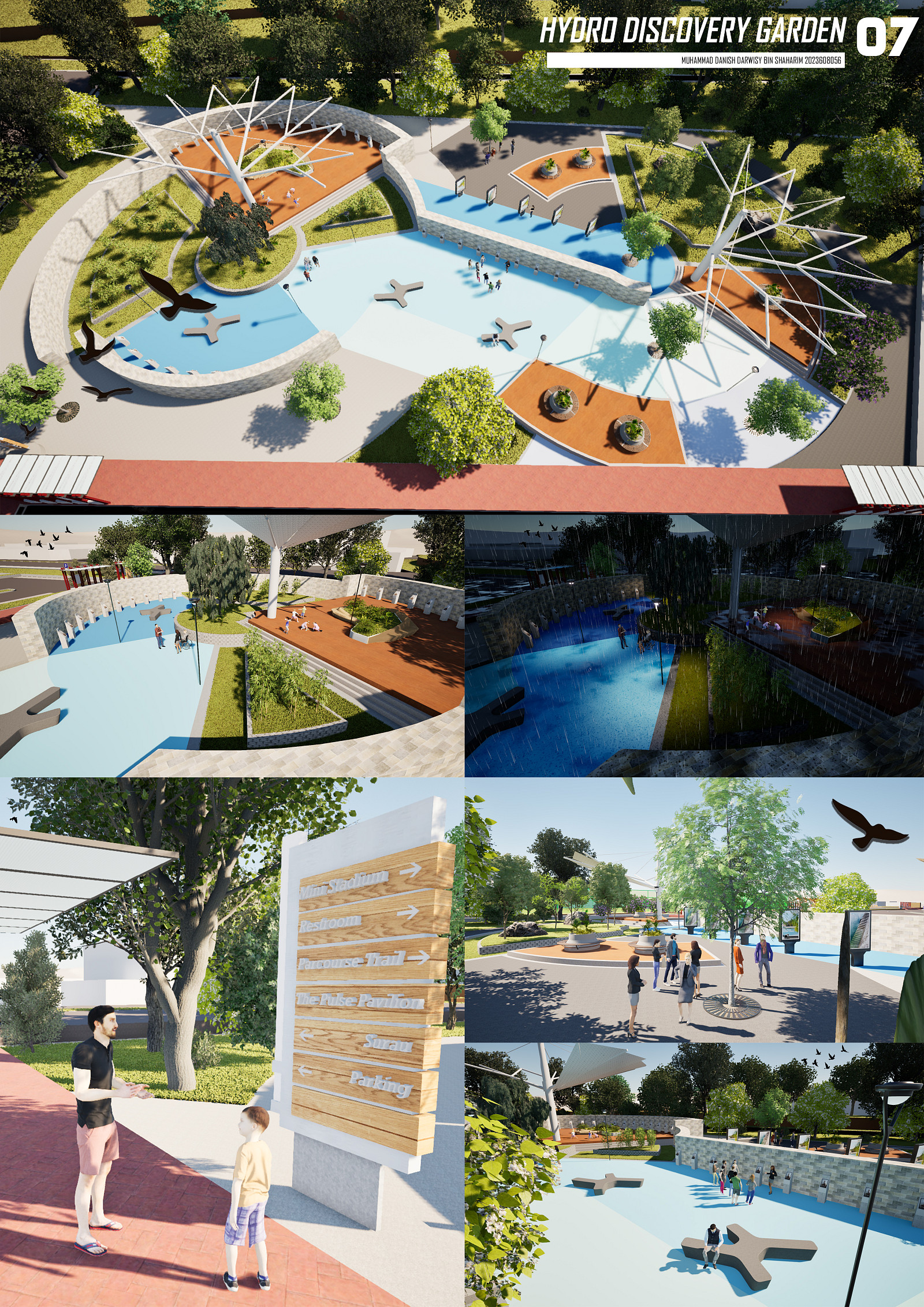
The Hydro Pulse: A network of continuous, reticulated meandering bioswales and sponge gardens directing surface runoff to a centralised Engineered Retention Pond.
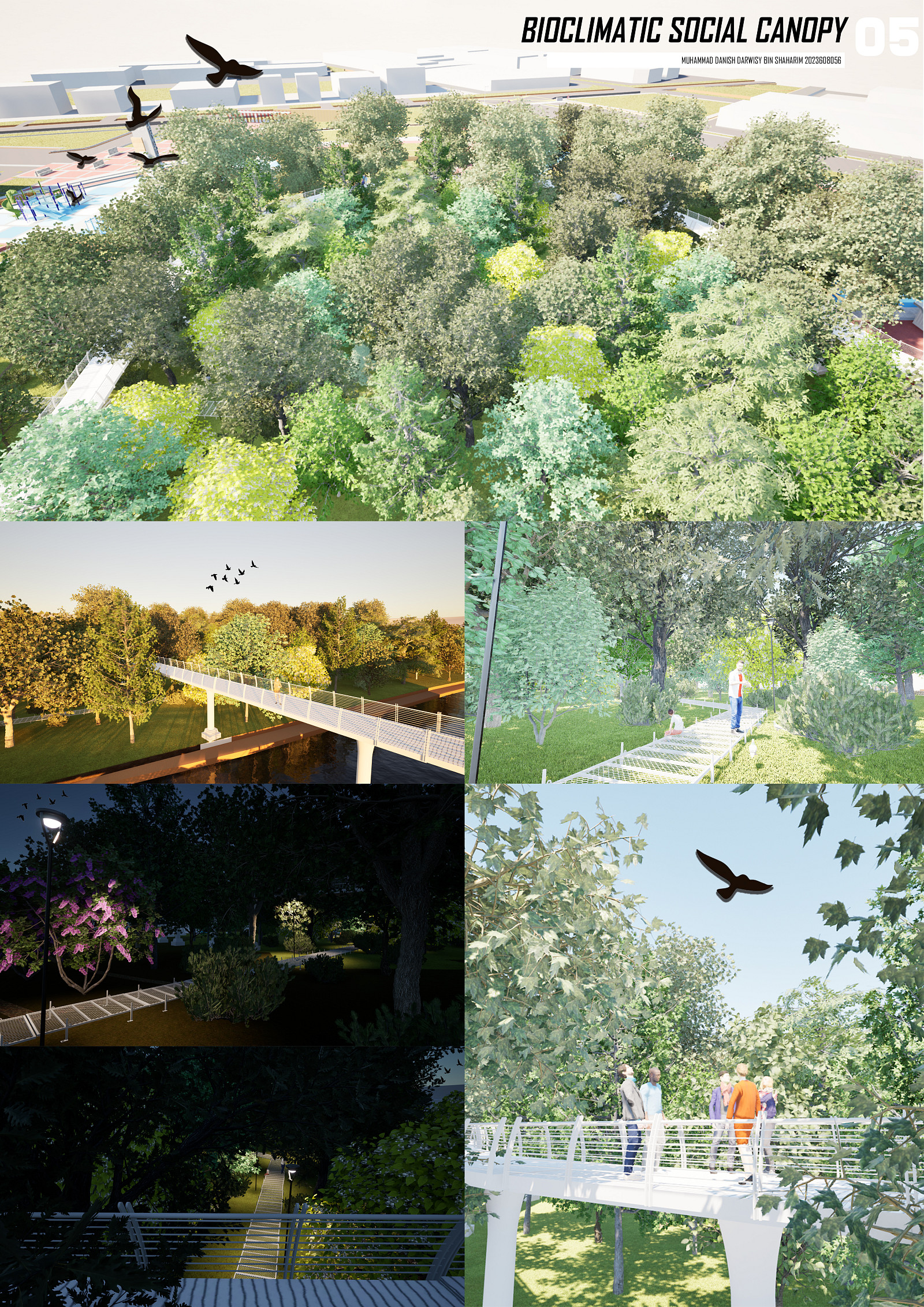
The Bioclimatic Pulse: Concentrations of dense, indigenous woodland positioned strategically along prevailing ‘Aeolian’ (wind) corridors. These zones serve as thermal buffers, moving cooled air across the active recreational zones.
The Social Pulse: inclusive and barrier-free circulation routes to connect the site.
The park’s form is carefully designed to accommodate different scenarios. In heavy monsoons, the parallel bioswales visibly celebrate water attenuation, turning a flood threat into a beautiful, sensory “visible water” experience. Conversely, the widened curvilinear pathways on event days (e.g., local football matches) naturally generate pocket spaces for crowd overflow while the bioclimatic canopies shade spectators and food court patrons.
Technical information
The project’s resilience is achieved through precise ecological engineering and sustainable landscape technologies.
Hydrological Engineering (BGCDN): Implementation of a Blue-Green Coding & Drainage Network to capture and manage 100% of the surface runoff from the site. It employs terraced bio-retention basins and reticulated bioswales with gravel filtration beds and phytoremediation aquatic plants to naturally treat urban runoff before it reaches the retention pond.
Miyawaki Afforestation Method: To mitigate the UHI effect, the bioclimatic zones use the Miyawaki method, which involves high-density native planting (3 to 4 saplings/sq. m) with four different ecological layers (canopy, tree, sub-tree, and shrub). This speeds up the forest growth 10x, maximises the carbon sequestration and acts as a localised air conditioner. The aim is to reduce the ambient temperature by 2°C to 4°C.
Inclusive Safety & CPTED: The circulation network is designed in strict adherence to Crime Prevention Through Environmental Design (CPTED) principles. The curvilinear paths eliminate sharp 90-degree blind spots, allowing for clear panoramic visibility.
Sustainable Materials: Use modular, pre-fabricated, low-impact boardwalks that float above sensitive ecological swales to prevent soil compaction. The site is also supported by a grid of solar-powered smart lighting, providing zero-carbon lighting and 24-hour secure access for the community.
Documentation
Copyright © 2026 INSPIRELI | All rights reserved. Use of this website signifies your agreement to the Terms of Use, Privacy Policy, and use of cookies.