Cañas De Luz

 Carolina
Project idea
Cañas de Luz is an urban, landscape, and architectural project located on the site of the former Miguel de Azcuénaga Arsenal in San Miguel de Tucumán. The project stems from the need to redefine a space marked by memory, pain, and loss, transforming it into an open, accessible, and vibrant public space for the community.
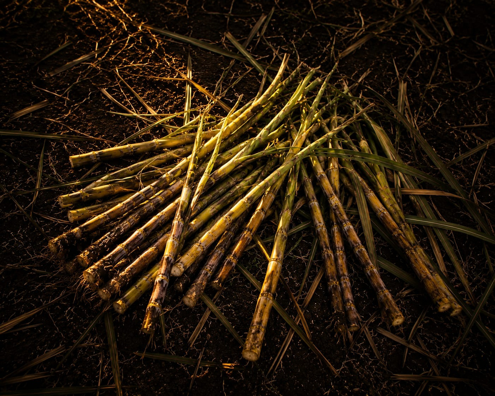
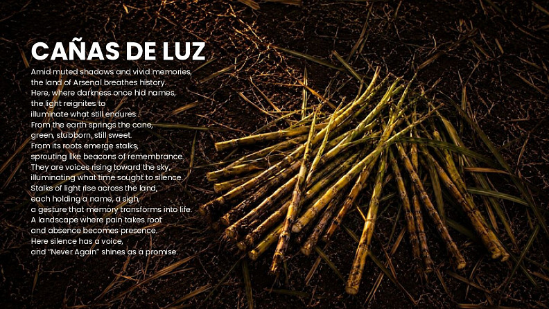
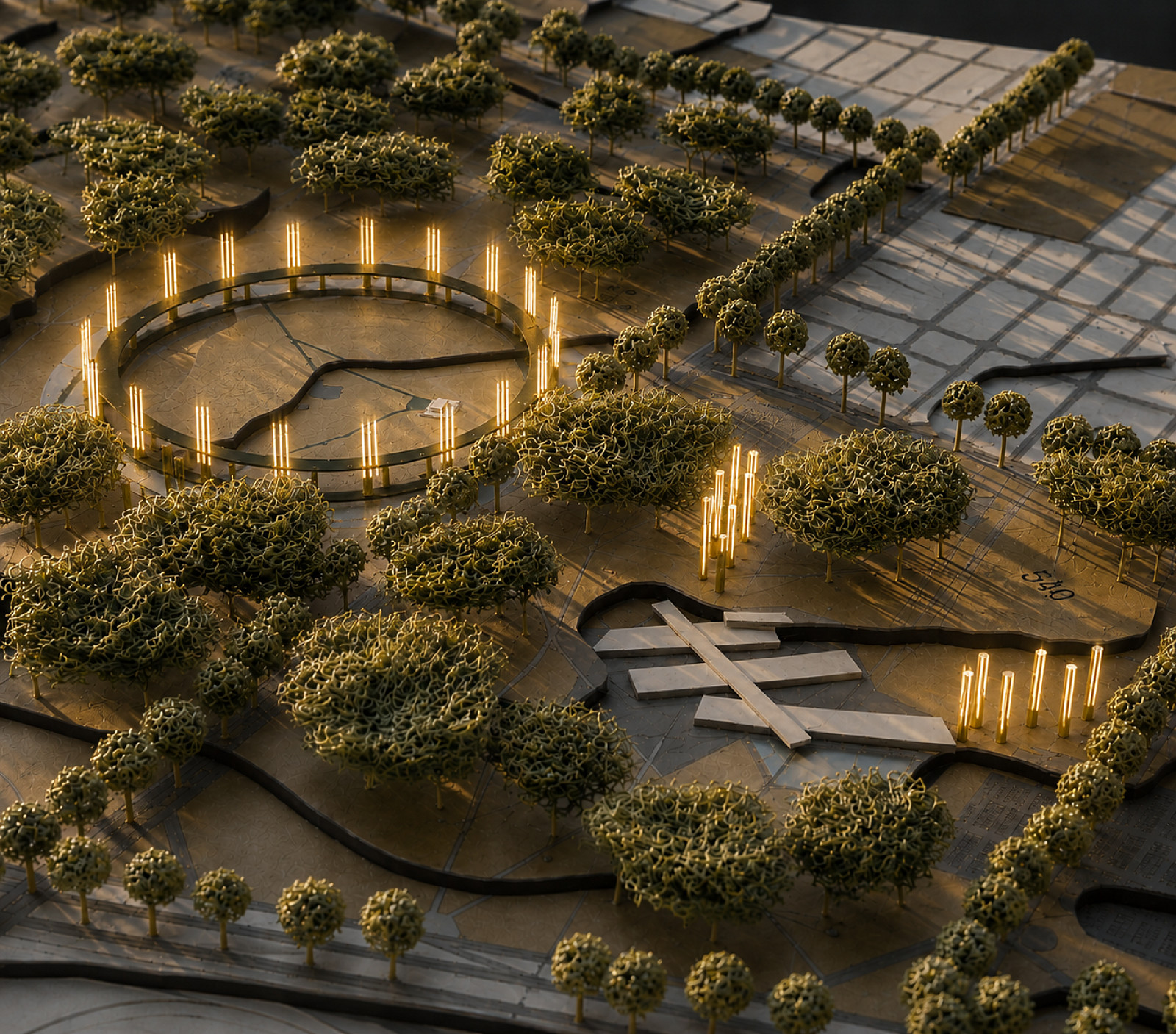
The conceptual idea takes the sugarcane as its symbol, an element that defines the landscape, history, and culture of Tucumán. Through it, light is understood as a representation of living memory, justice, and hope. The “cañas de luz” become pathways, structures, and spaces that seek to make visible what was silenced.
The main objective is to transform a former urban boundary into a new landscape of integration, memory, and the future. Its goals are to restore the site’s historical value, strengthen the connection between neighborhoods, promote sustainable mobility, incorporate environmental strategies, and create public spaces for gathering, reflection, and community life.
Project description
The project proposes the comprehensive transformation of the Former Arsenal into a hub for metropolitan integration. The initiative operates on various scales—territorial, urban, and sectoral—bringing together memory, landscape, mobility, the environment, and community.
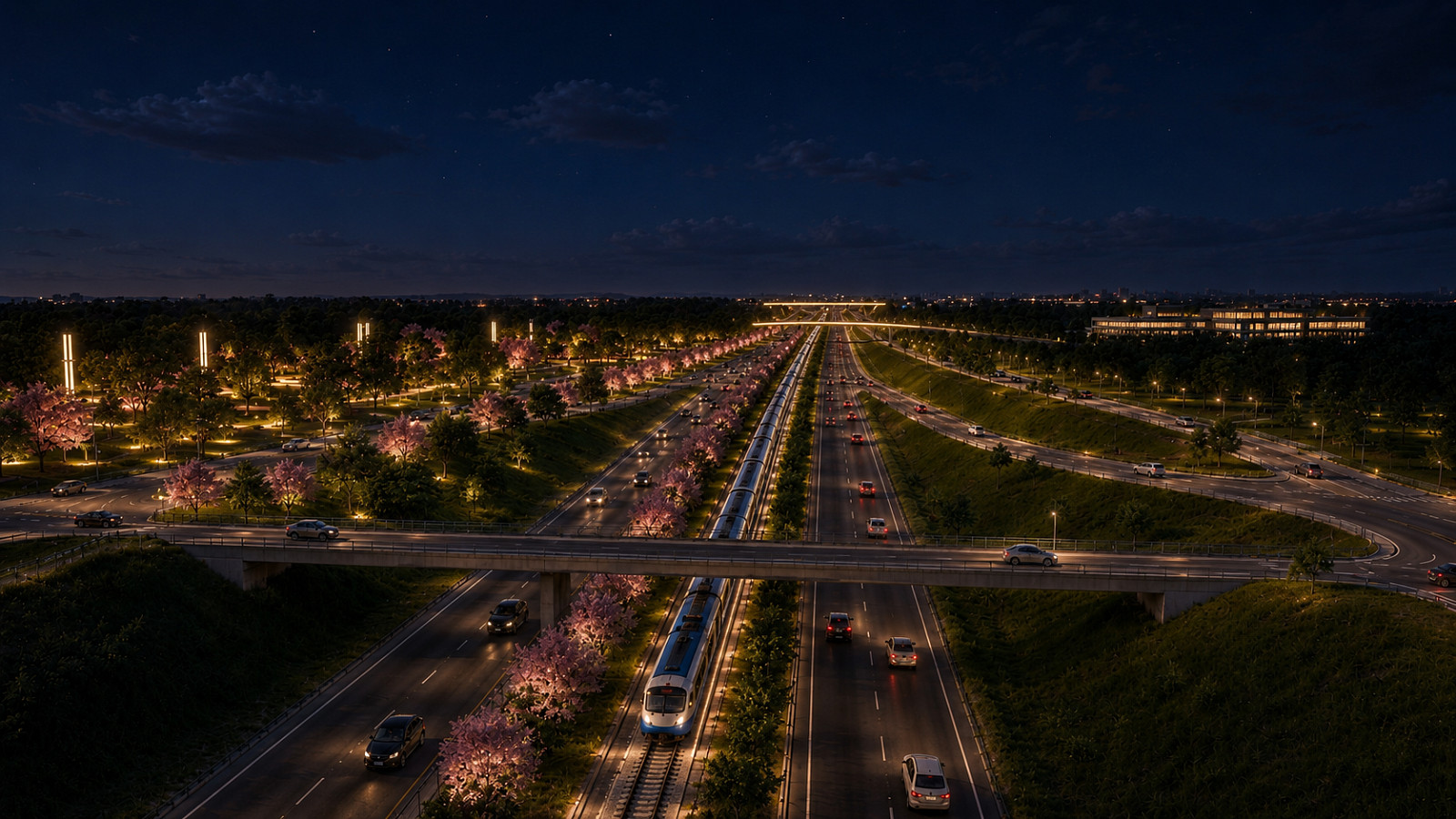
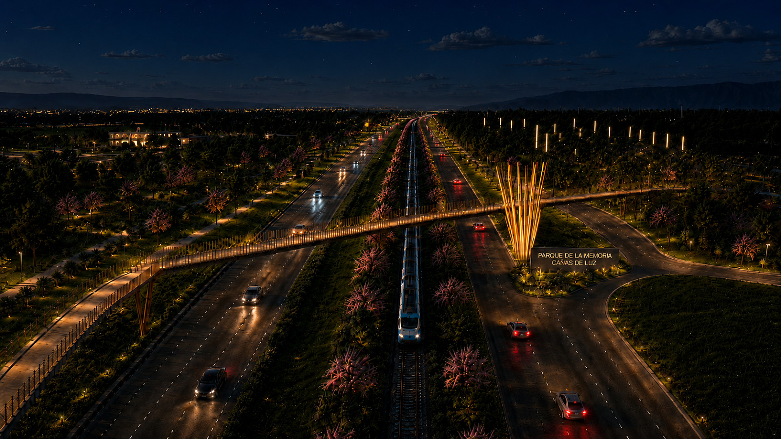
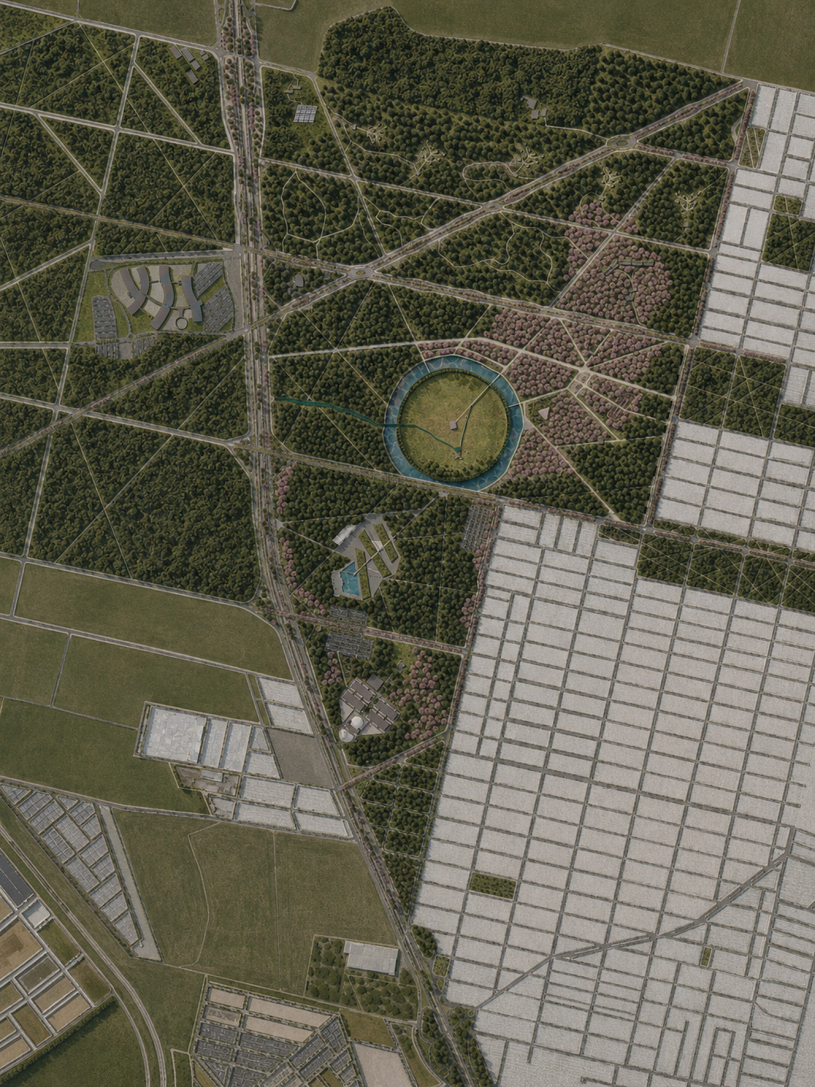
At the metropolitan scale, the proposal calls for a network of corridors connecting fragmented areas of the AMET: the Ecological Corridor, the Sponge Corridor, and the Railway Corridor. These infrastructures aim to improve connectivity, link green spaces, restore existing routes, and address environmental issues such as runoff and flooding.
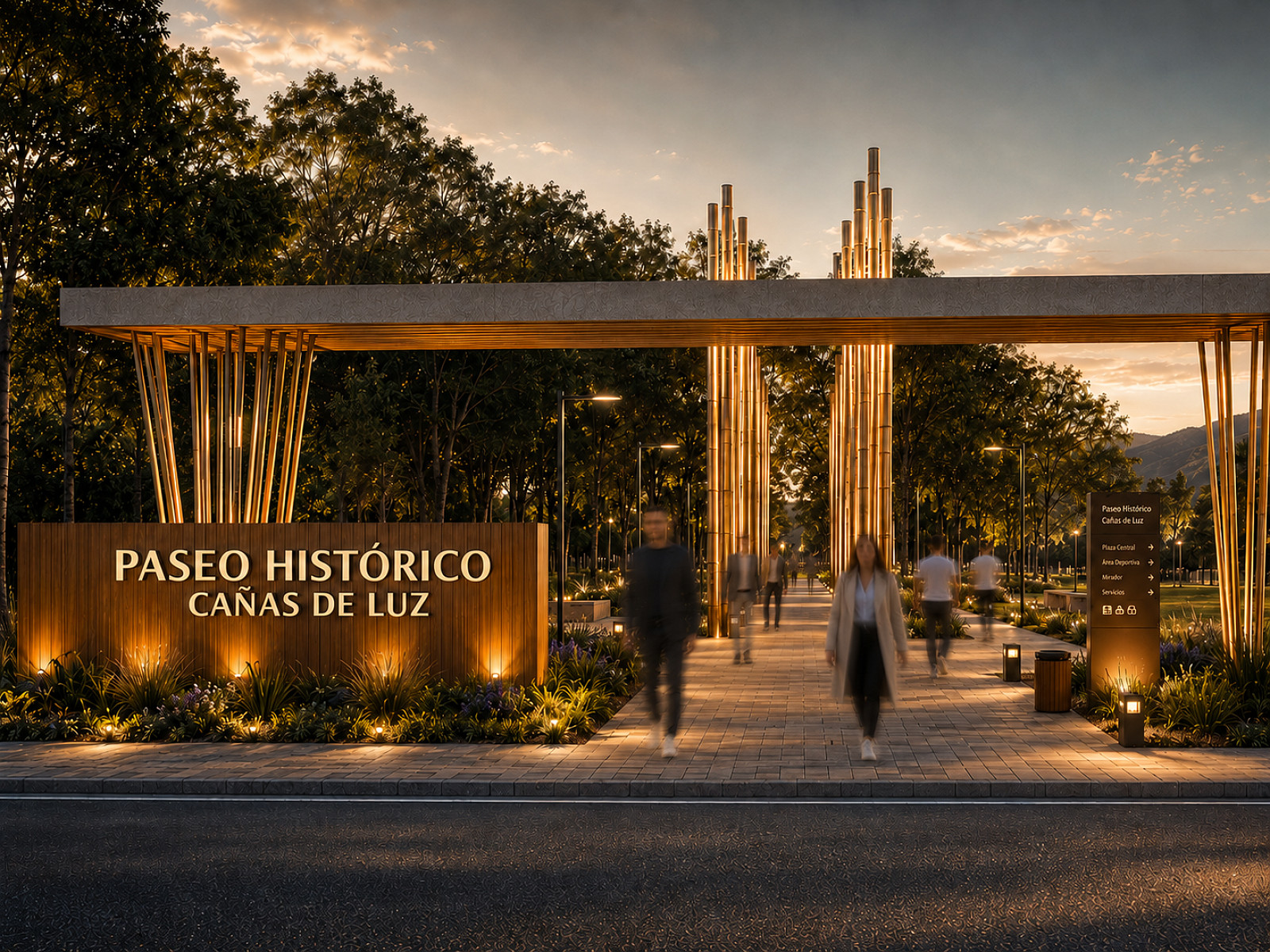
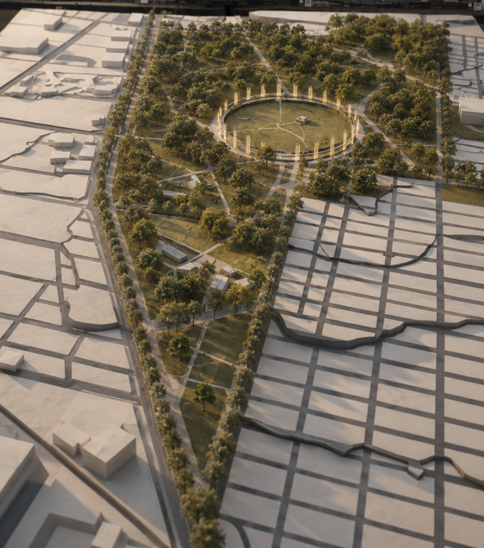
At the local scale, the proposal develops the Cañas de Luz Memorial Park, the Ecohabitat, the Interpretation Center, pedestrian paths, bike lanes, green spaces, educational areas, recreational sectors, and community facilities. The scope of the solution is not limited to intervening on the site itself, but seeks to restore its relationship with the surrounding area, connecting it to Route 9, nearby neighborhoods, and new urban centers.
Technical information
The project is structured around a network of primary and secondary routes that organize internal mobility and connect the site with its surroundings. It incorporates local streets, boulevards, pedestrian paths, bike lanes, elevated walkways, and a sustainable rail corridor with an electric train.
From an environmental perspective, the design proposes permeable surfaces, retention ponds, flood-prone parks, preservation of existing vegetation, incorporation of native species, and green corridors that enhance water absorption, biodiversity, and urban comfort.
The Park of Memory is organized around a historical route and a central contemplative space associated with water and “light canes.” The Interpretation Center consists of structures integrated into the landscape, while the Ecohabitat proposes low-density housing, common spaces, productive areas, sustainable water management, composting, biodigesters, and renewable energy.
Together, the proposal integrates memory, landscape, mobility, environmental infrastructure, and architecture, building a new urban system capable of connecting, restoring, and revitalizing the area.
Documentation
Created in:
Copyright © 2026 INSPIRELI | All rights reserved. Use of this website signifies your agreement to the Terms of Use, Privacy Policy, and use of cookies.