Brownfield Regeneration: Revitalizing The Hazaribagh Tannery Area


Project idea
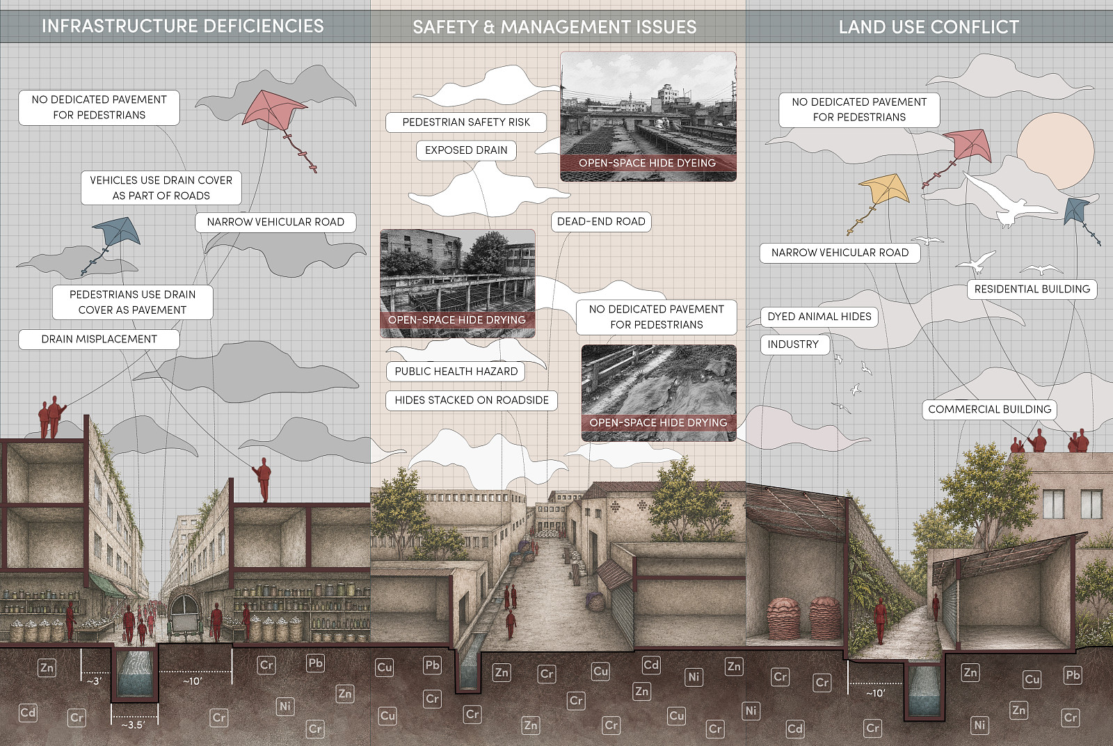
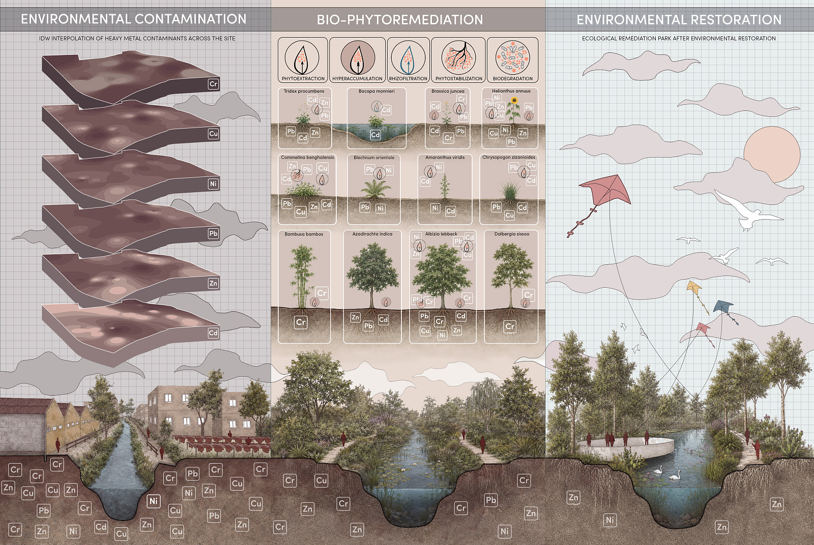
The regeneration of the Hazaribagh Tannery Area proposes the transformation of one of Dhaka’s most environmentally degraded industrial landscapes into a resilient urban-ecological system. For more than seventy years, Hazaribagh served as the center of Bangladesh’s leather industry, leaving behind severe topsoil contamination after the relocation of the tanneries in 2017. Toxic heavy metals, particularly chromium (Cr), along with lead (Pb), copper (Cu), zinc (Zn), nickel (Ni), and cadmium (Cd) continue to pose significant environmental and public health risks.
The project addresses two interconnected challenges: environmental degradation caused by industrial pollution and urban fragmentation resulting from the abandonment of the former tannery district. Rather than viewing contamination as a barrier to development, the proposal treats ecological restoration as the catalyst for urban regeneration.
Inspired by the logic of natural root systems, the project establishes a fluid network of movement, ecology, and public space that reconnects Hazaribagh with the wider urban fabric of Dhaka. Through a phased process of remediation and development, the proposal seeks to restore ecological health, improve environmental quality, create inclusive public spaces, preserve cultural identity, and establish a sustainable framework for future growth.
The primary objective is to transform a contaminated brownfield into a healthy, productive, and livable urban environment where nature, research, culture, and community coexist within a single regenerative landscape.
Project description
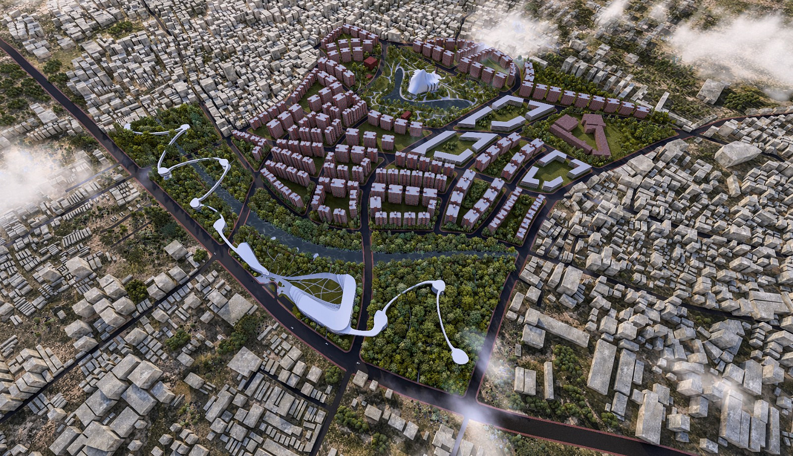
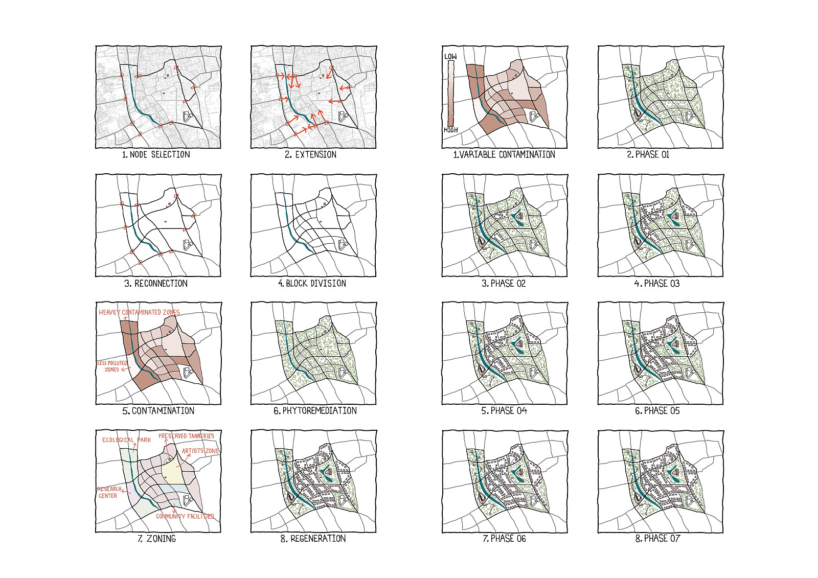
The masterplan organizes the former tannery area through an interconnected system of ecological, cultural, research, and development zones. Existing roads and urban nodes are extended and reinterpreted as organic circulation corridors that function as the primary structural framework of the site. These corridors improve connectivity, divide the area into interconnected blocks, and facilitate future phases of development.
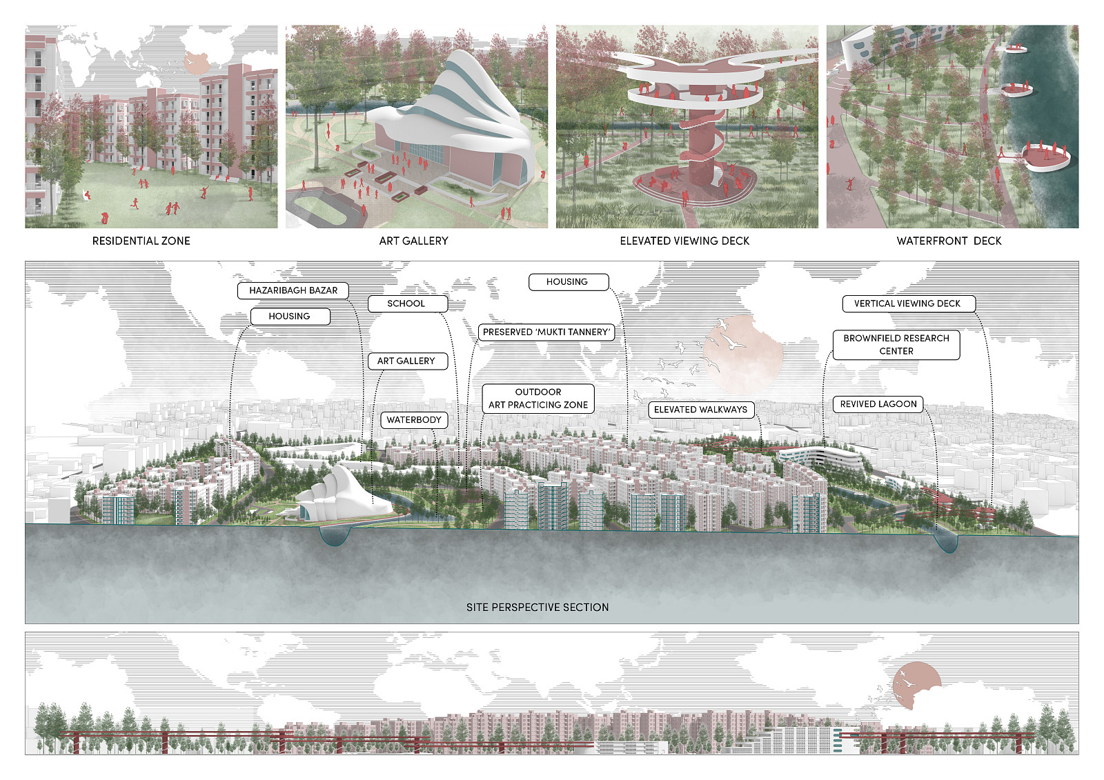
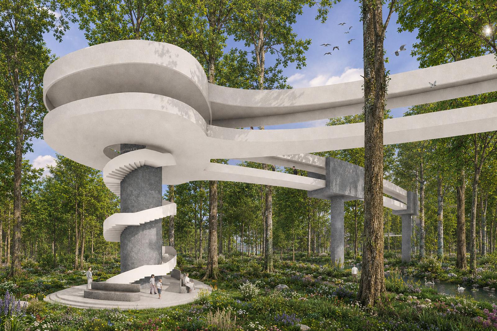
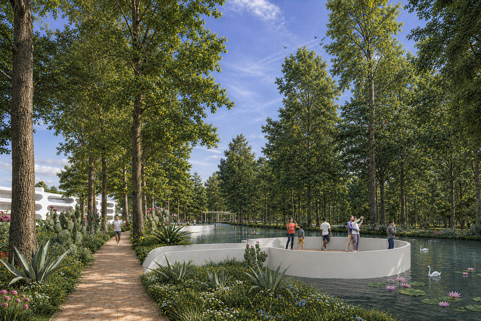
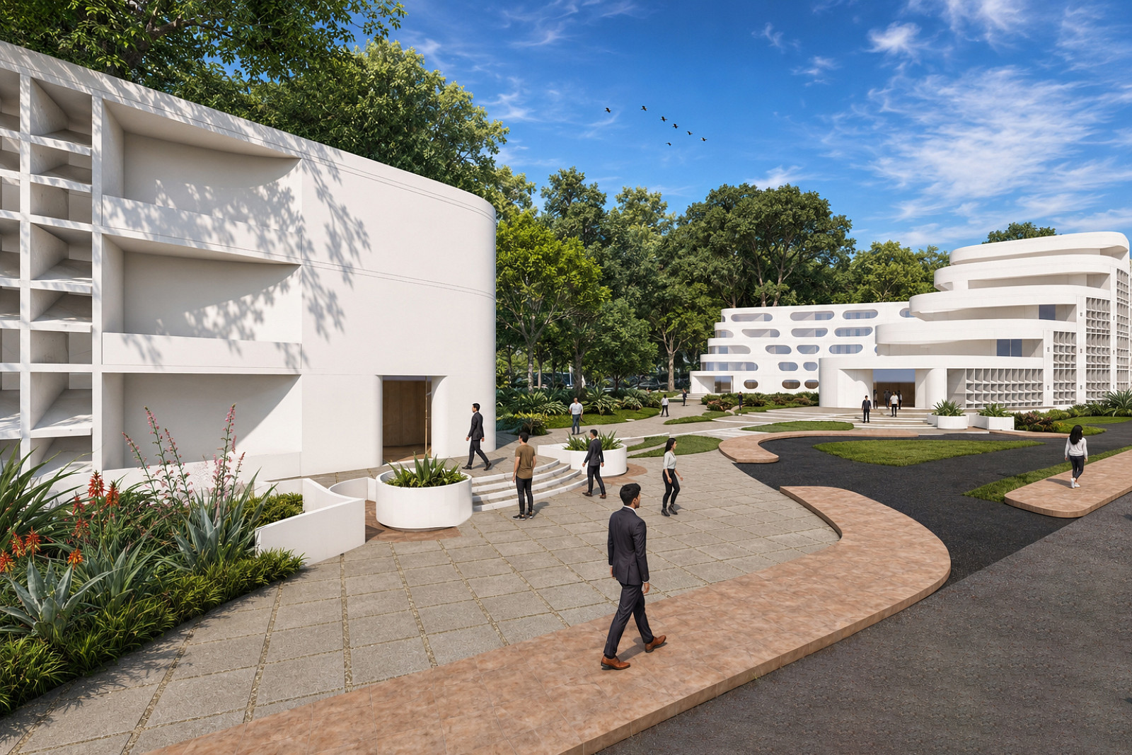
The most contaminated zones are designated as ecological remediation parks. These landscapes serve as active environments where soil and water restoration take place while remaining accessible to visitors. At the center of these parks, a Brownfield Remediation Research Center provides facilities for environmental monitoring, scientific research, and public education. Elevated walkways and observation towers extend throughout the landscape, allowing visitors and researchers to observe the remediation process and experience the evolving ecological conditions of the site.
The project follows a phased regeneration strategy. As environmental remediation progresses, individual blocks are gradually adapted for new urban functions while adjacent areas continue their recovery process. This approach ensures long-term flexibility and minimizes environmental disturbance.
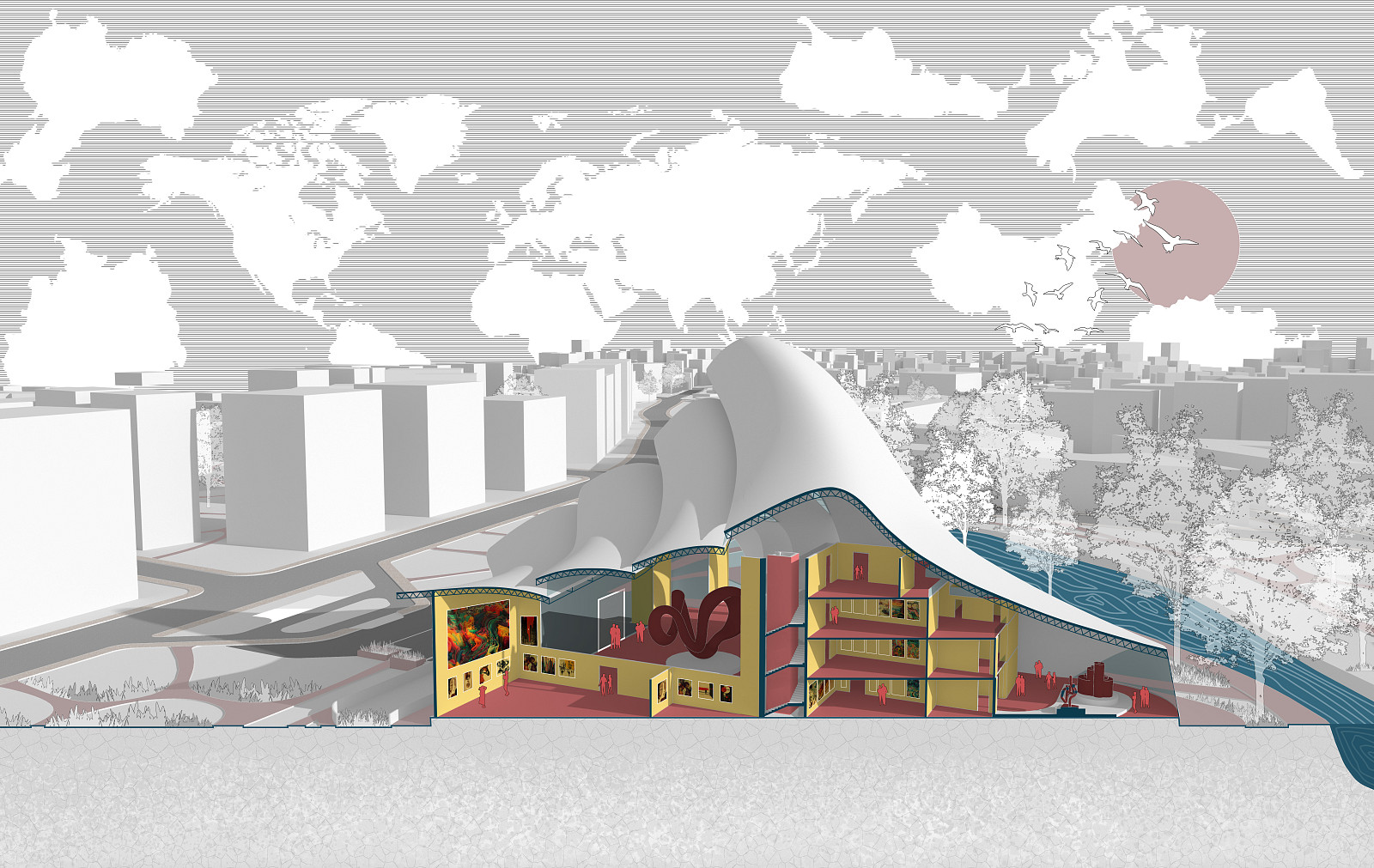
To preserve the site's cultural heritage and emerging creative identity, several former tannery buildings that have already been adapted as art studios are retained and integrated into the masterplan. These are complemented by a new art gallery and outdoor art practice spaces that encourage interaction between artists and the public. A network of water features, open spaces, pedestrian routes, and ecological landscapes connects the various program elements, creating a cohesive and vibrant urban environment.
The proposal ultimately establishes a framework where environmental restoration, scientific innovation, cultural activity, and urban life evolve together over time.
Technical information
Project Type: Brownfield Regeneration and Urban Ecological Masterplan
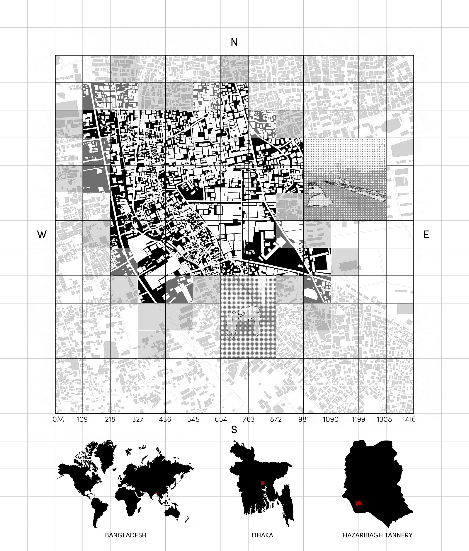
Site Location: Former Hazaribagh Tannery Area, Dhaka, Bangladesh
Site Condition:
The site consists of a former industrial tannery district characterized by significant soil and groundwater contamination resulting from decades of untreated industrial waste disposal. Major contaminants include chromium (Cr), lead (Pb), copper (Cu), zinc (Zn), nickel (Ni), and cadmium (Cd).
Remediation Strategy:
The project employs a nature-based remediation approach combining phytoremediation and bioremediation techniques. Native tree species and vegetation are strategically introduced to absorb, stabilize, and extract heavy metals from contaminated soils while improving biodiversity and ecological performance. The remediation process is implemented in phases to allow continuous environmental recovery and site activation.
Planning Strategy:
The masterplan is structured around an interconnected circulation network derived from existing roads and urban nodes. This framework creates permeable movement corridors, improves accessibility, and organizes the site into adaptable development blocks. A phased implementation strategy allows ecological restoration and urban development to occur simultaneously.
Key Program Components:
• Ecological Remediation Parks
• Brownfield Remediation Research Center
• Environmental Education Facilities
• Observation Towers and Elevated Walkways
• Retained Adaptive-Reuse Art Studios
• Art Gallery and Outdoor Art Practice Spaces
• Public Open Spaces and Community Landscapes
• Future Mixed-Use Development Blocks
Sustainability Measures:
• Soil and groundwater remediation through phytoremediation and bioremediation
• Preservation and adaptive reuse of existing structures
• Increased green coverage and biodiversity restoration
• Pedestrian-oriented circulation system
• Environmental education and community engagement
• Long-term phased regeneration framework
The project demonstrates how ecological restoration can serve as the primary driver of sustainable urban redevelopment, transforming a contaminated industrial brownfield into a resilient and environmentally productive urban landscape.

Copyright © 2026 INSPIRELI | All rights reserved. Use of this website signifies your agreement to the Terms of Use, Privacy Policy, and use of cookies.