ŽI-línia


Project idea
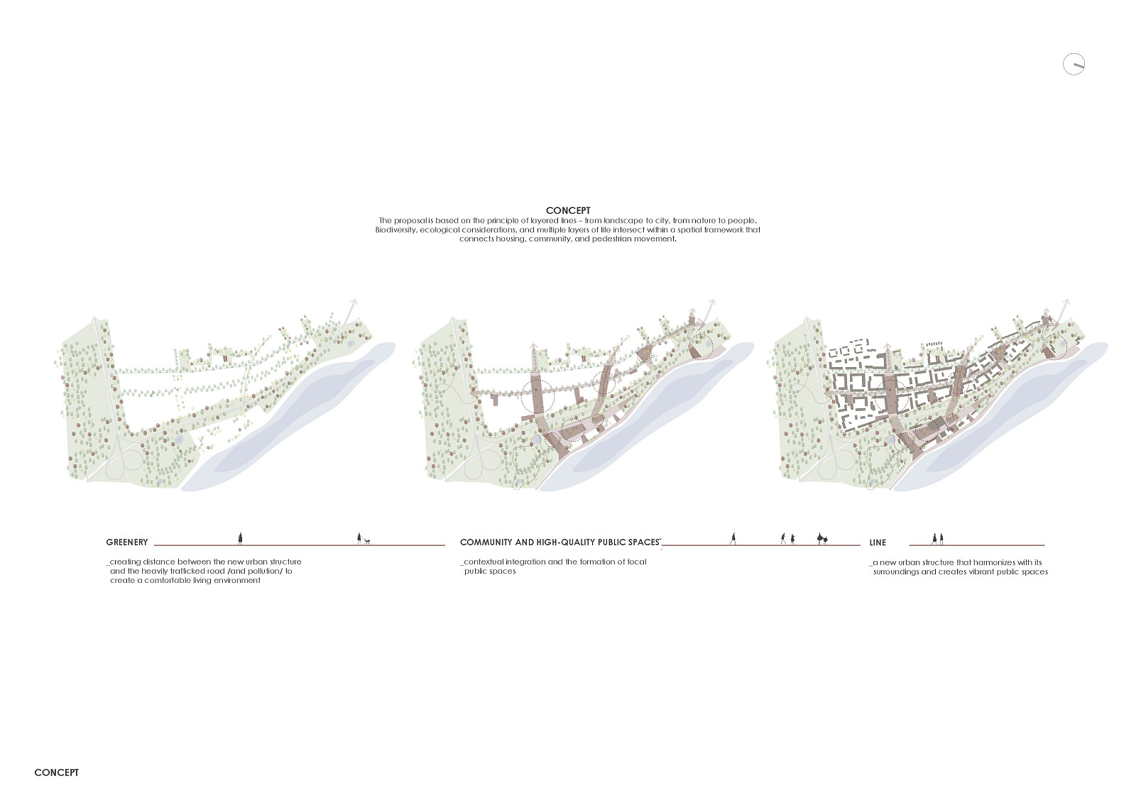
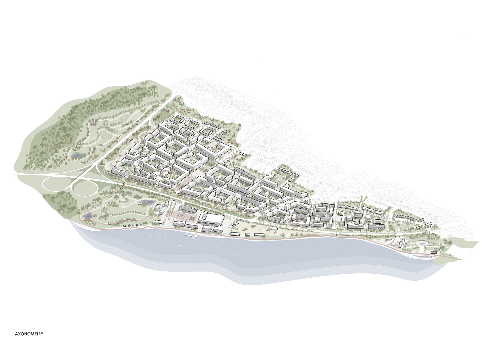
The idea of the project is to create a new urban district on the edge of Žilina that forms a natural continuation of the city while responding to the specific conditions of the site. The proposal transforms an underdeveloped area with weak connections, missing public spaces, and traffic pressure into a coherent urban structure. Its main goal is to connect housing, greenery, public life, and pedestrian movement into one readable framework that supports everyday life, community, and contact with the landscape.
Project description
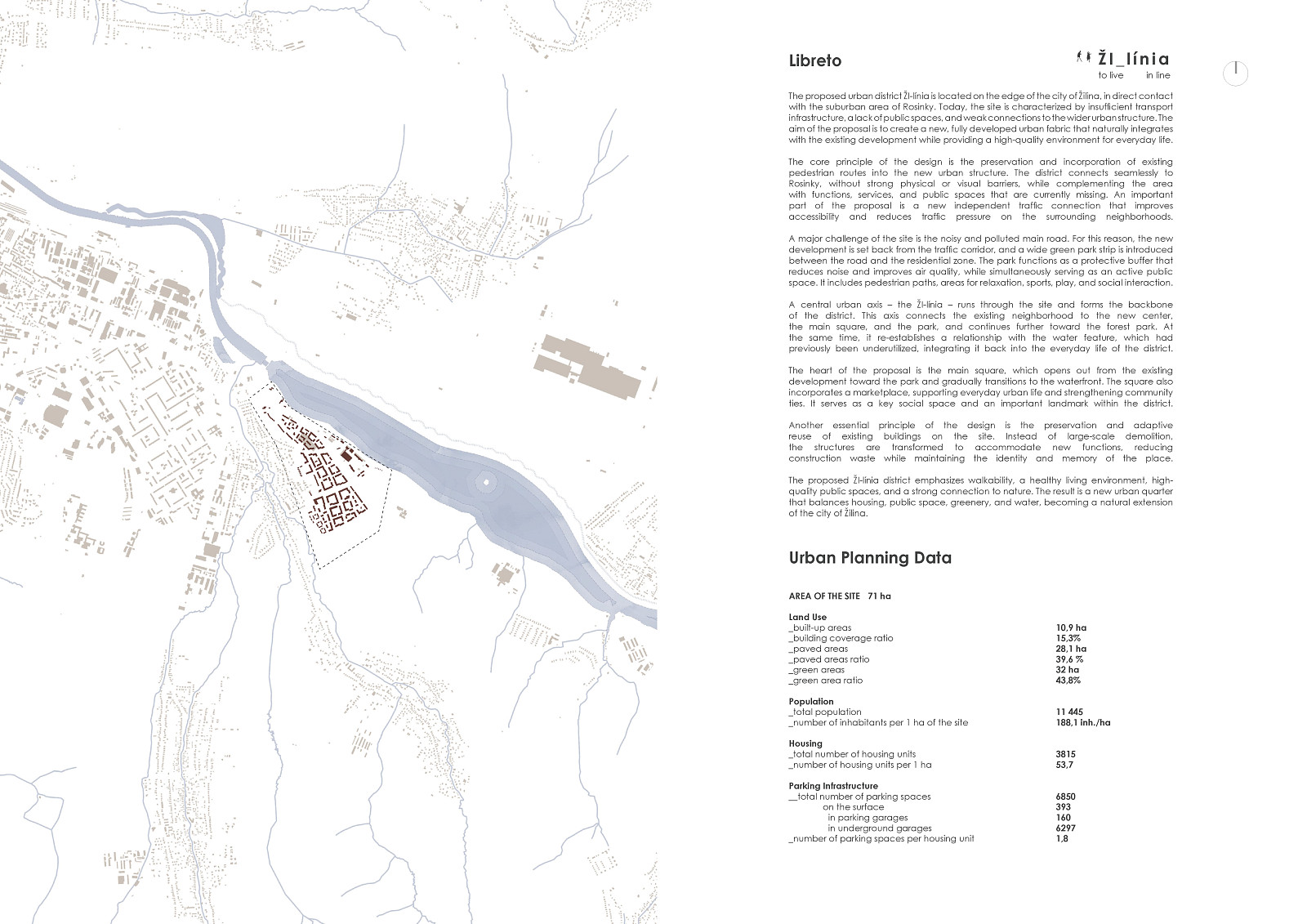
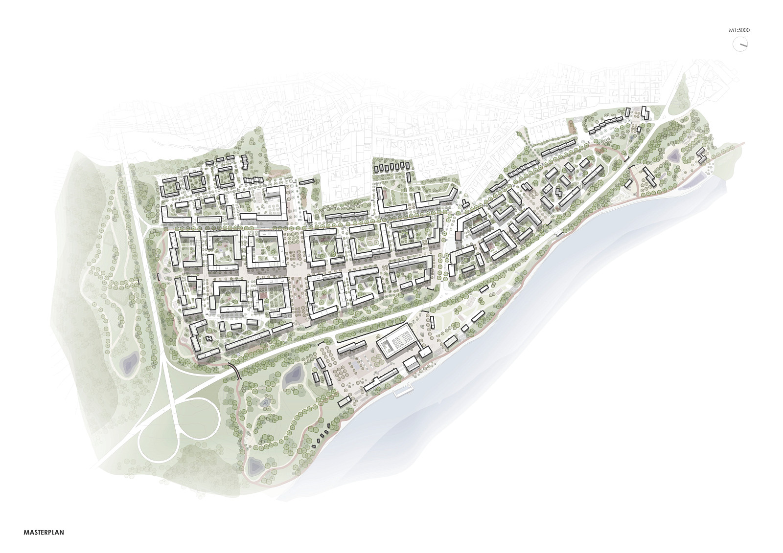
The proposed urban district ŽI-línia is located on the edge of the city of Žilina, in direct contact with the suburban area of Rosinky.
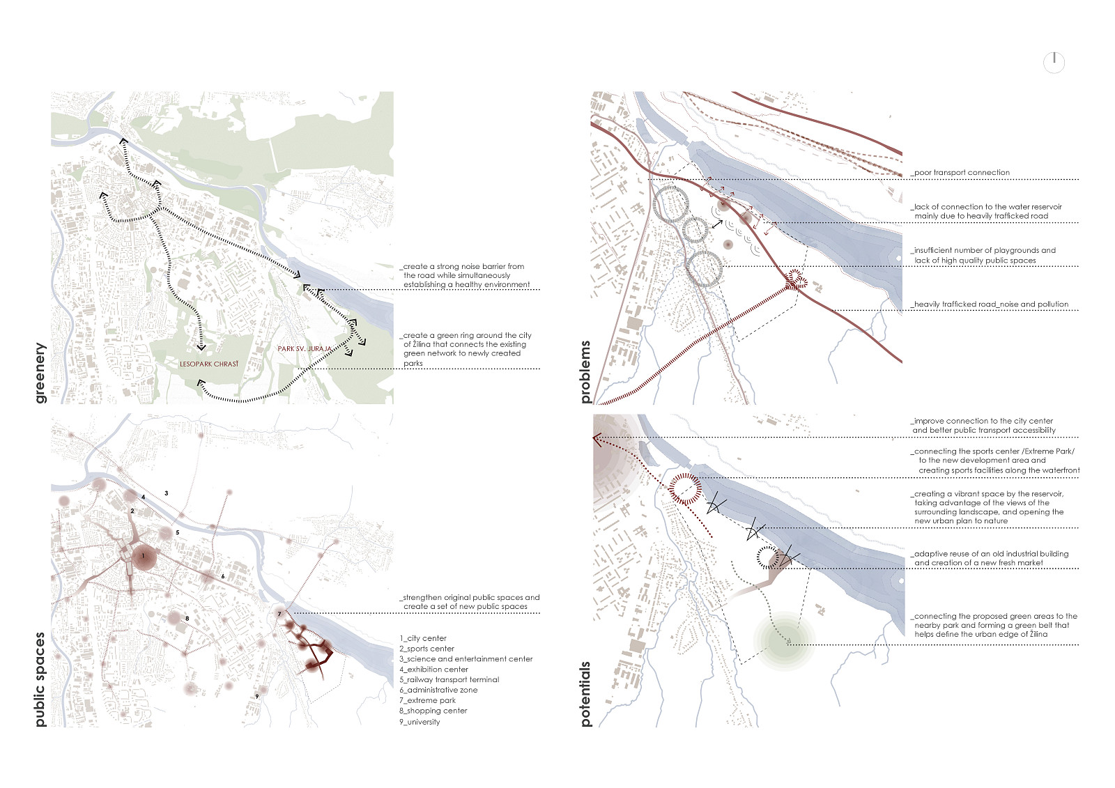
Today, the site is characterized by insufficient transport infrastructure, a lack of public spaces, and weak connections to the wider urban structure. The aim of the proposal is to create a new, fully developed urban fabric that naturally integrates with the existing development while providing a high-quality environment for everyday life.
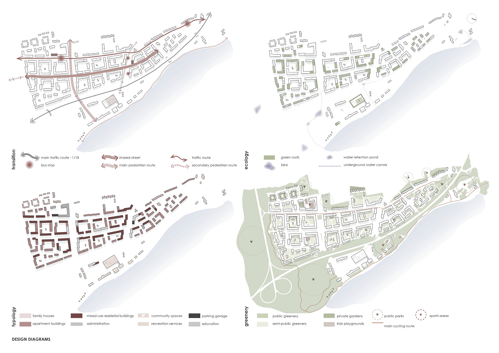
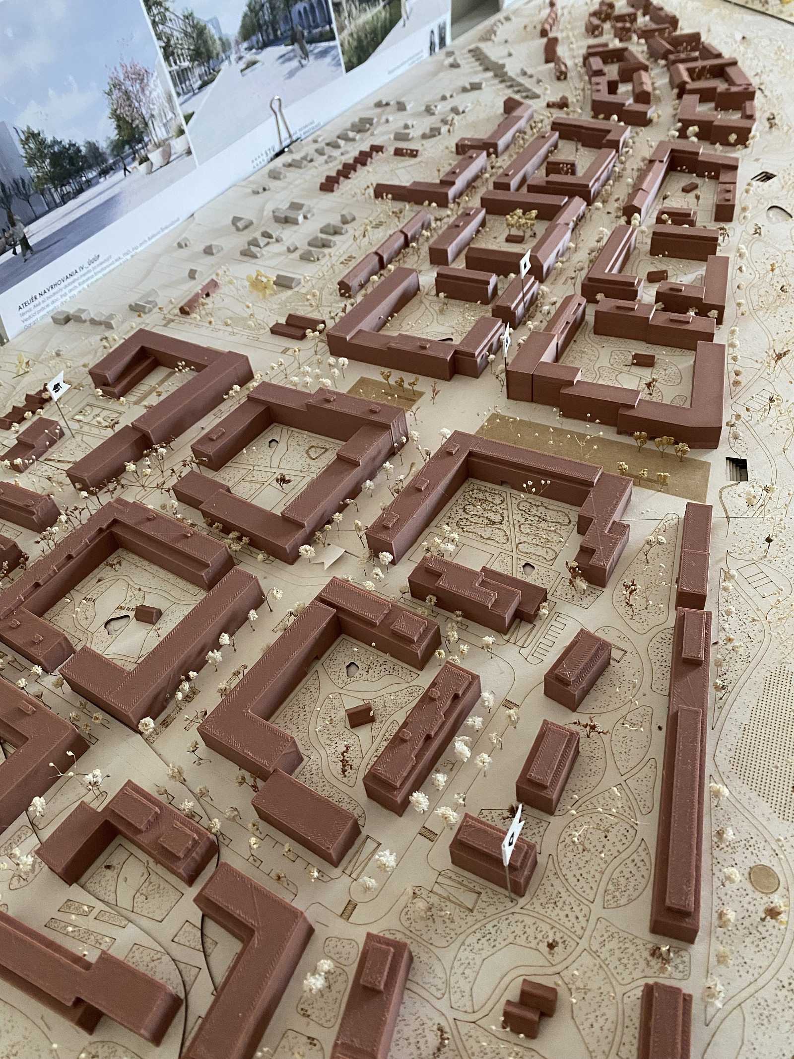
The core principle of the design is the preservation and incorporation of existing pedestrian routes into the new urban structure. The district connects seamlessly to Rosinky, without strong physical or visual barriers, while complementing the area with functions, services, and public spaces that are currently missing. An important part of the proposal is a new independent traffic connection that improves accessibility and reduces traffic pressure on the surrounding neighborhoods.
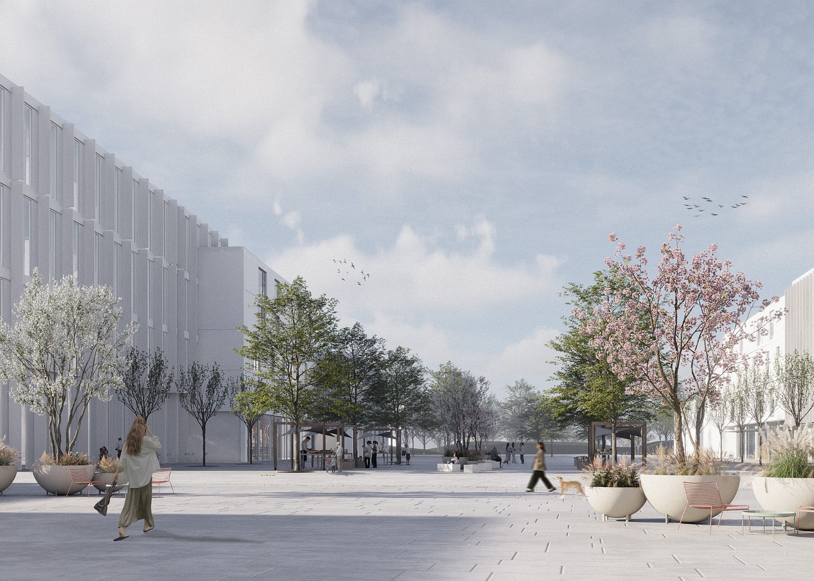
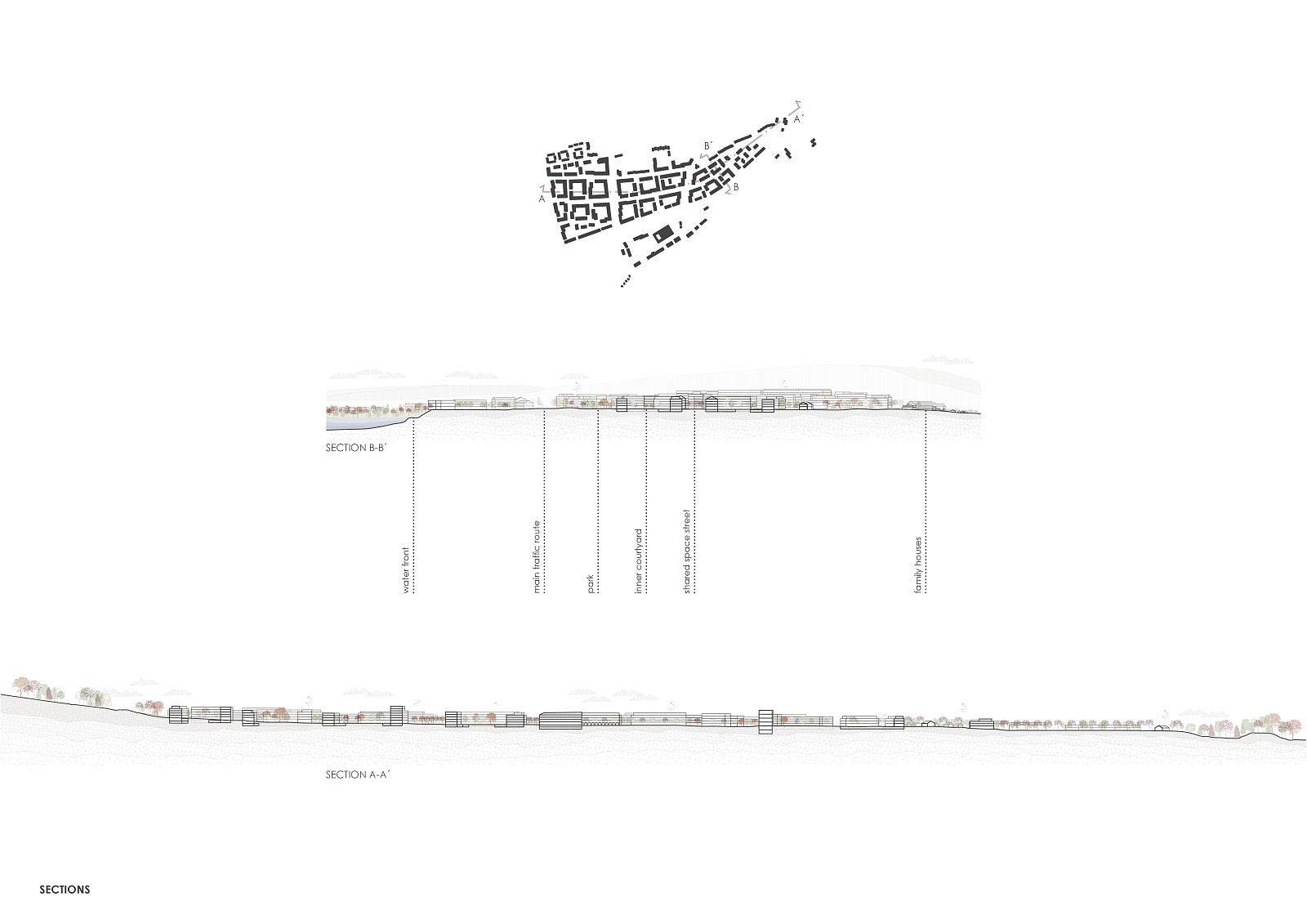
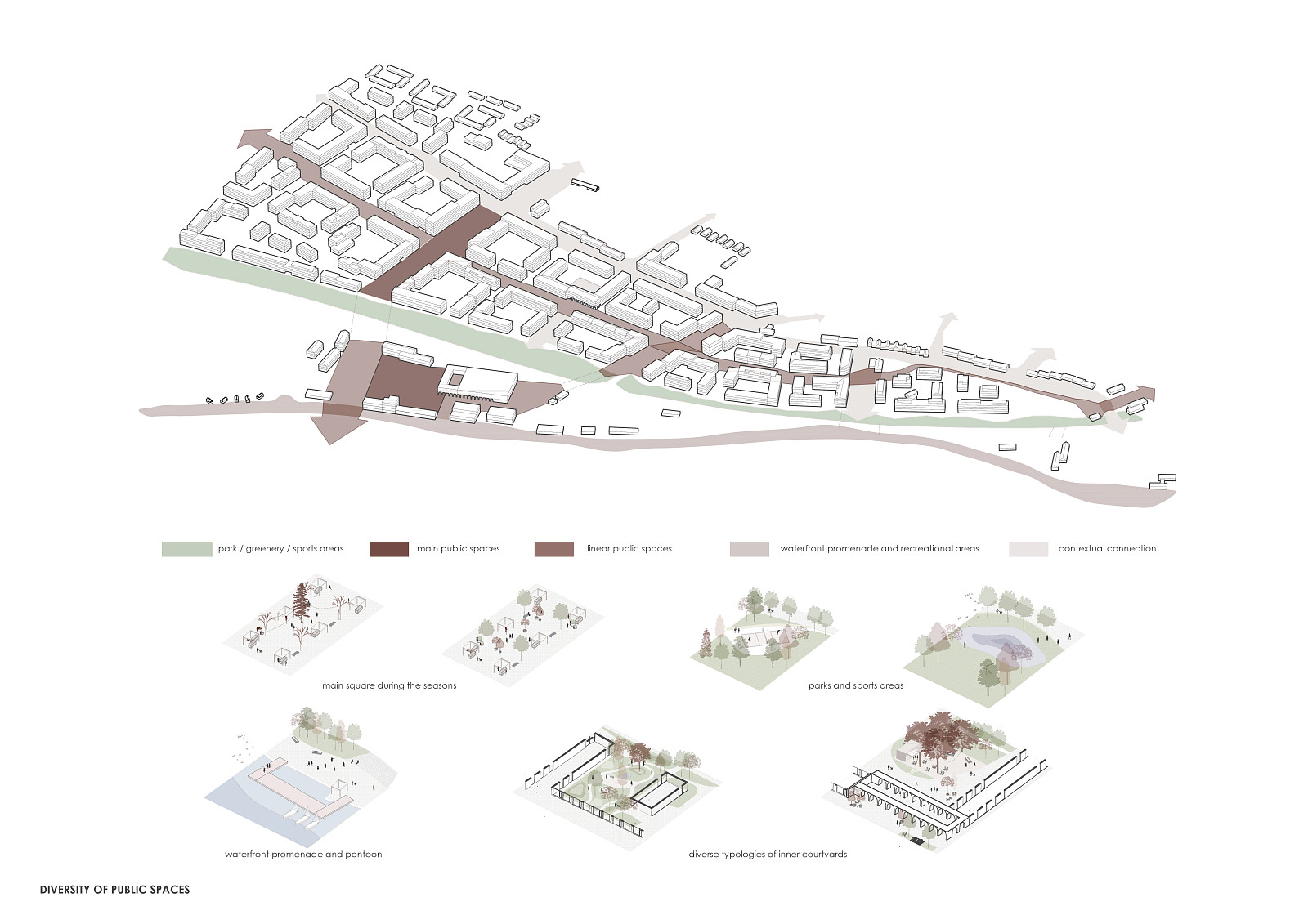
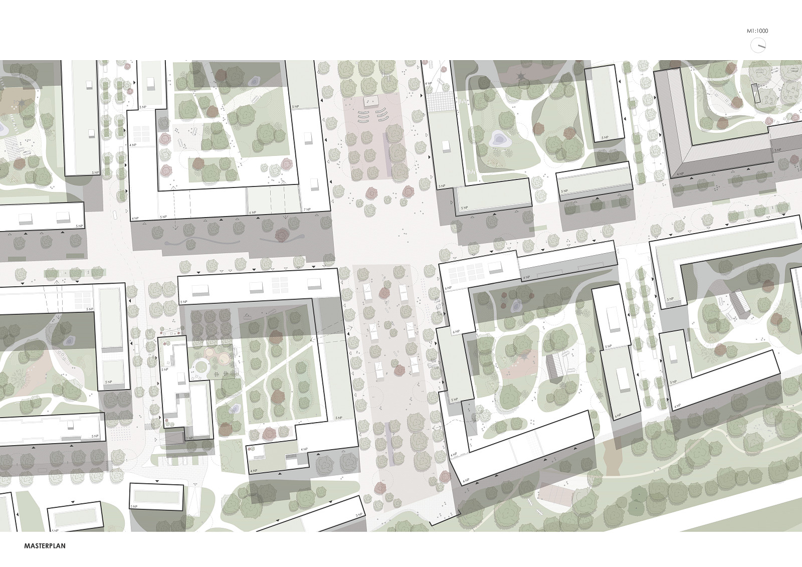
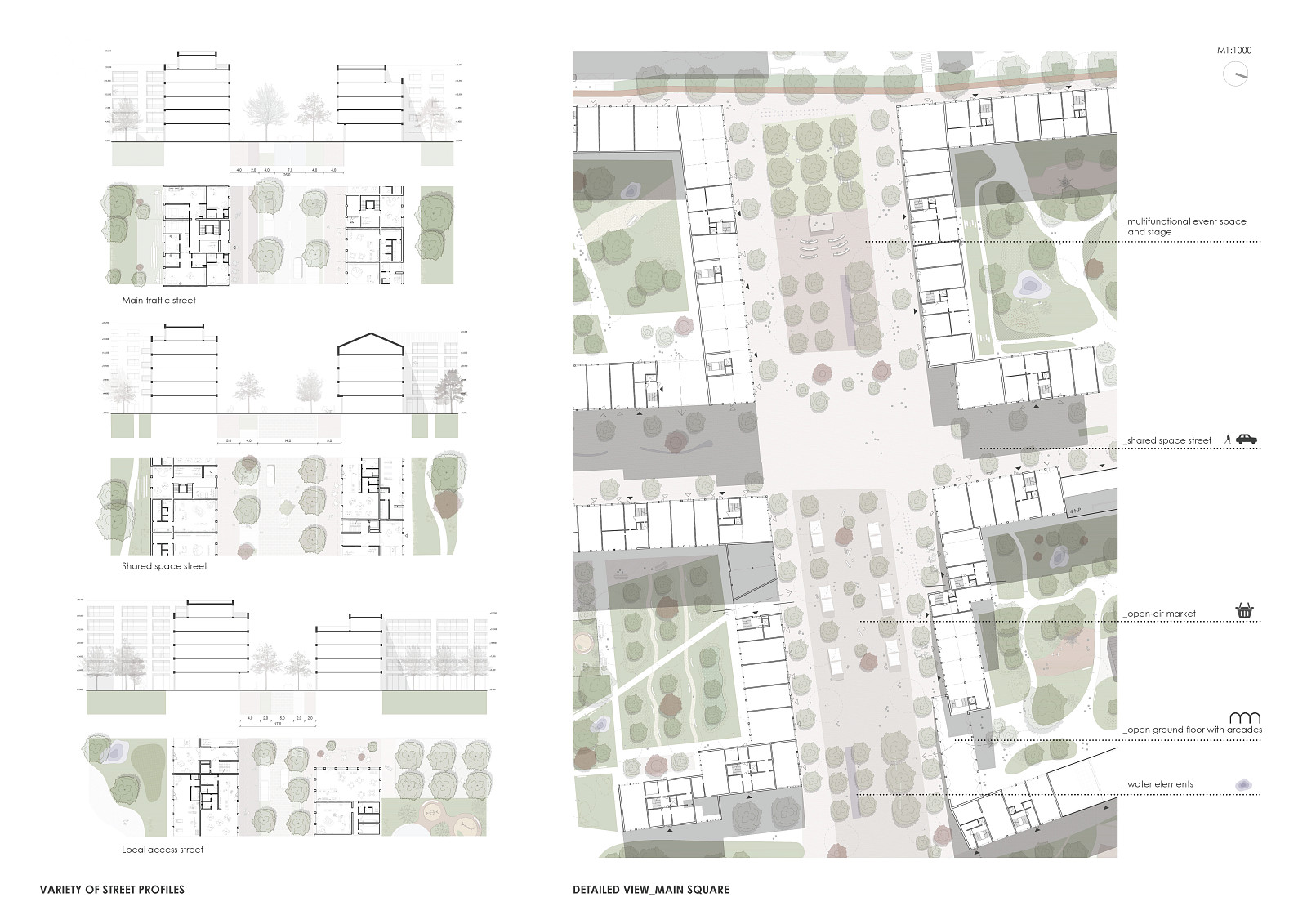
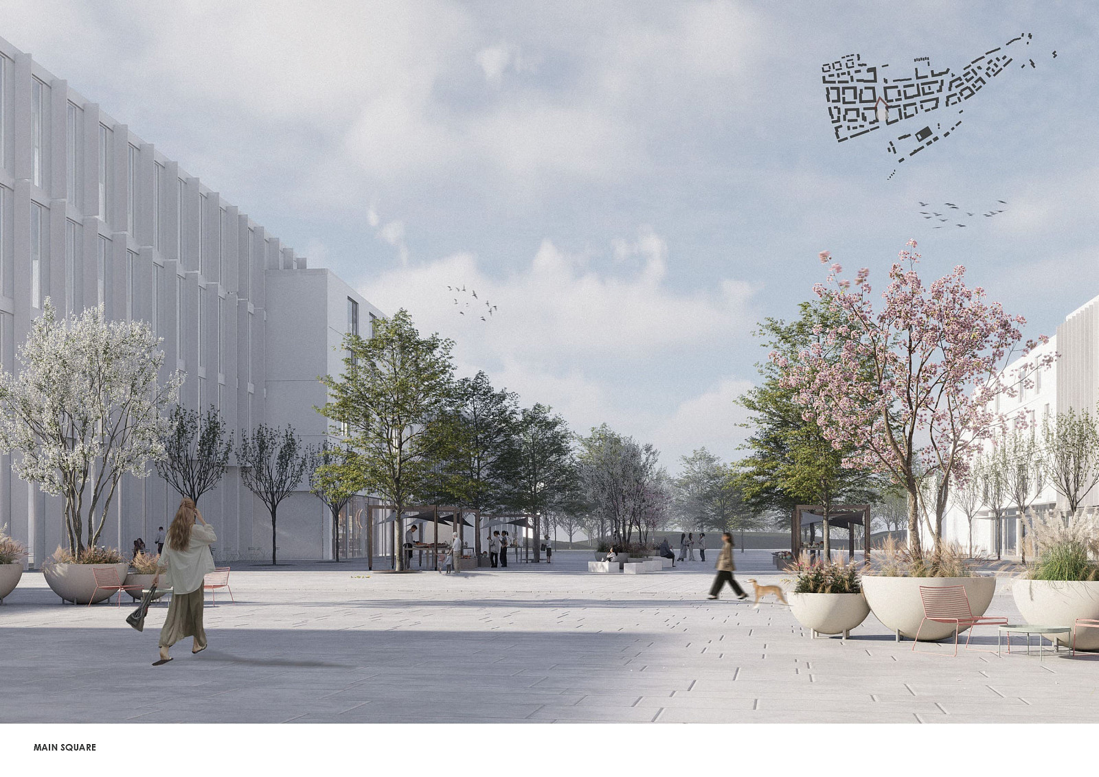
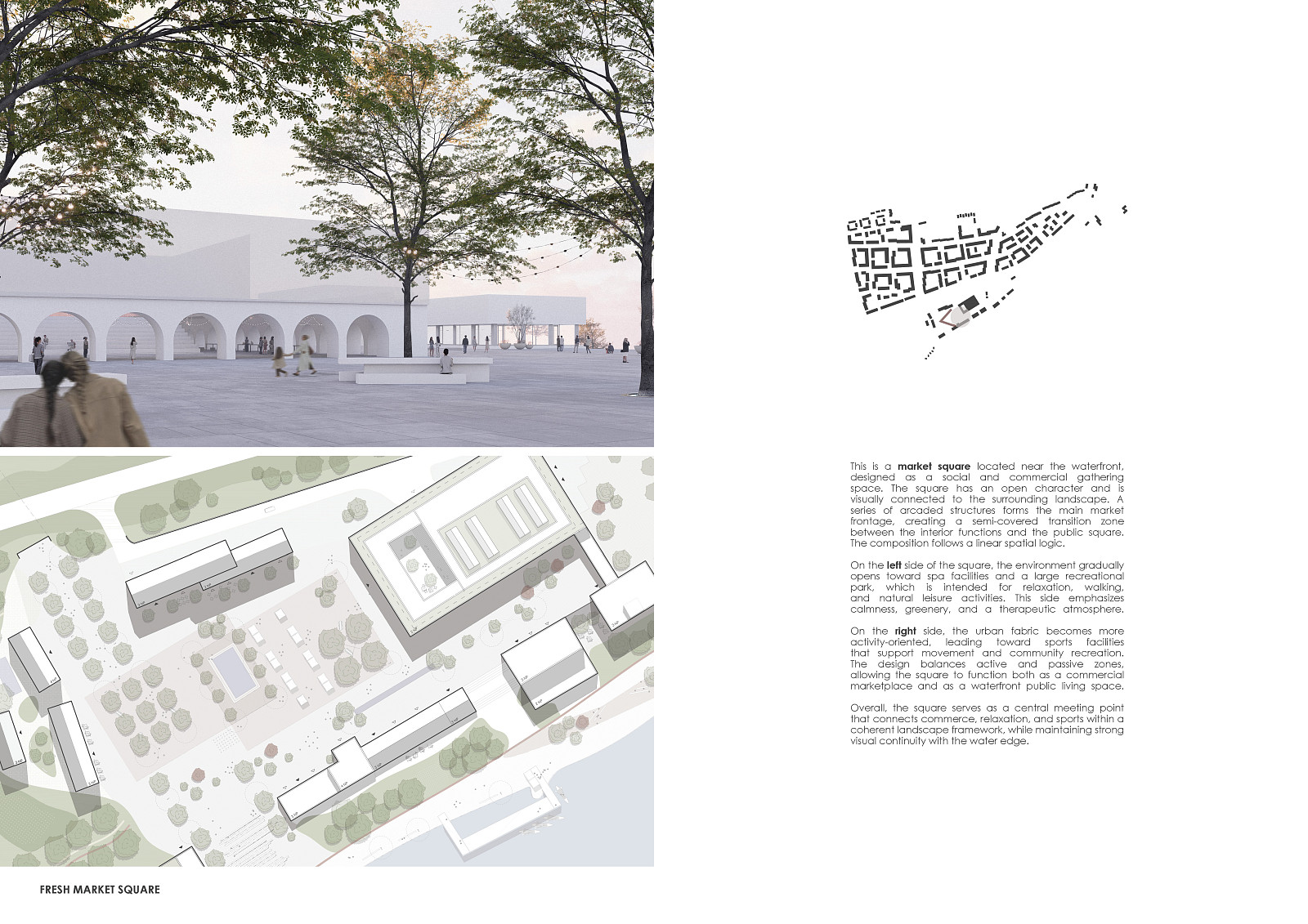
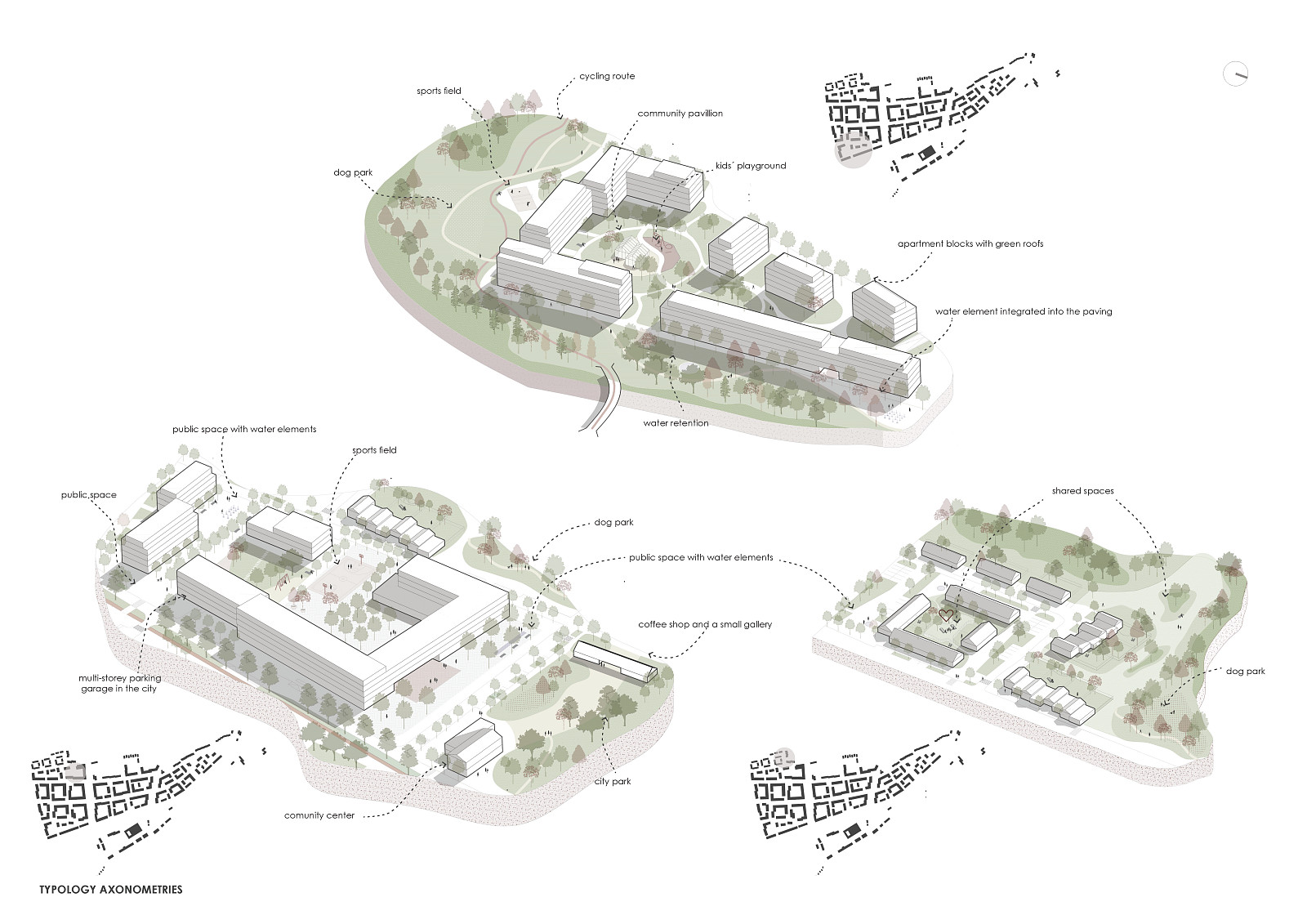
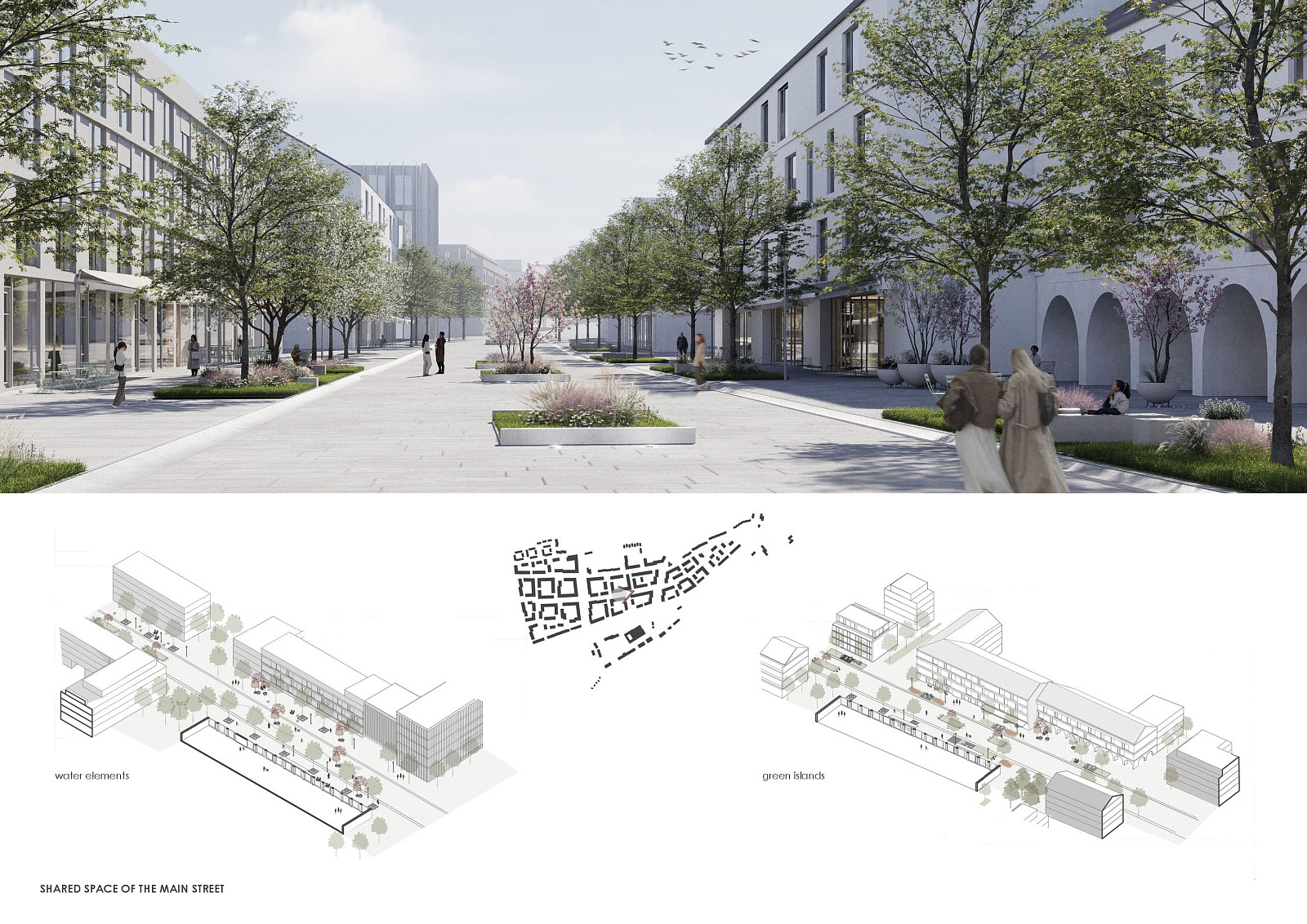
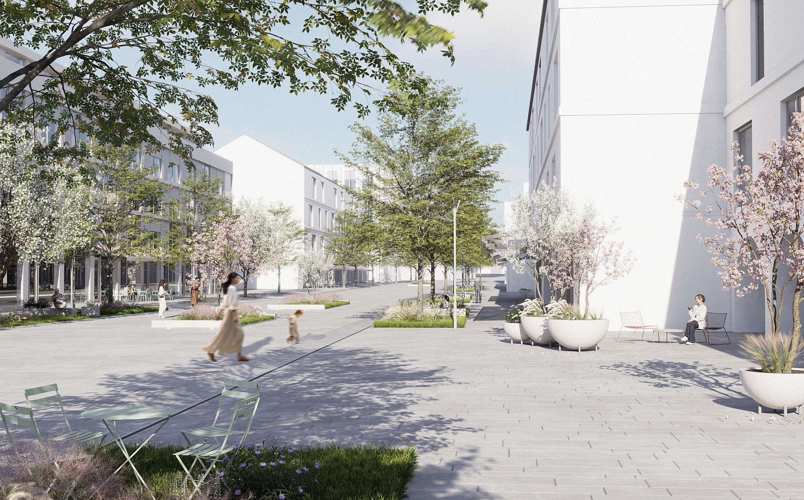
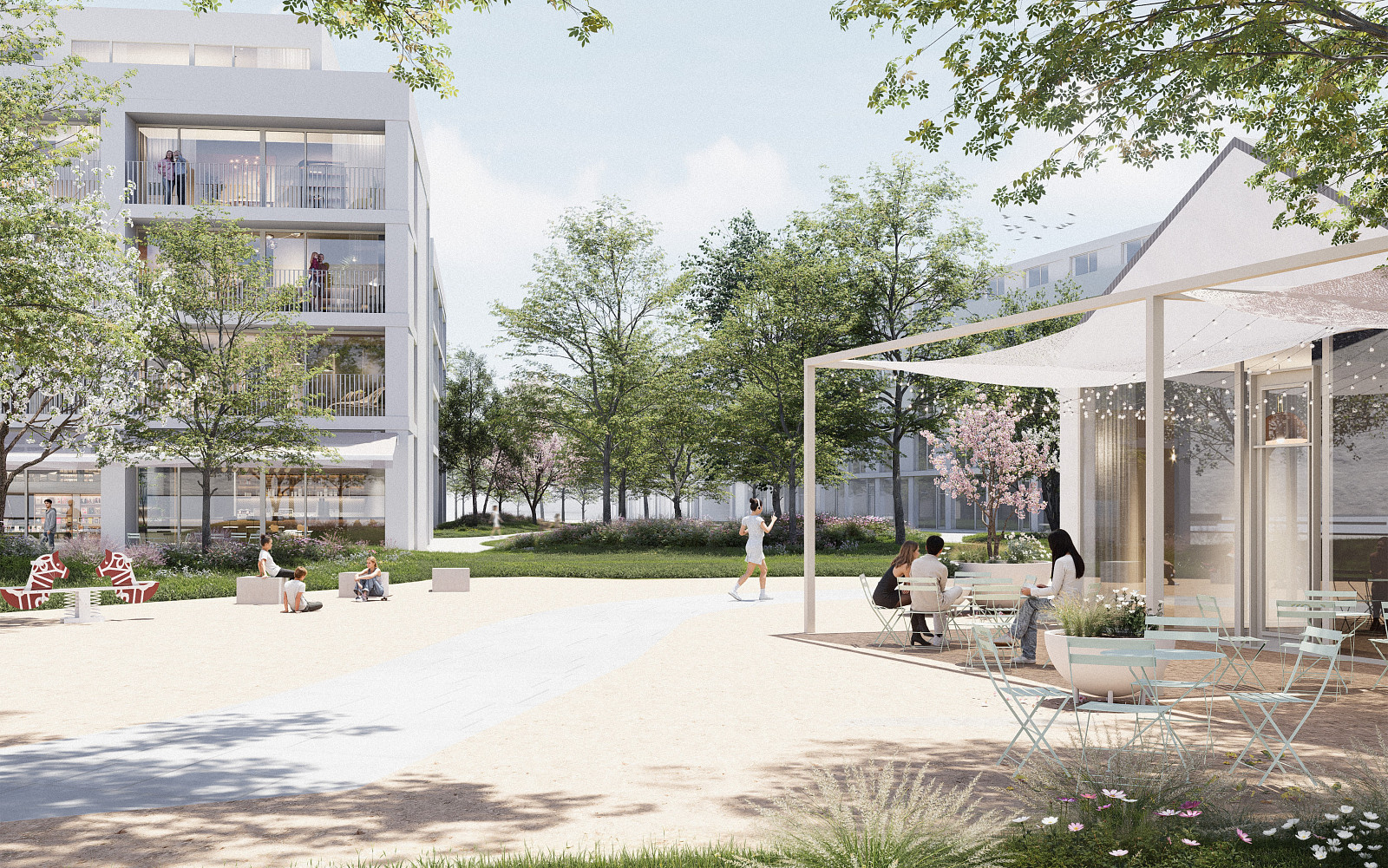
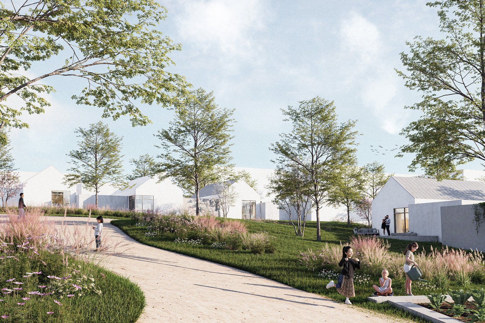
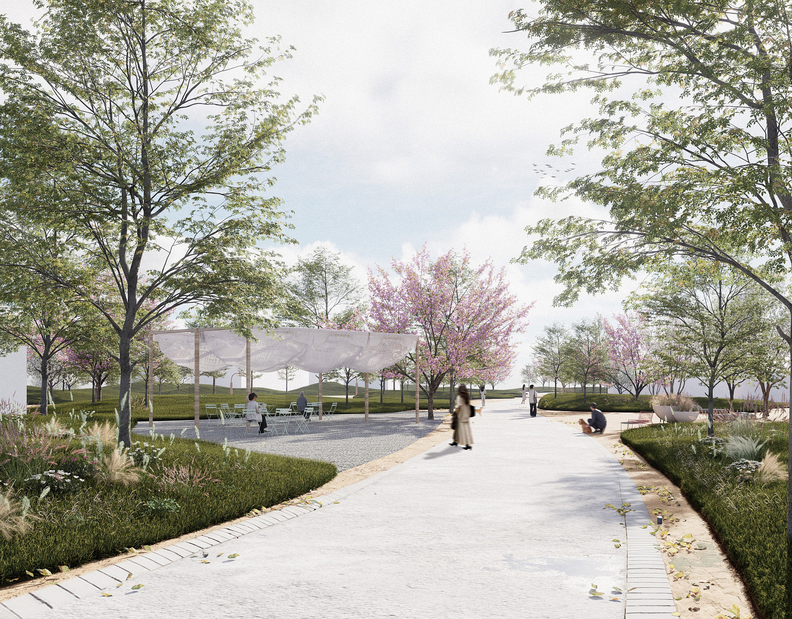
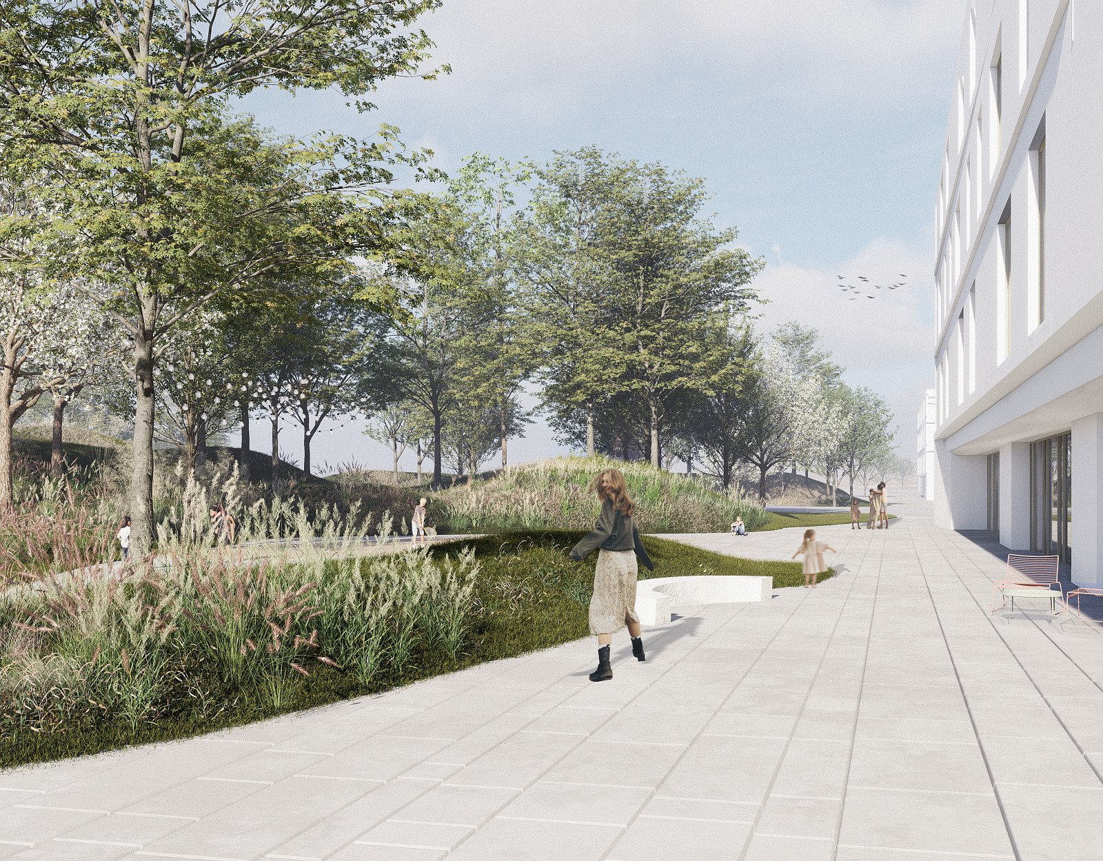
A major challenge of the site is the noisy and polluted main road. For this reason, the new development is set back from the traffic corridor, and a wide green park strip is introduced between the road and the residential zone. The park functions as a protective buffer that reduces noise and improves air quality, while simultaneously serving as an active public space. It includes pedestrian paths, areas for relaxation, sports, play, and social interaction. A central urban axis – the ŽI-línia – runs through the site and forms the backbone of the district. This axis connects the existing neighborhood to the new center, the main square, and the park, and continues further toward the forest park. At the same time, it re-establishes a relationship with the water feature, which had previously been underutilized, integrating it back into the everyday life of the district. The heart of the proposal is the main square, which opens out from the existing development toward the park and gradually transitions to the waterfront. The square also incorporates a marketplace, supporting everyday urban life and strengthening community ties. It serves as a key social space and an important landmark within the district. Another essential principle of the design is the preservation and adaptive reuse of existing buildings on the site. Instead of large-scale demolition, the structures are transformed to accommodate new functions, reducing construction waste while maintaining the identity and memory of the place. The proposed ŽI-línia district emphasizes walkability, a healthy living environment, highquality public spaces, and a strong connection to nature. The result is a new urban quarter that balances housing, public space, greenery, and water, becoming a natural extension of the city of Žilina.
Technical information
The project covers a total area of 71 hectares. The land-use structure is based on a balanced relationship between built-up areas, paved surfaces, and greenery. Built-up areas occupy 10,9 hectares, representing a building coverage ratio of 15,3%, while paved areas cover 28,1 hectares, or 39,6% of the site. Green areas make up approximately 32 hectares, reaching a green area ratio of 43,8% and supporting the ecological and recreational character of the district.
The proposal accommodates approximately 11 445 inhabitants and includes 3815 housing units, with average density of 53,7 housing units per hectare.
Parking is provided through a combination of 393 surface parking spaces, 160 spaces in parking garages, and 6297 spaces in underground garages. In total, the project provides 6850 parking spaces, which equals approximately 1,8 parking spaces per housing unit. The technical concept supports walkability, environmental quality, and long-term adaptability. Green corridors, permeable surfaces, park areas, and stormwater management elements, are integrated into the spatial structure of the district. Most parking is placed underground, allowing the public space to remain accessible, green, and pedestrian-oriented.

Copyright © 2026 INSPIRELI | All rights reserved. Use of this website signifies your agreement to the Terms of Use, Privacy Policy, and use of cookies.