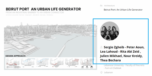
São Paulo Innovation District: an example of urban resilience

Project idea
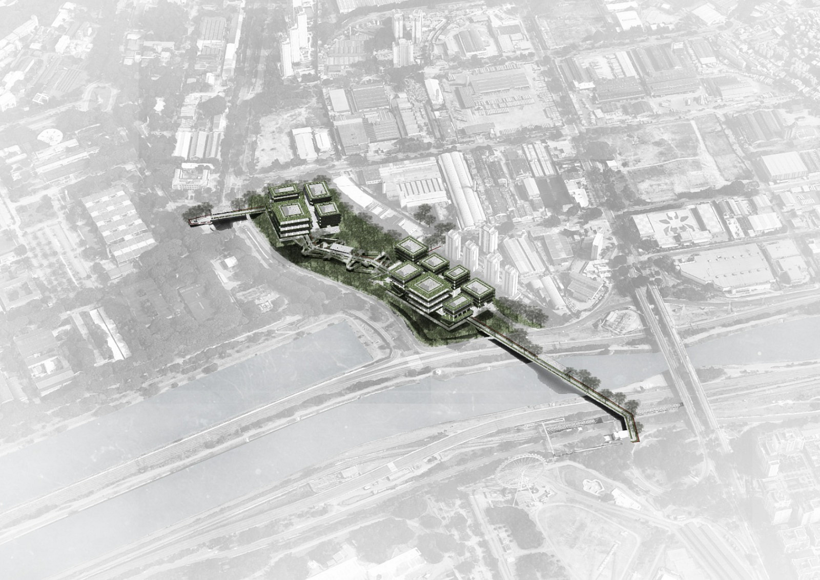
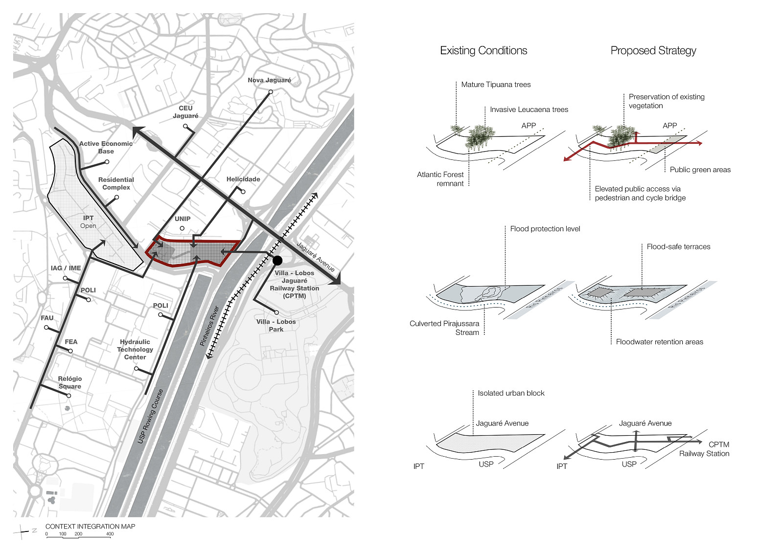
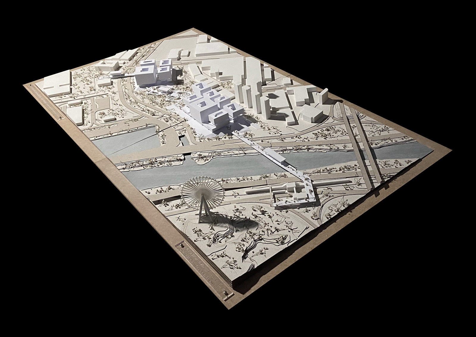
The São Paulo Innovation District emerges from the need to redefine the relationship between knowledge production, environmental regeneration, and urban life. Located in the Jaguaré district, a strategically positioned area with exceptional potential for urban transformation, the proposal requalifies an underutilized territory characterized by environmental vulnerabilities and direct proximity to leading universities, research centers, and innovation institutions. By leveraging these existing assets, the project transforms a fragmented urban landscape into an integrated ecosystem for innovation, collaboration, and sustainable development.
Inspired by the principles of contemporary innovation districts, the project brings together research centers, technology companies, housing, public amenities, and green infrastructure within a cohesive urban framework. Rather than functioning as an isolated technological enclave, the district is conceived as a living environment where scientific advancement, entrepreneurship, and everyday urban experiences coexist and reinforce one another.
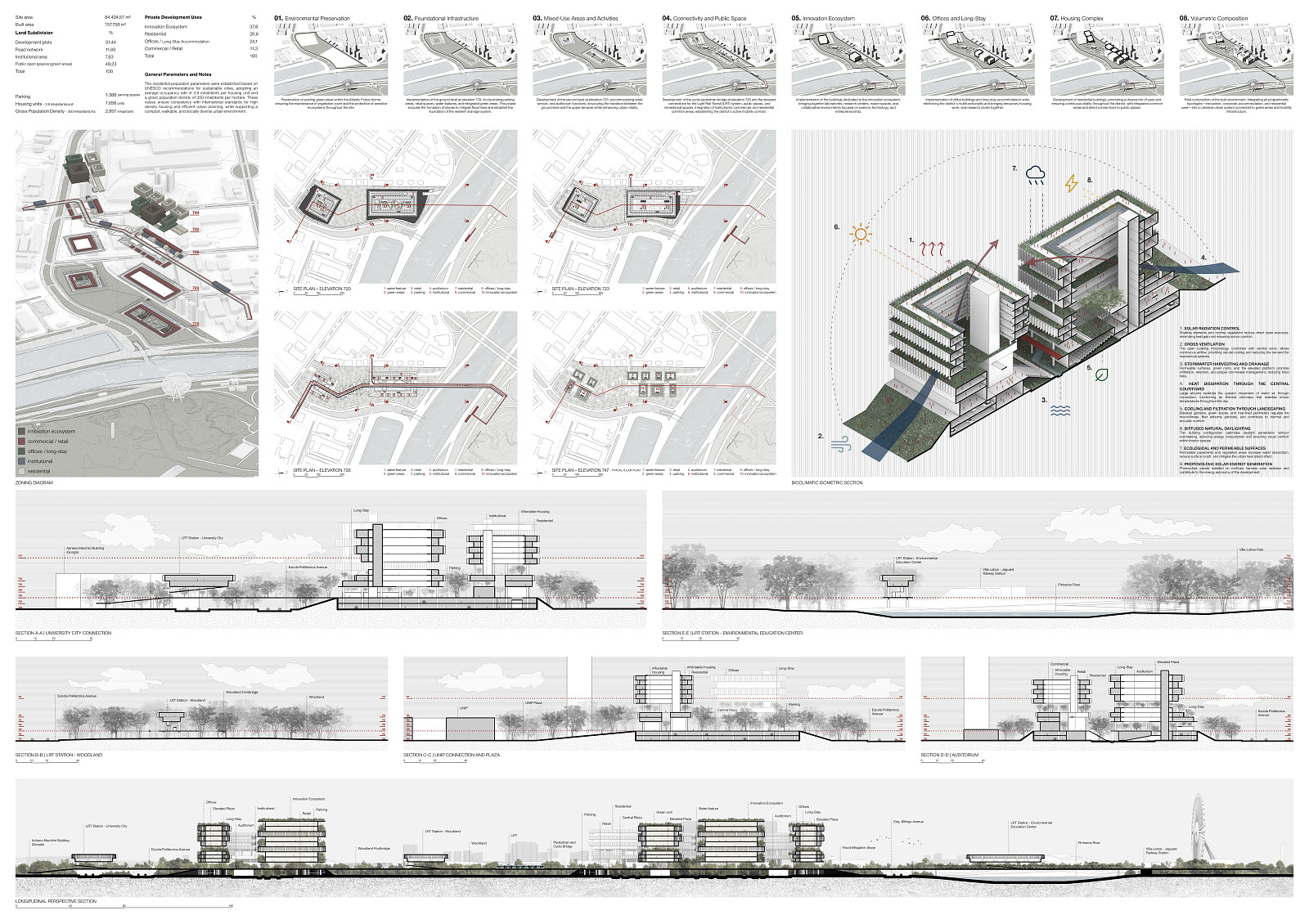
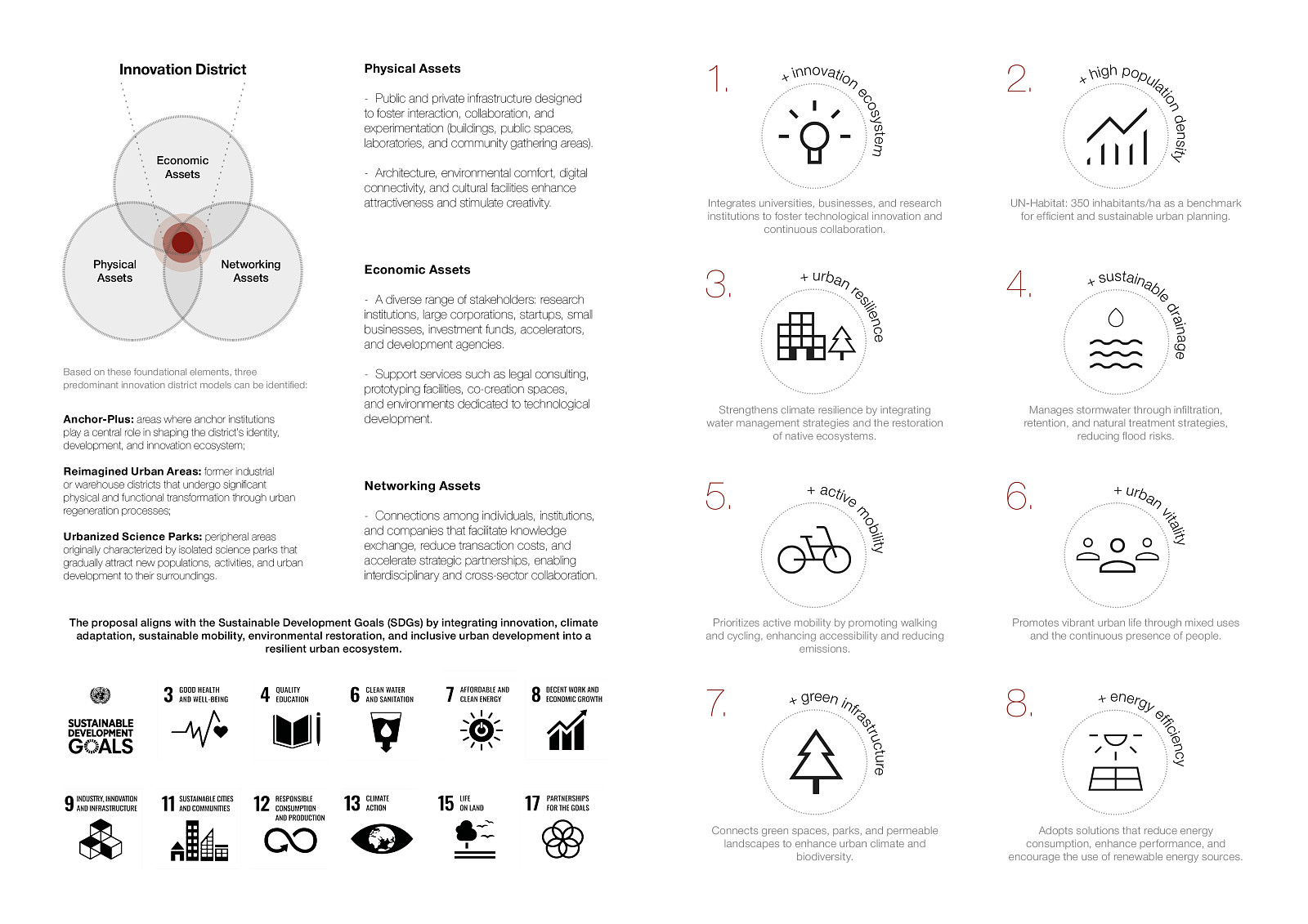
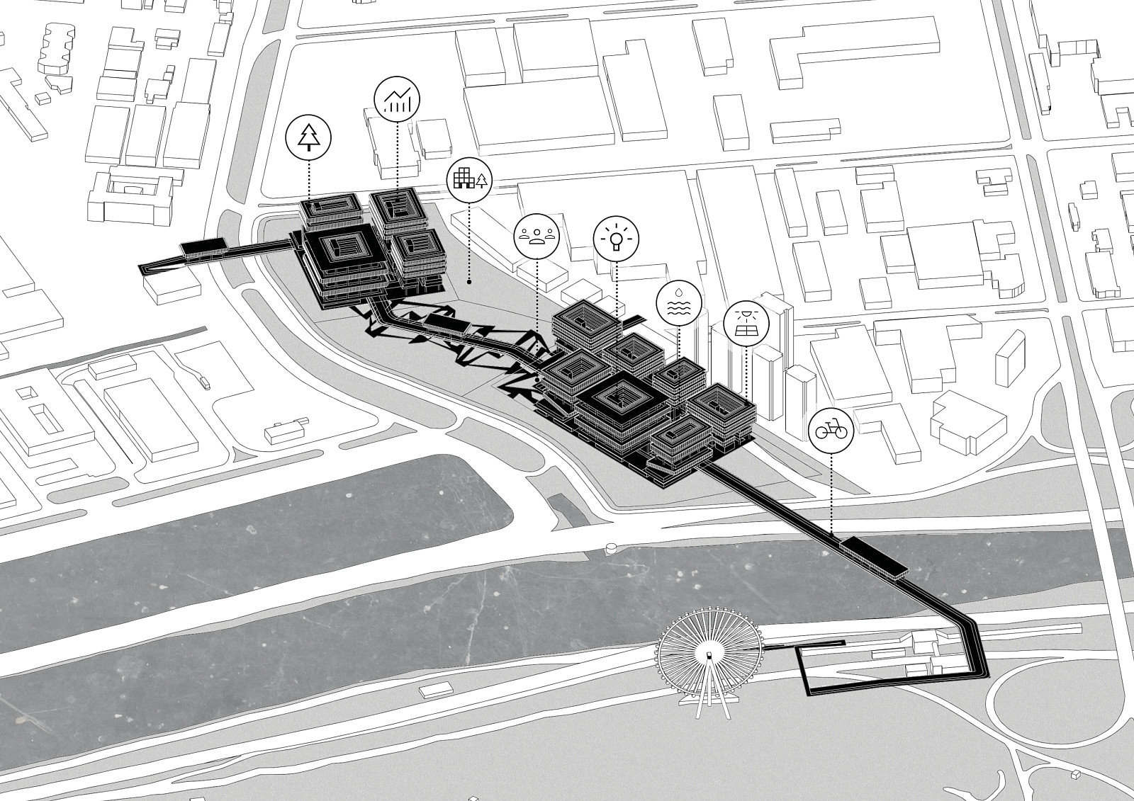
The proposal is guided by eight fundamental principles: innovation ecosystem, high population density, urban resilience, sustainable drainage, active mobility, urban vitality, green infrastructure, and energy efficiency. Together, these strategies establish a resilient urban model capable of addressing climate challenges while promoting social interaction, economic development, and environmental sustainability.
Project description
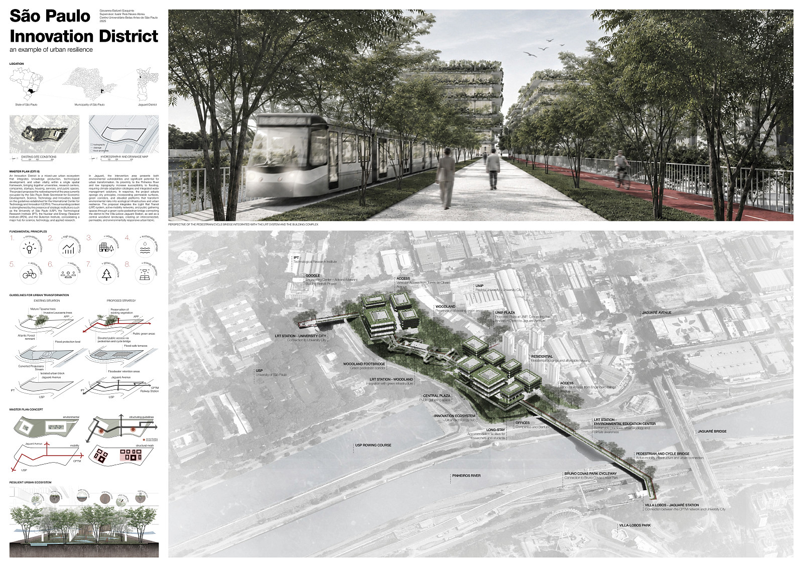
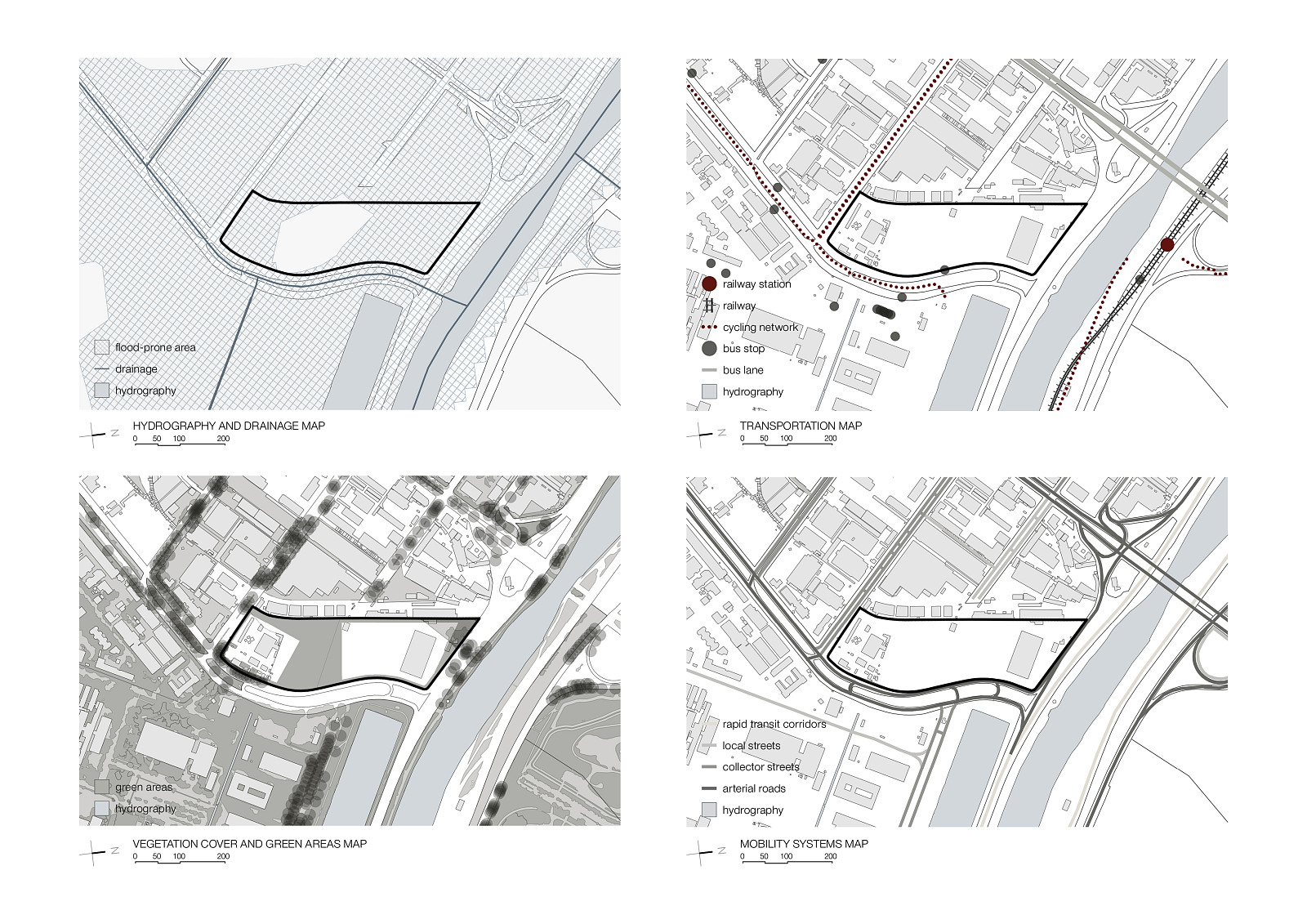
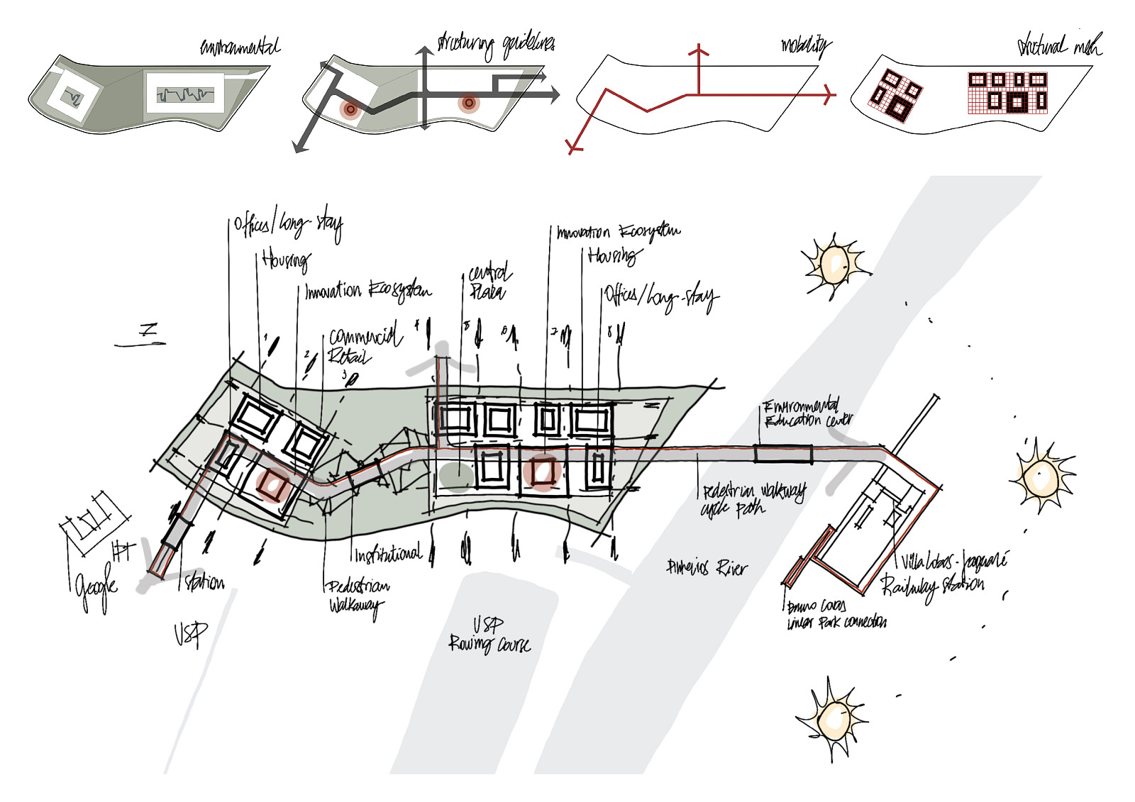
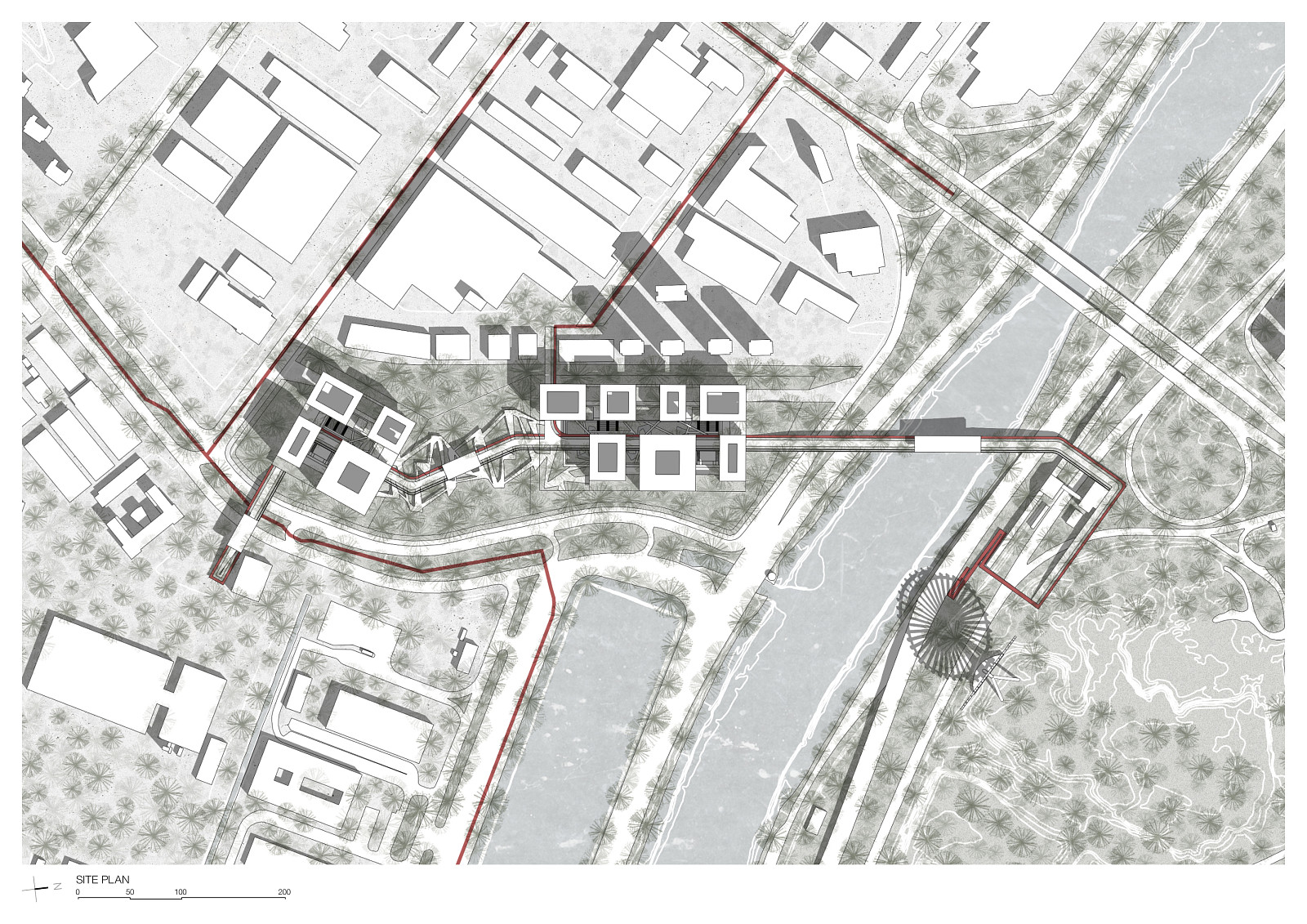
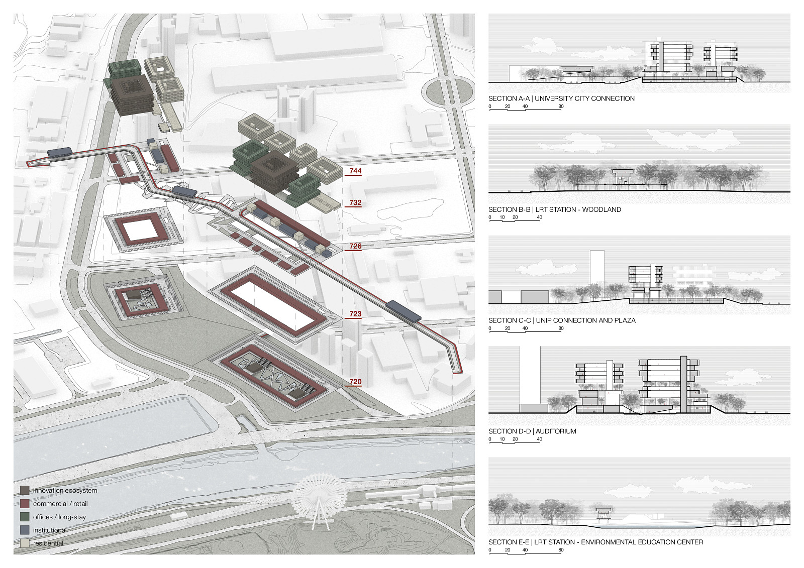
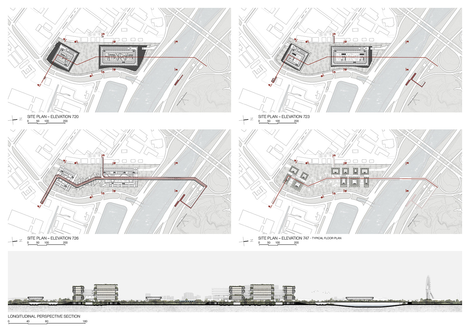
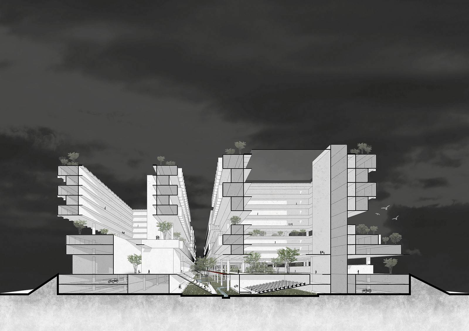
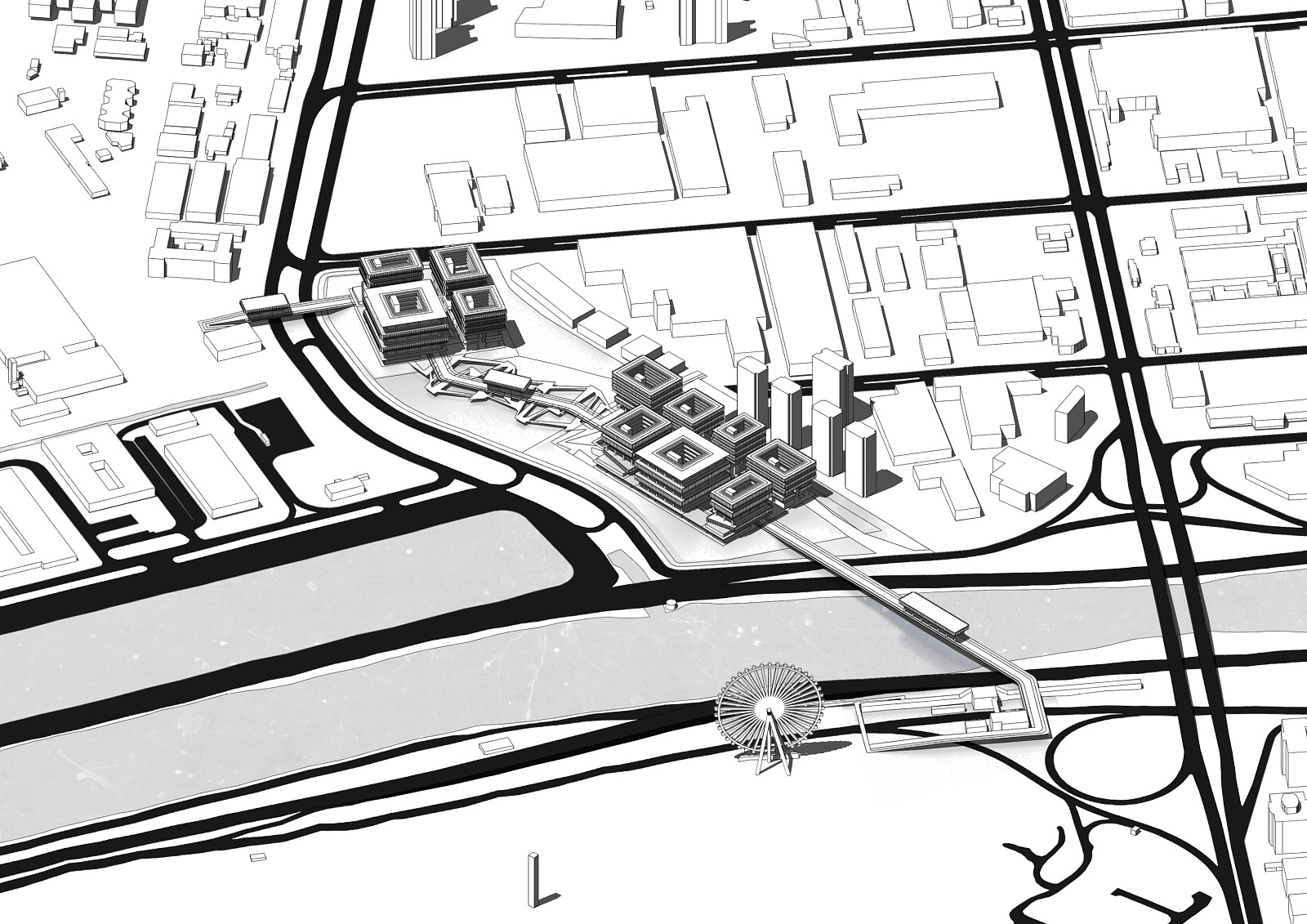
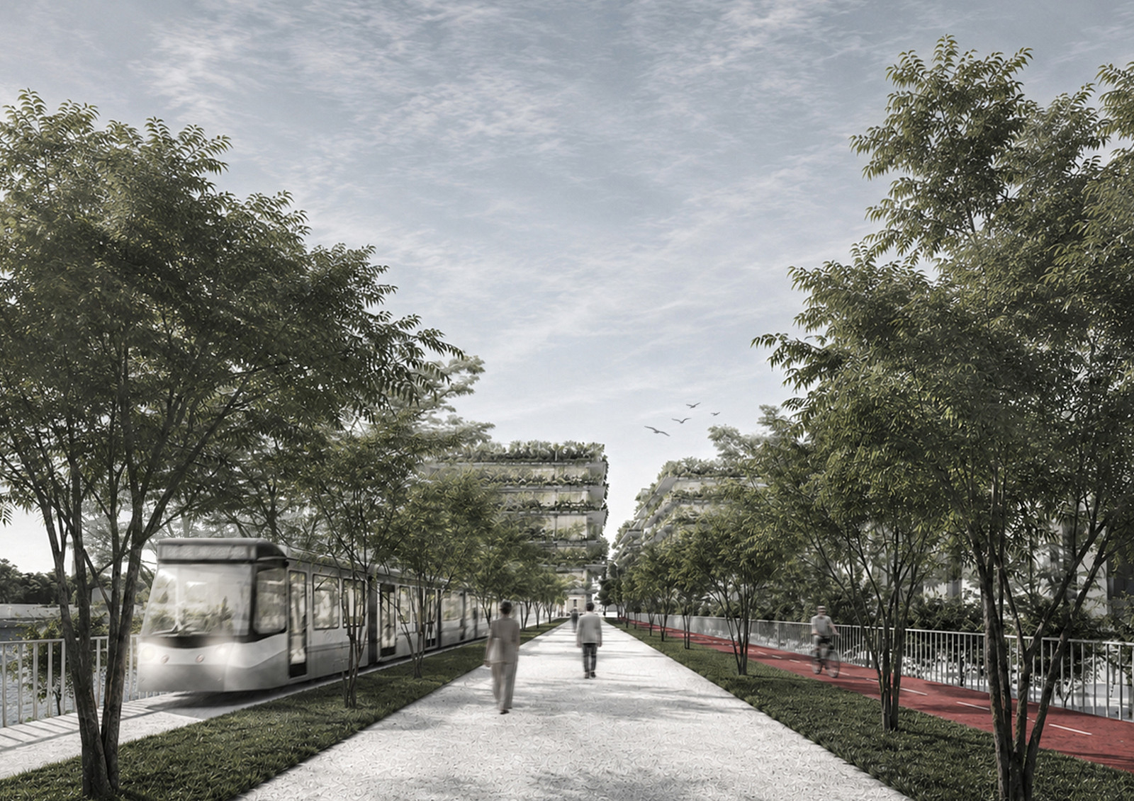
The master plan reorganizes the intervention area through a mixed-use urban structure that prioritizes connectivity, environmental performance, and public life. A network of pedestrian routes, cycling infrastructure, green corridors, and public spaces links the district to surrounding institutions, including the University of São Paulo (USP), the Institute for Technological Research (IPT), the Institute of Energy and Nuclear Research (IPEN), and the Butantan Institute.
The project integrates the Light Rail Transit (LRT) system, active mobility networks, and a green pedestrian/cycle
bridge connecting the district to Villa-Lobos–Jaguaré Station, strengthening accessibility and reducing dependence on private vehicles. At the heart of the proposal, a central public plaza and a sequence of open spaces encourage social interaction, cultural activities, and knowledge exchange.
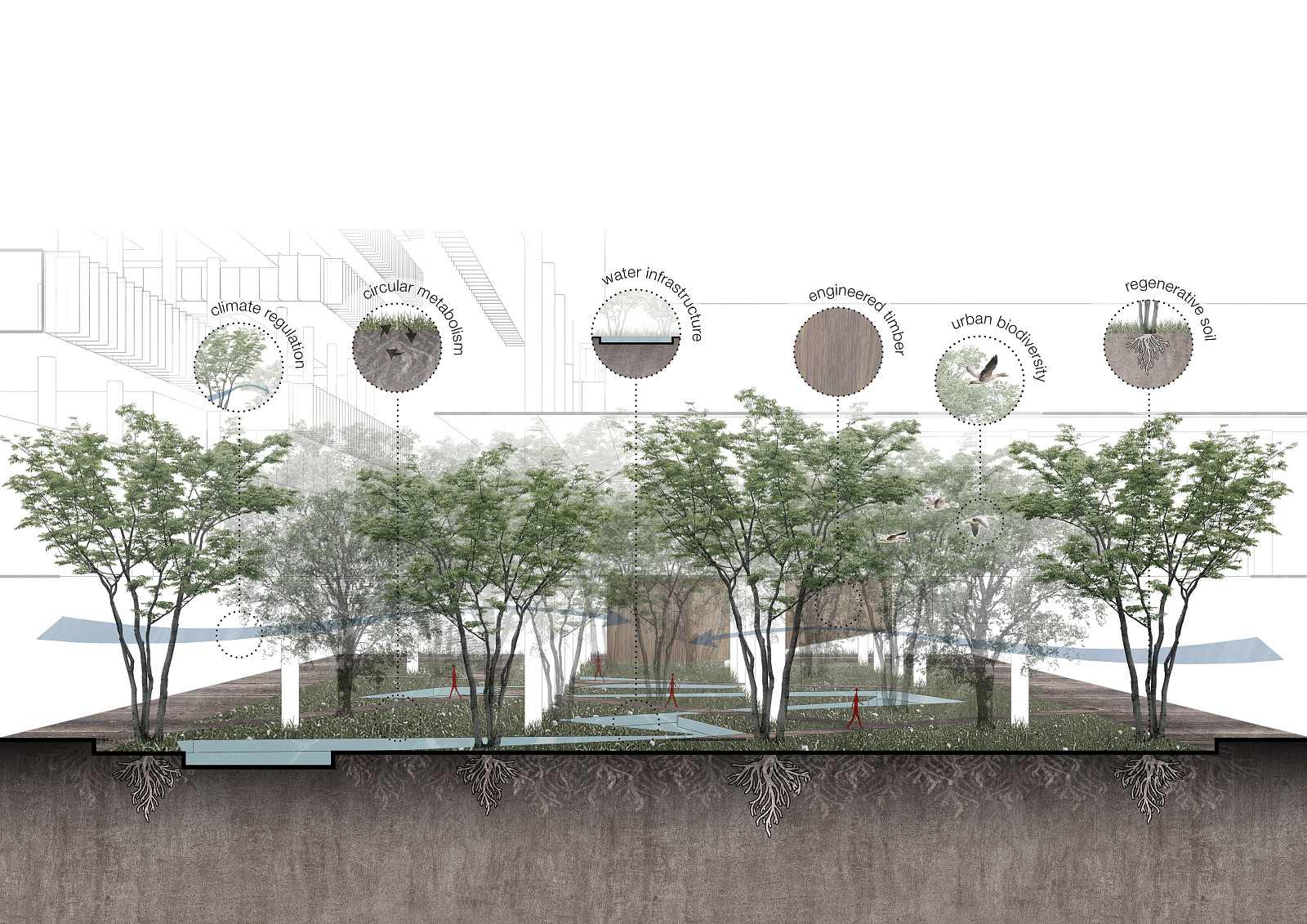
Given the site's proximity to the Pinheiros River and its susceptibility to flooding, the proposal adopts sponge city principles, incorporating permeable landscapes, retention areas, flood-safe terraces, ecological corridors, and water-sensitive urban design strategies. Landscaped flood mitigation slopes were strategically integrated into the masterplan to reduce flood exposure, improve stormwater management, and strengthen the district’s resilience against extreme weather events. Together, these interventions transform environmental constraints into opportunities for ecological restoration and climate adaptation.
The district combines research facilities, innovation hubs, offices, educational programs, long-stay accommodation, social housing, retail services, and public amenities, creating a diverse and active urban environment throughout the day. By integrating technological development with ecological systems and public life, the proposal establishes a model for a more resilient, inclusive, and sustainable metropolitan future.
Technical information
The project is structured around a modular planning system based on a 10 × 10 meter structural grid, subdivided into 1.25 meter increments to ensure flexibility, efficiency, and long-term adaptability. This rational framework supports different building typologies while allowing future expansion and functional transformation over time.
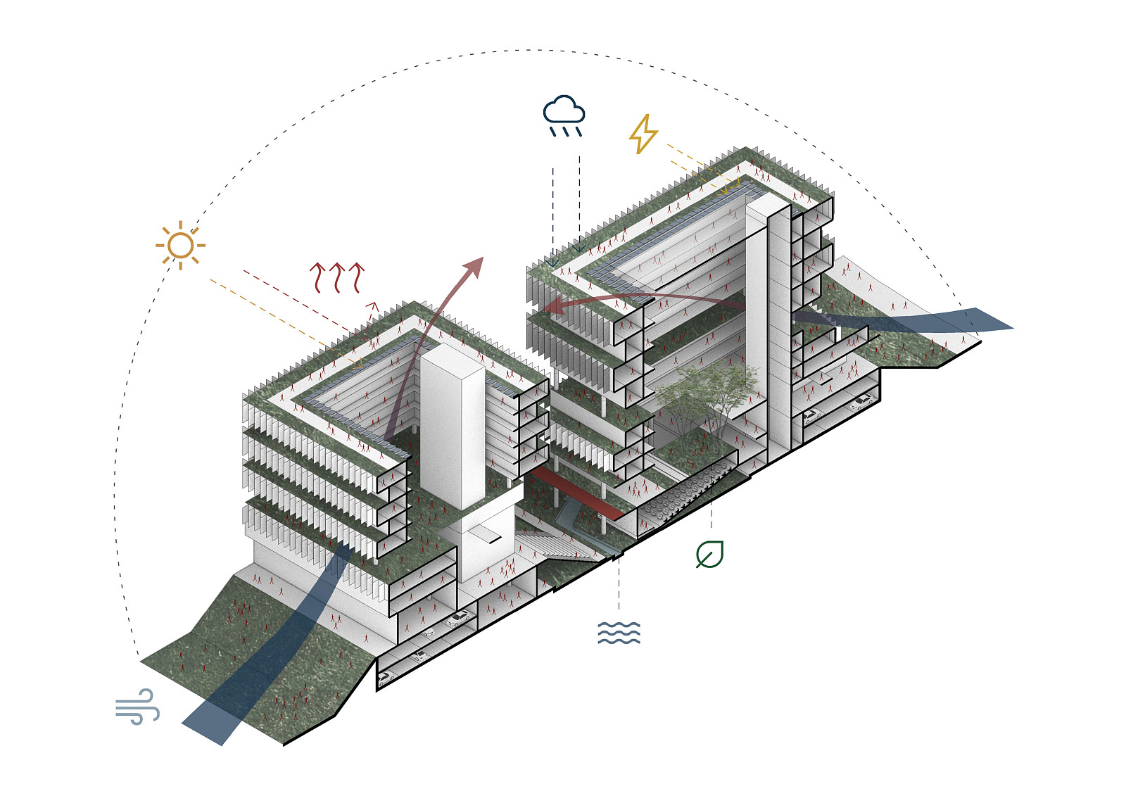
Considering the site's flood-prone condition, the ground floor structure is primarily composed of reinforced concrete, providing durability, stability, and resilience against periodic flooding events. The upper levels employ engineered timber construction, significantly reducing the environmental footprint while enabling efficient assembly, structural performance, and material optimization.
Environmental performance is enhanced through passive design strategies, including optimized solar orientation, natural ventilation, shaded public spaces, green roofs, permeable surfaces, and extensive vegetation. Sustainable drainage systems promote infiltration, retention, and treatment of stormwater, reducing runoff and mitigating flood risks. Photovoltaic panels integrated into the building roofs contribute to on-site renewable energy generation, reducing operational energy demand and supporting the district’s sustainability goals.
Recognizing the ongoing transition toward more sustainable mobility patterns, the parking structures were conceived with long-term adaptability in mind. As dependence on private vehicles decreases over time, these spaces can be progressively repurposed to accommodate commercial activities, community facilities, workspaces, and other urban functions, ensuring the district remains responsive to future social and economic demands.
The development prioritizes active mobility through a comprehensive pedestrian and cycling network integrated with public transportation infrastructure. Together, these strategies create a resilient urban framework that combines technological innovation, environmental responsibility, and high-quality public spaces, establishing a contemporary model for sustainable urban development.
Documentation
Copyright © 2026 INSPIRELI | All rights reserved. Use of this website signifies your agreement to the Terms of Use, Privacy Policy, and use of cookies.