Makro Vizyondan Mikro Tasarıma: Alanya'nın Entegre Master Planı


Project idea
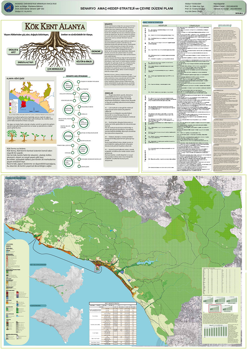
"RootCity Alanya" is guided by a vision of a flexible, productive, and sustainable city that draws its strength and resilience from its deep-rooted historical, cultural, and ecological past. Inspired by the organic structure of tree roots, this concept transforms vital urban dimensions such as ecology, disaster resilience, economy, infrastructure, and cultural identity into structural anchors that directly carry life and energy to the city's sub-centers. Completely rejecting superficial design interventions, the project focuses on establishing a deep ecological and social network that connects regional systems with micro-level public spaces.
Project description
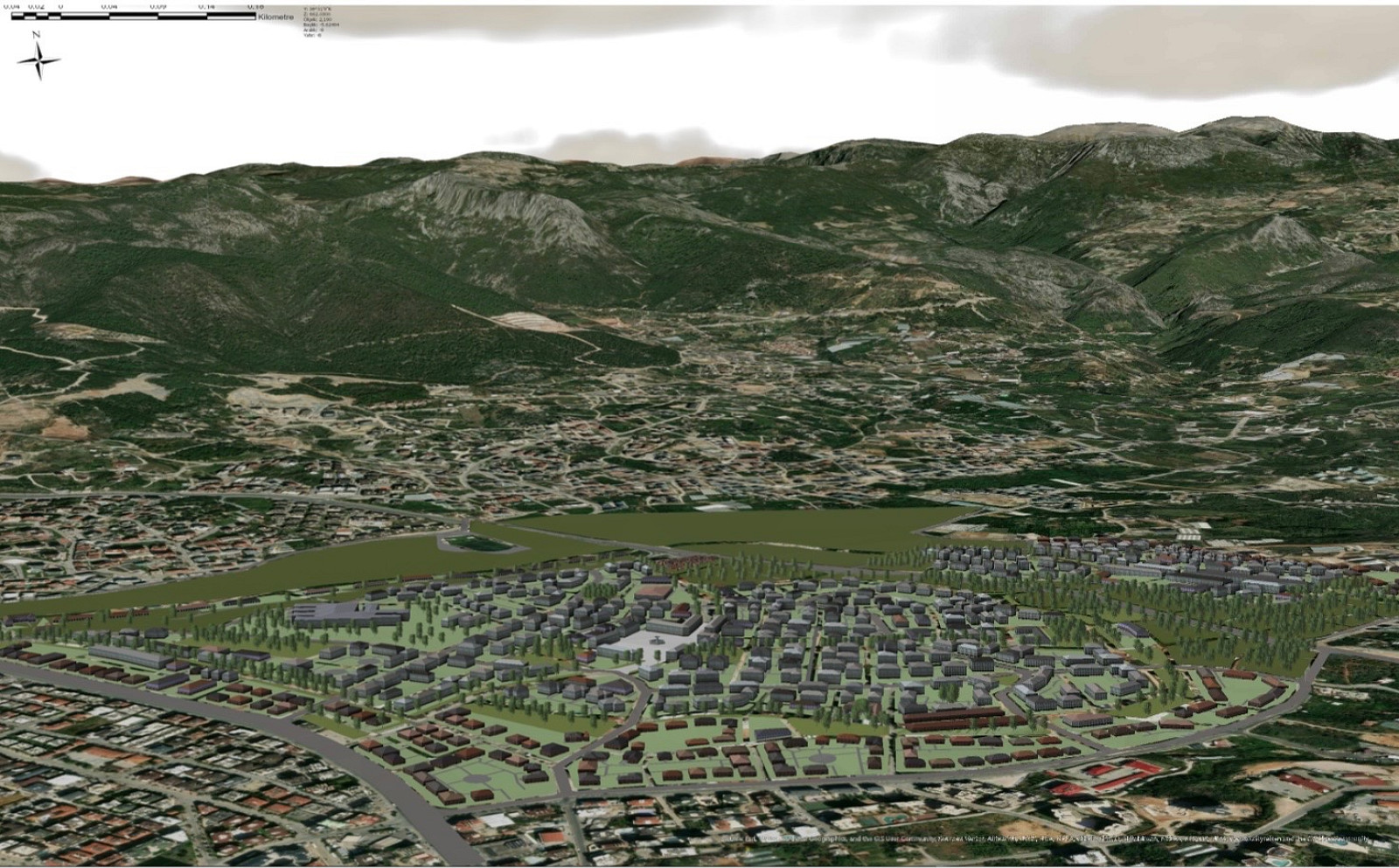
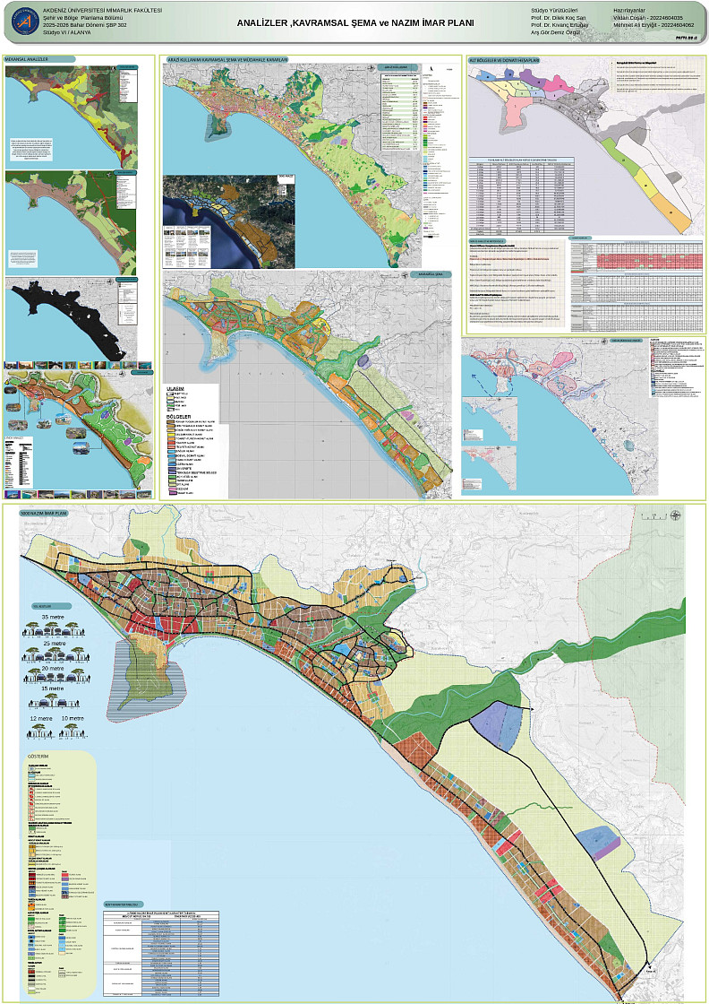
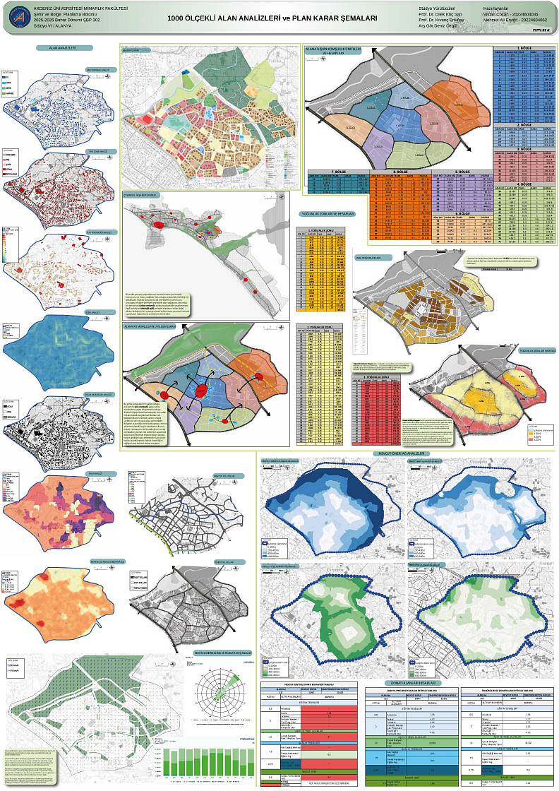
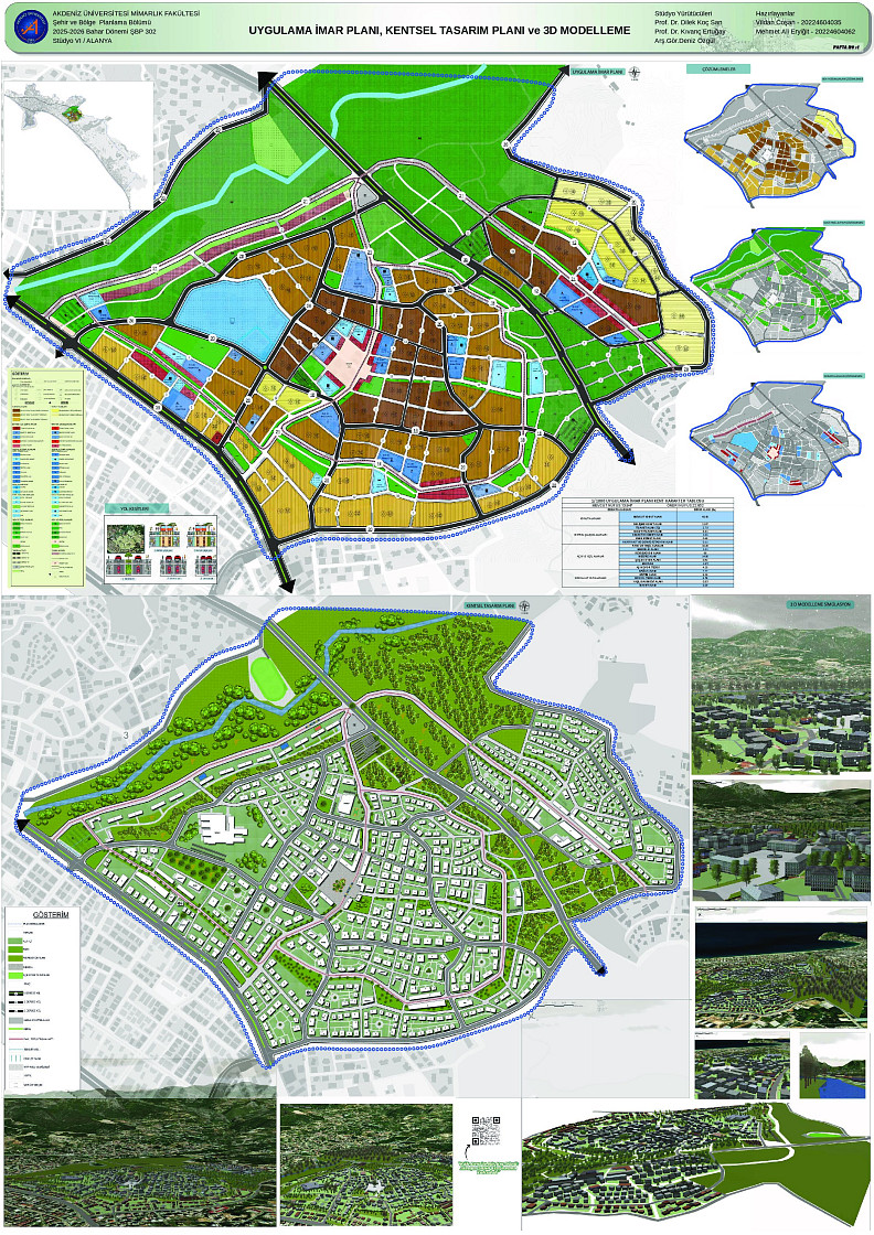
This project showcases a highly comprehensive and multi-scale urban planning and design methodology that operates seamlessly across four distinct phases. The process begins with macro-regional decisions at the 1/25,000 scale Environmental Layout Plan level, defining key objectives, disaster mitigation scenarios, and spatial strategies. This is followed by a 1/5,000 scale Master Development Plan and conceptual framework; this is then followed by meticulous site analyses and Implementation Development Plans at a 1/1000 scale. The entire planning workflow culminates in a highly detailed 1/1000 scale Urban Design Project and 3D architectural modeling. The final product integrates complex road hierarchies, green corridor networks, pedestrian-focused zones, and structural adaptations such as topographically sensitive terraced houses, offering a seamless design language from the regional to the parcel scale.
Technical information
The technical backbone of the project is based on layered spatial analyses, geographic data synthesis, and advanced digital modeling workflows. Large spatial matrices, demographic projections, macro-level environmental threshold/suitability analyses, and land-use typologies have been systematically analyzed and mapped using Geographic Information Systems (GIS) platforms. The structural implementation side involves an advanced transportation design with clear road hierarchies (sections ranging from 10 meters to 35 meters in width), rail corridors, pedestrian networks, and overpasses. At the micro level, the digital workflow combines precise CAD map sheets, 3D modeling software (SketchUp), and real-time visualization engines (Lumion) to effectively simulate urban massing, square designs, and complex topographic layers.
Documentation
Show PDF 1Show PDF 2Show PDF 3Show PDF 4


Copyright © 2026 INSPIRELI | All rights reserved. Use of this website signifies your agreement to the Terms of Use, Privacy Policy, and use of cookies.