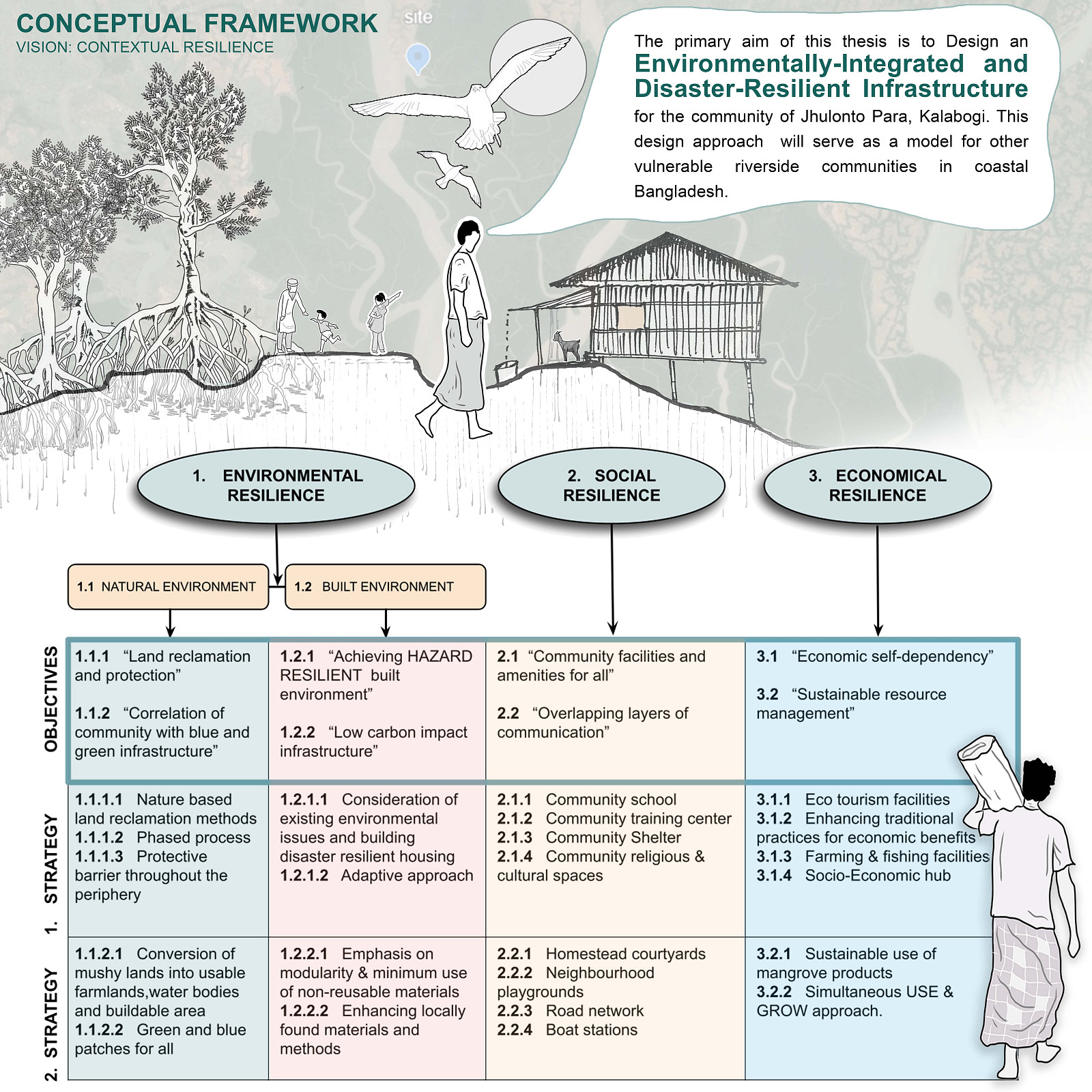
DESIGN OF A RESILIENT SETTLEMENT AT THE JUXTAPOSITION OF DISASTERS

Project idea
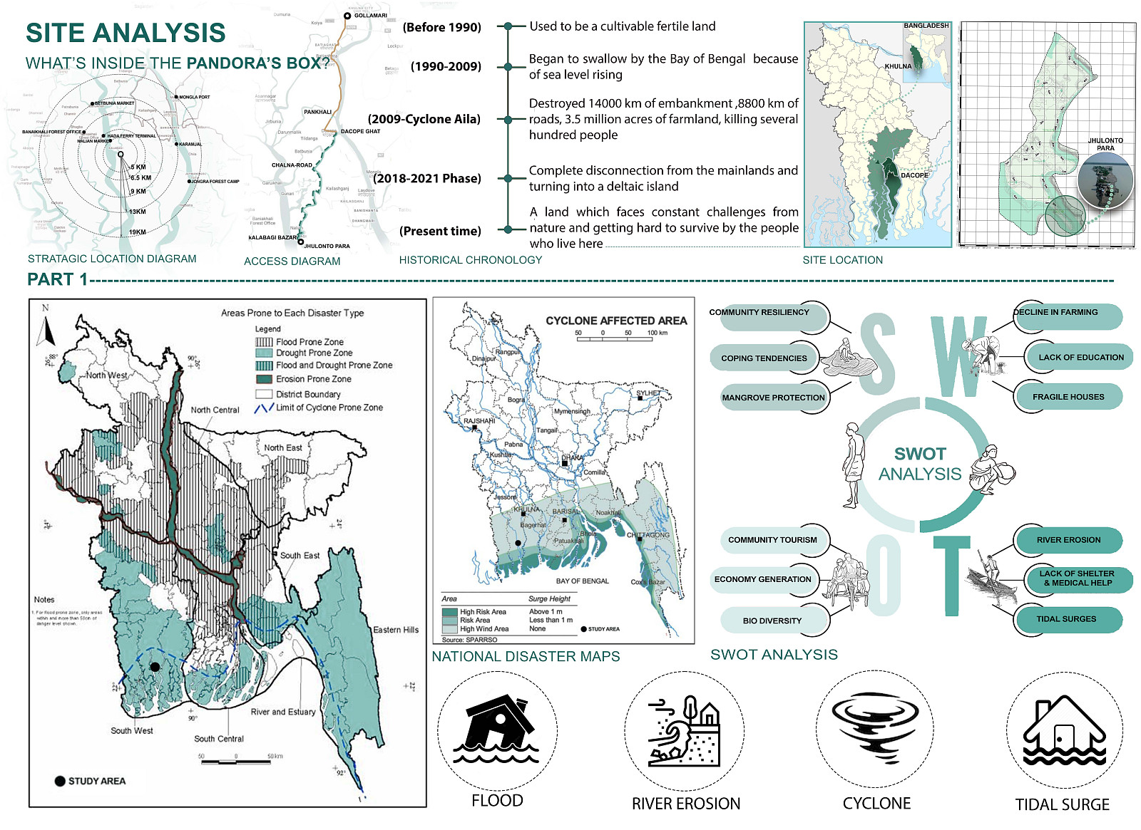
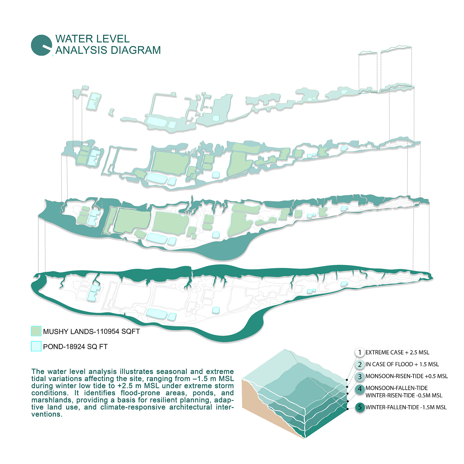
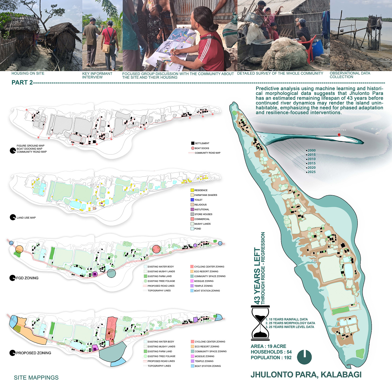
Jhulonto Para is a small riverside settlement in Kalabogi, Khulna, located at the fragile edge between the Sundarbans mangrove ecosystem and the Shibsha River. Over the last decade, continuous riverbank erosion, cyclones, tidal surges, flooding, and salinity intrusion have transformed the once-connected village into an isolated deltaic island. Homes, farmland, community spaces, and even burial grounds have gradually disappeared into the river, threatening not only physical survival but also the community's cultural identity and way of life.
Yet the people remain. Their lives continue to depend on fishing, crab collection, honey gathering, and Golpata harvesting from the surrounding mangrove landscape. Rather than treating these environmental forces as enemies, the project explores how architecture can work with them.
From its inception, the project was conceived not as the design of a single building or intervention, but as a comprehensive framework for the entire settlement. The challenges facing Jhulonto Para are deeply interconnected; land loss affects housing, housing affects livelihoods, livelihoods affect social stability, and environmental degradation threatens them all. For the settlement to become truly resilient and self-sufficient, every component of its physical, ecological, social, and economic infrastructure had to be addressed as part of a unified system.
The proposal therefore reimagines resilience as a dynamic relationship between water, land, ecology, and people. Through nature-based land reclamation, mangrove-assisted shoreline protection, disaster-responsive housing, community facilities, water and energy infrastructure, and livelihood-generating spaces, the project establishes a framework that allows the settlement to adapt and grow alongside an evolving delta.
Instead of relying on rigid defensive infrastructure, the design introduces an adaptive system capable of responding to future environmental uncertainty. The goal is not simply to protect a settlement from climate change, but to enable a community to remain on its ancestral land while restoring ecological systems, strengthening local economies, and preserving cultural identity.
Ultimately, the project proposes a replicable model for climate-vulnerable coastal settlements across Bangladesh and other deltaic regions, demonstrating how architecture can become an instrument of environmental restoration, community empowerment, social resilience, and long-term climate adaptation.
Project description
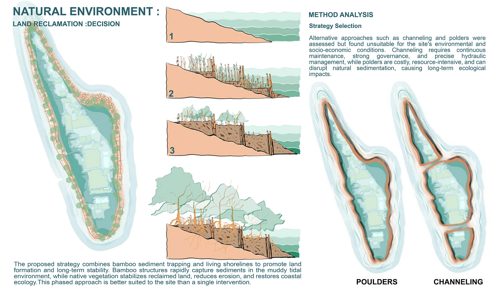
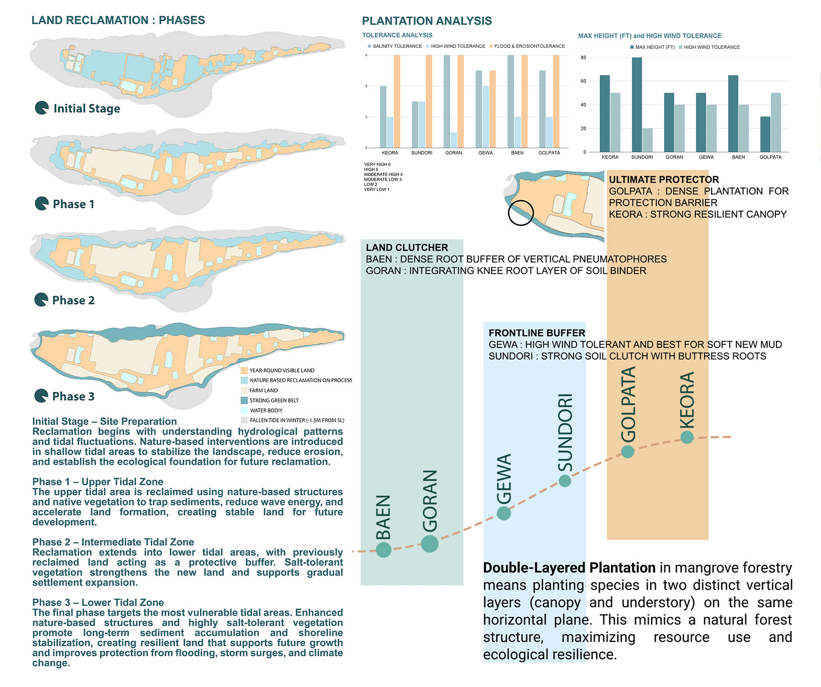
The project proposes a comprehensive resilience framework for Jhulonto Para. The intervention begins with a phased land reclamation program designed to recover eroded land and stabilize the island perimeter through nature-based techniques. Reclaimed areas are progressively protected and strengthened through native vegetation and mangrove regeneration, creating a resilient ecological buffer against erosion, storm surges, and tidal flooding.
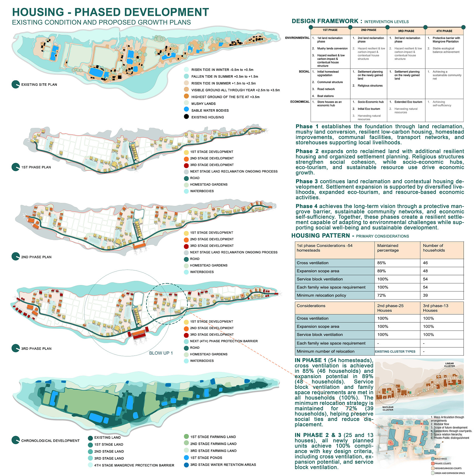
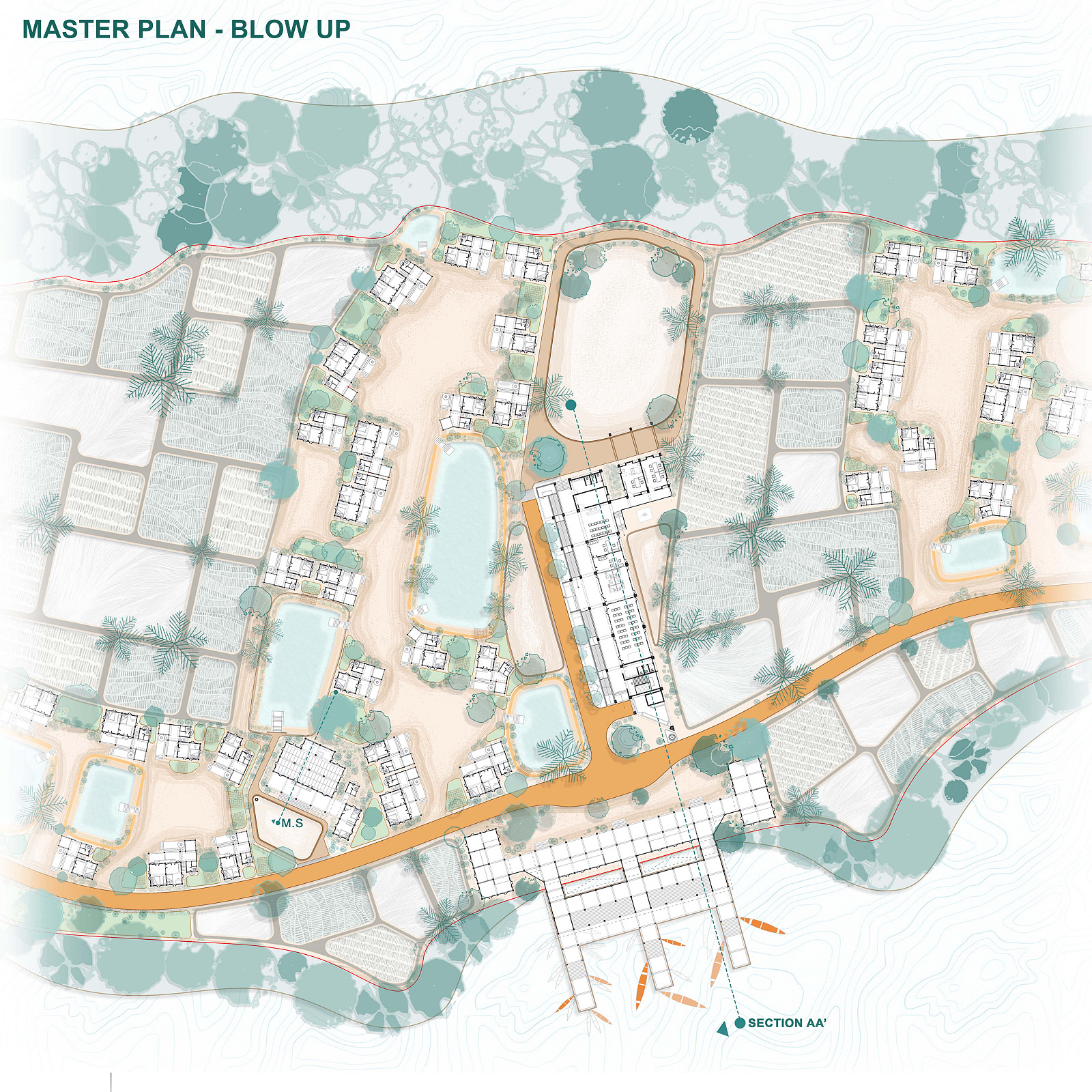
Building on this stabilized landscape, the settlement is reorganized through a phased masterplan guided by long-term erosion predictions and existing social patterns. New development is concentrated within safer zones while minimizing relocation and preserving community networks. Housing clusters are arranged to maximize natural ventilation, allow future expansion, and respond to the spatial requirements of different family structures.
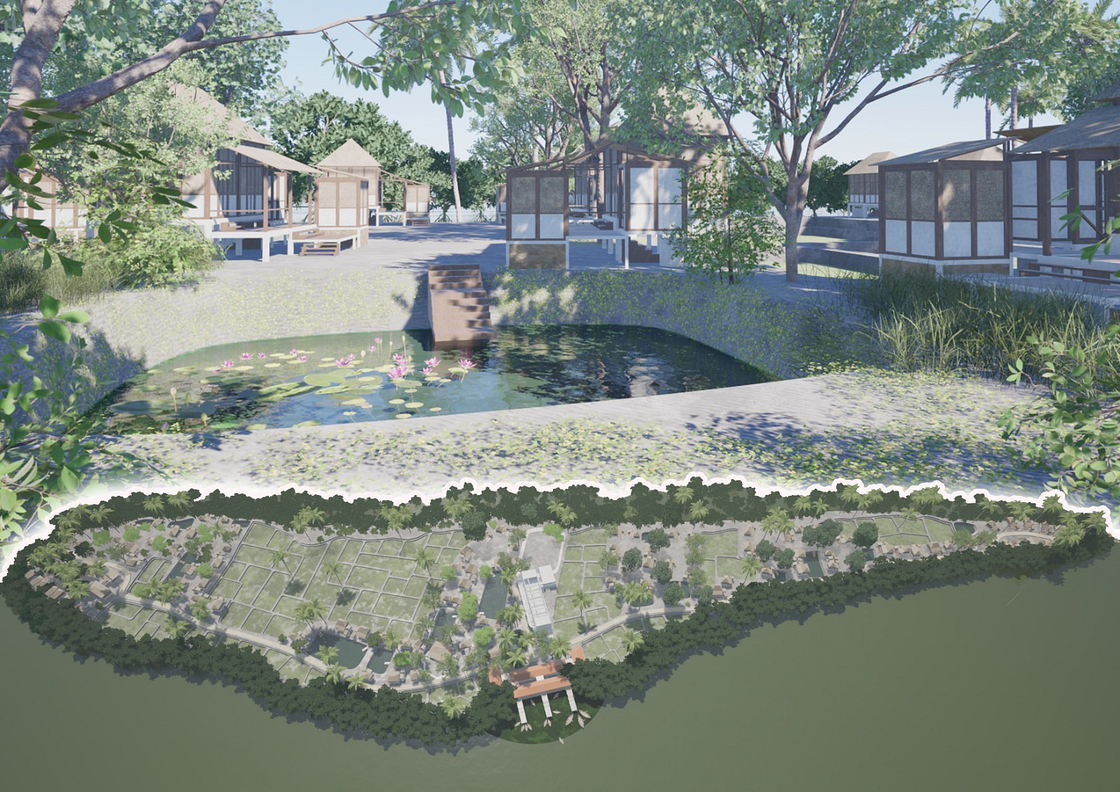
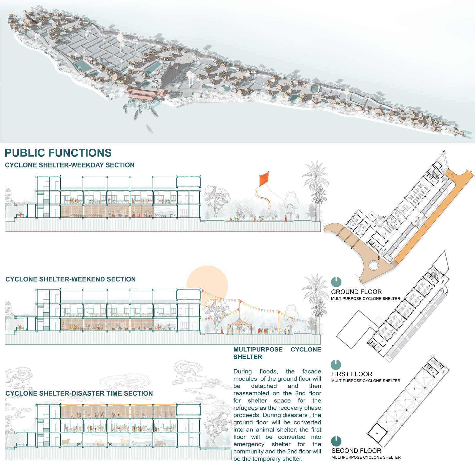
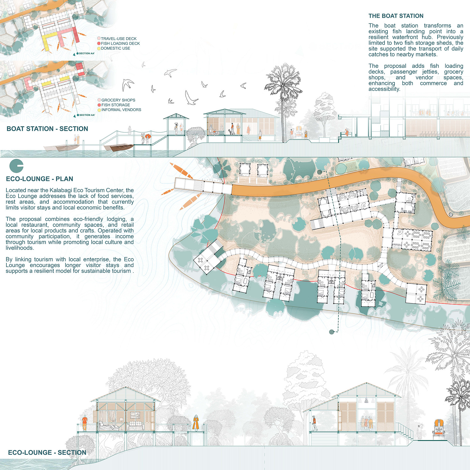
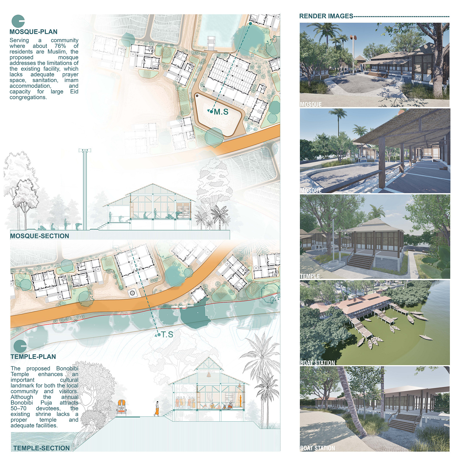
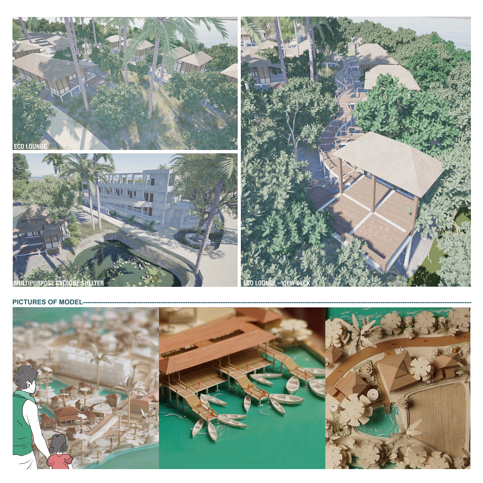
The proposal introduces a range of community facilities that address existing service deficiencies within the settlement. These include a mosque, Bonobibi temple, community gathering spaces, educational and healthcare support facilities, improved waterfront infrastructure, a cyclone shelter, and a boat station. Together, these facilities strengthen social cohesion while improving access to essential services.
Economic resilience is supported through infrastructure directly linked to local livelihoods. Fishing and fish-processing activities are enhanced through improved waterfront facilities, while eco-tourism opportunities are developed through the introduction of an Eco Lounge and community-based tourism services connected to the nearby Kalabagi Eco Tourism Center. Productive landscapes and resource-based economic activities further diversify income sources and reduce seasonal vulnerability.
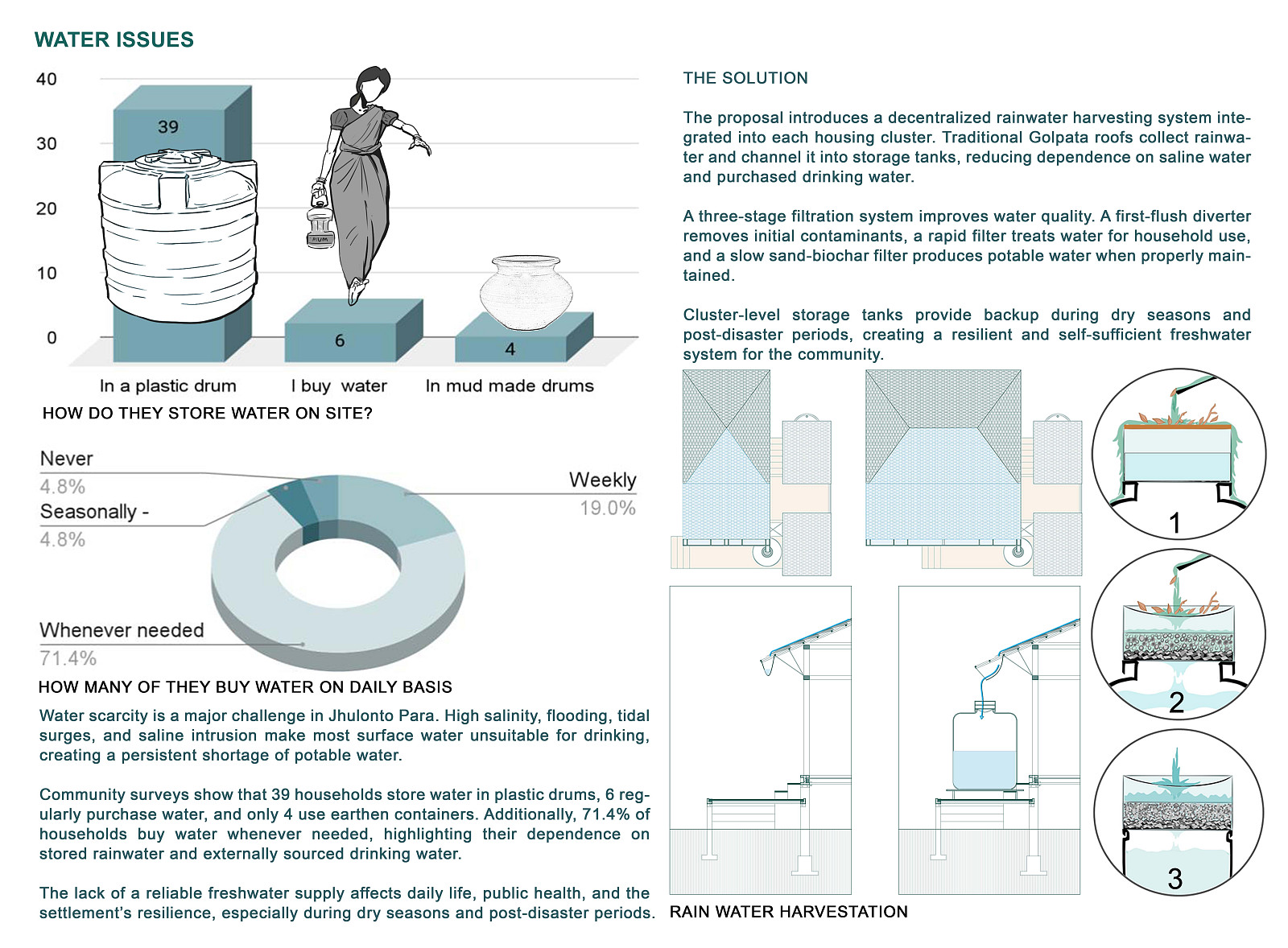
Water and energy security are addressed through decentralized rainwater harvesting systems and expanded solar-energy integration. These systems increase settlement self-sufficiency while reducing dependence on external resources.
The project ultimately establishes a resilient and self-sustaining settlement model capable of adapting to environmental change while preserving the cultural identity, livelihoods, and social structure of the community.
Technical information
Adaptive Land Reclamation System : The proposal employs a phased land reclamation strategy using bamboo sediment-trapping structures and living shorelines. Bamboo barriers reduce water velocity and capture suspended sediments, accelerating natural land formation. Once sediment accumulation reaches a stable condition, native salt-tolerant vegetation is introduced to reinforce soil stability, reduce erosion, and establish long-term shoreline protection.
Mangrove-Based Protection Belt : A continuous mangrove buffer is established along vulnerable shoreline edges. The vegetation system reduces wave energy, slows wind velocity, enhances sediment deposition, restores habitat, and provides an ecological defense against storm surges and tidal flooding.
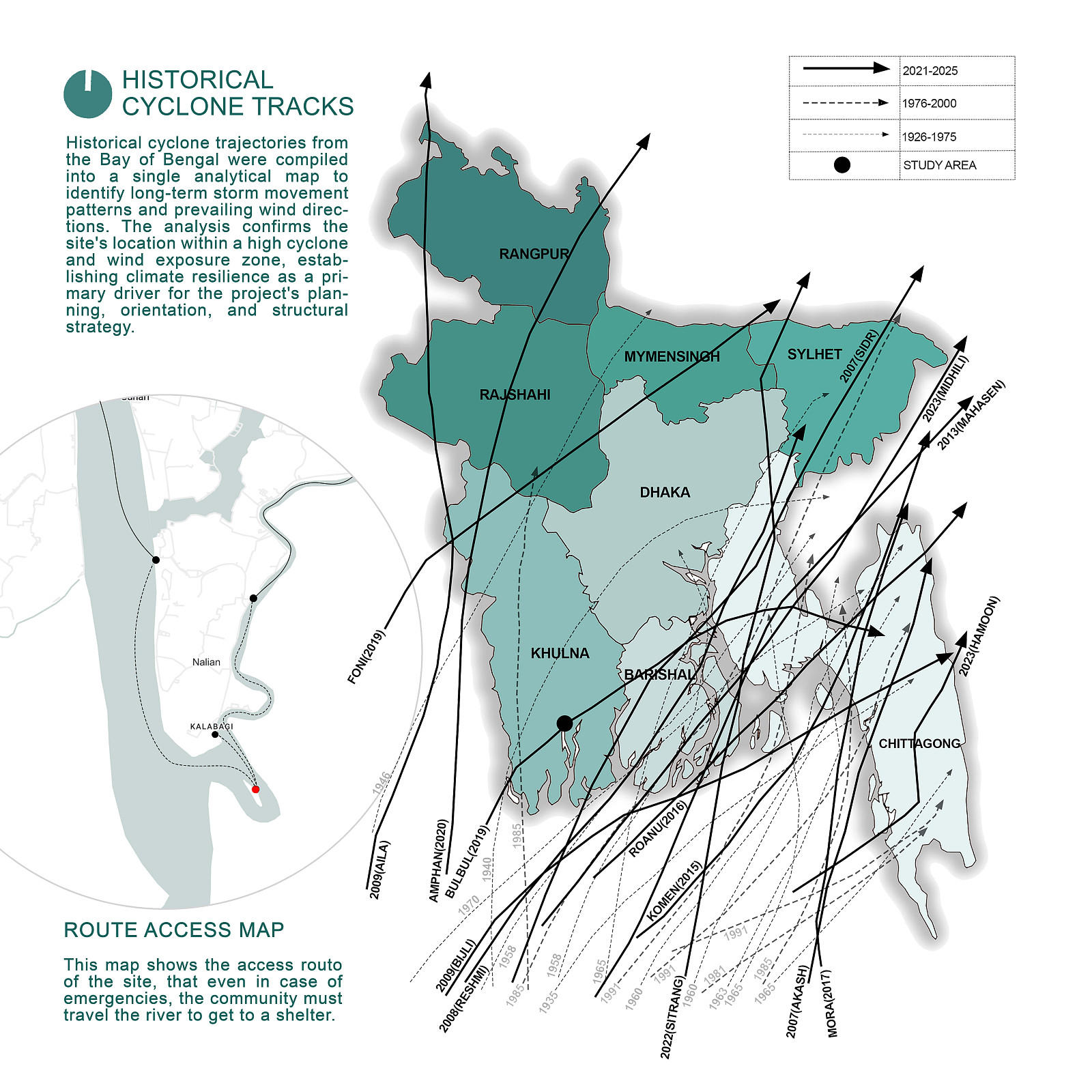
Predictive Settlement Planning With Help of Machine Learning : Settlement expansion and infrastructure placement are guided by a GIS-based erosion prediction model developed from historical land-loss analysis, hydrological data, and observed shoreline migration patterns. This framework identifies safer development zones and reduces future exposure to erosion hazards.
Settlement Structure : The masterplan organizes development into interconnected residential clusters positioned around communal spaces and essential facilities. The layout preserves existing social relationships while improving accessibility, disaster response, and future expansion capacity. Primary circulation routes maintain connectivity between housing areas, public facilities, waterfront infrastructure, and evacuation points.
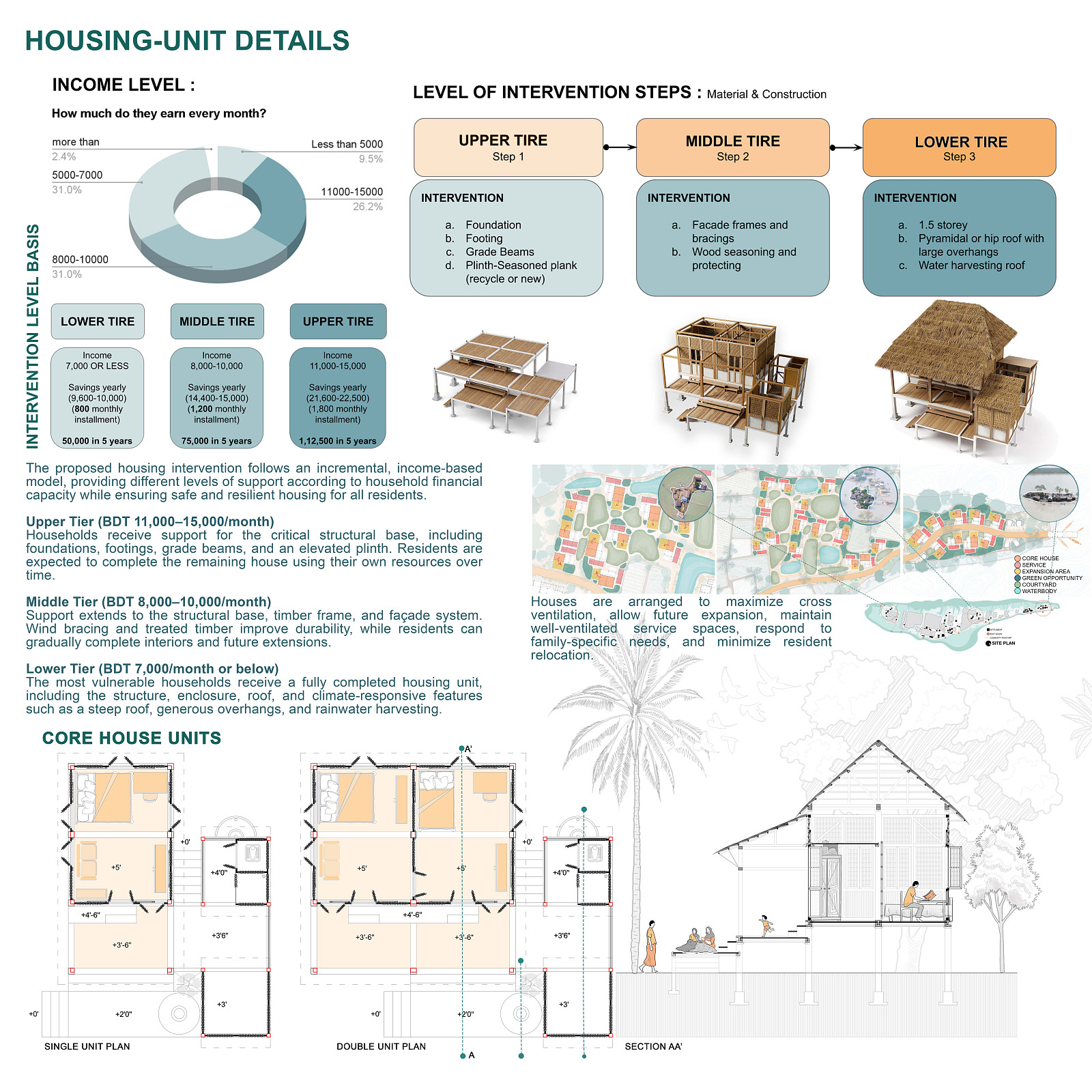
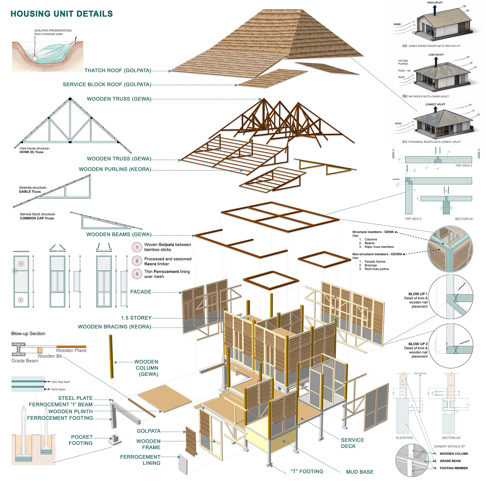
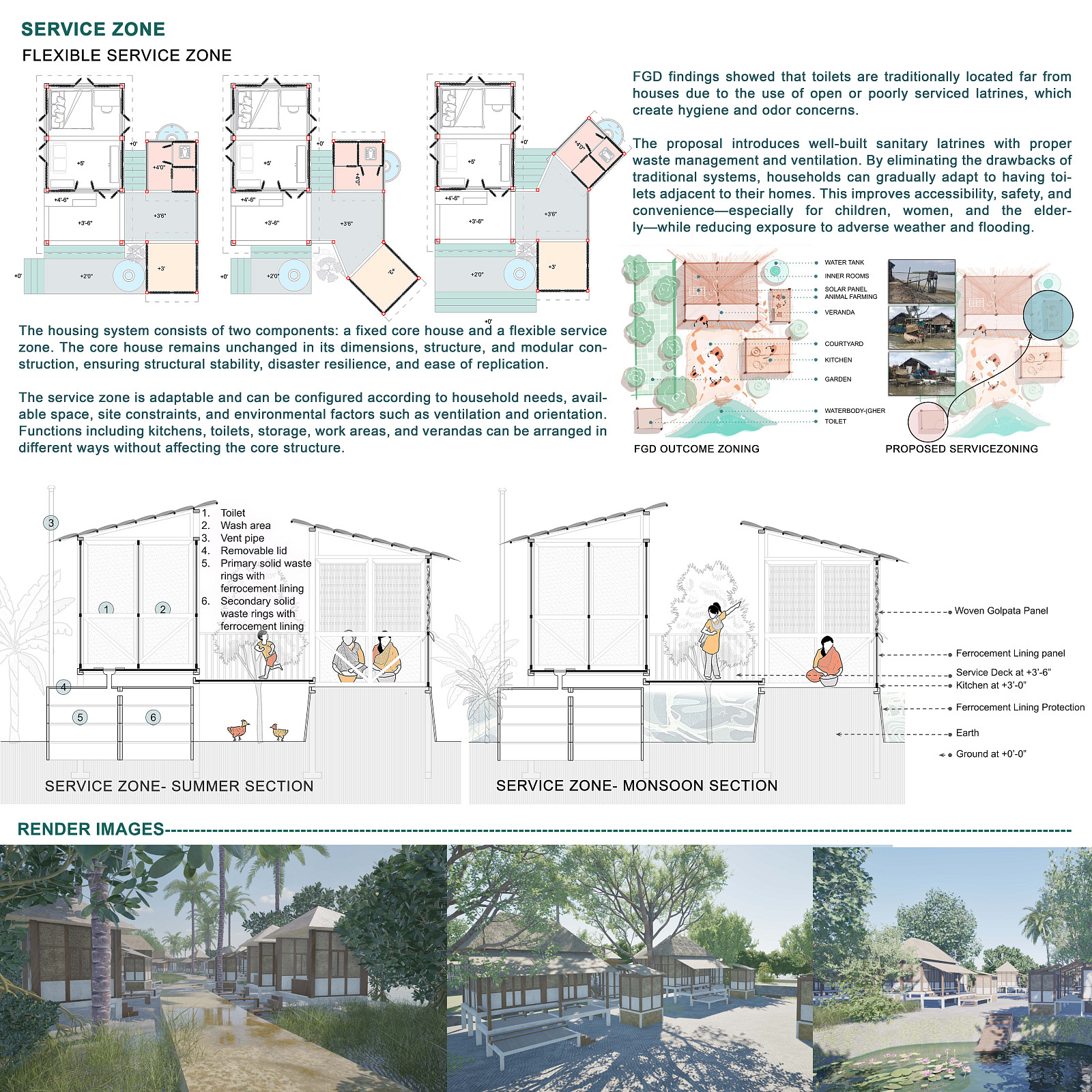
Housing System : The housing strategy follows an incremental development model based on household income levels. Construction support ranges from foundation-only assistance for higher-income households to fully completed units for economically vulnerable families.
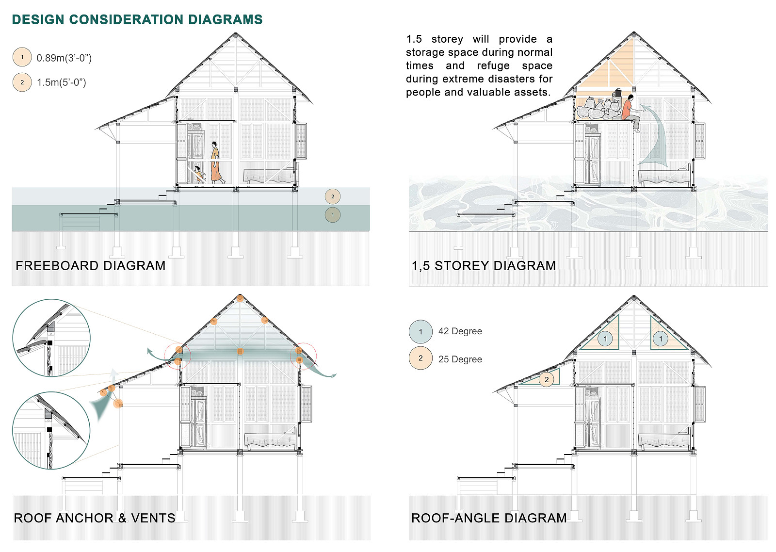
Housing prototypes incorporate: Elevated flood-resistant plinths , Modular structural systems , Wind-resistant forms , Naturally ventilated layouts , Locally available materials , Expandable building configurations . Steep pyramidal and hip roofs are utilized to reduce wind uplift during cyclones while improving rainwater collection efficiency.
Community Infrastructure : Public facilities such as the multipurpose cyclone shelter is designed as multi-functional structures capable of supporting daily activities and emergency operations. The proposed mosque, Bonobibi temple, Eco Lounge, and boat station serve social, cultural, economic, and disaster-response functions simultaneously, increasing overall settlement resilience.
Water Infrastructure : The water management system utilizes decentralized rainwater harvesting integrated into individual housing units and community facilities. Collected rainwater is stored locally to provide potable water throughout the year and reduce dependence on saline surface water sources.
Renewable Energy Infrastructure : Solar-energy systems are distributed throughout the settlement to support household and community-level electricity demands. The decentralized approach increases energy security during post-disaster periods and reduces dependence on external power networks.
Livelihood Infrastructure : Economic activities are embedded within the settlement framework through fishing infrastructure, fish storage facilities, tourism services, retail spaces, productive landscapes, and forest-resource-based enterprises. This integrated approach strengthens economic resilience and reduces dependence on a single livelihood source.
Adaptability and Replicability : All interventions are designed as incremental systems capable of adapting to future environmental change. The framework allows phased implementation, community participation, and future expansion without disrupting existing settlement patterns. While developed specifically for Jhulonto Para, the model can be applied to other climate-vulnerable coastal and riverine settlements facing similar environmental challenges.
Copyright © 2026 INSPIRELI | All rights reserved. Use of this website signifies your agreement to the Terms of Use, Privacy Policy, and use of cookies.