SYNERGY |Multi-scale Urban Mobility Project, Intermodal Transport Hub, and Metropolitan Cultural Center


Project idea
Faced with the fragmented growth and inefficient public transport system of the Tucumán Metropolitan Area (AMeT) —where obsolete railway infrastructures operate as urban scars and barriers of inequality— the "SINERGIA" project is born.
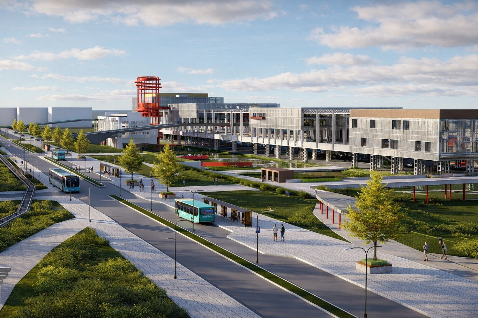
This proposal resignifies the disused railway land to reintroduce it as the great structural axis of the territory, capable of dignifying the citizen's experience. Through the paradigm of circular urbanism, "SYNERGY" operates as a democratic and connective catalyst at a regional, metropolitan, and urban scale. The architectural design resolves the fundamental paradox of contemporary mobility: articulating symbiotically the high speed of transit infrastructures with the pause of public space, transforming metropolitan flow into a pedestrian, playful, and sensory promenade of human scale.
Project description
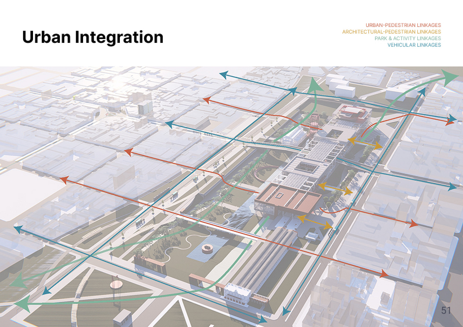
The Reactivator Concept proposes a roadmap toward a new model of interjurisdictional, intermodal, and integrated mobility. Under the paradigm of a circular and democratized urbanism, it coordinates multiple modes of transportation and addresses the sector's environmental challenges, such as the scarcity of green areas and recurrent flooding. By revitalizing the built heritage and guaranteeing access to high-quality public spaces where an urban barrier currently stands, the intervention deploys its objectives through three deeply interconnected, key dimensions.
First, 1. The "Mobility and Connectivity Axis" structures an integral transportation network that articulates a trunk or master system with feeder lines and a qualified network for cyclists and pedestrians, prioritizing flow hierarchy and the rehabilitation of the existing road and rail infrastructure.
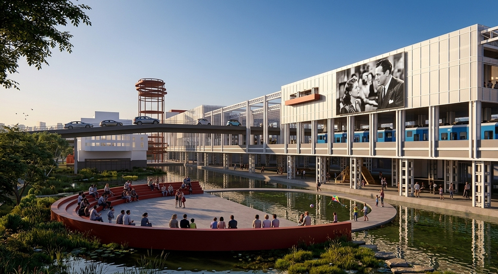
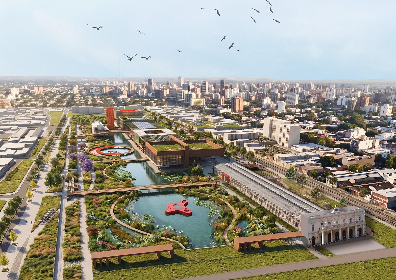
Second, 2. The "Urban Development and Landscape Axis" consolidates a green corridor that promotes a mix of uses and ensures spatial transparency thanks to a network of collective activities that fosters civic coexistence through culture, commerce, and services. At the landscape level, it conceives an "Urban Park" that leverages the natural depression of the terrain, transforming the topography into the ideal support to channel stormwater flows. Faced with the floods that paralyze downtown Tucumán, the project converts this threat into an opportunity through a "Controlled Flooding Strategy," transforming the environment into a dynamic ecosystem capable of boosting biodiversity and diversifying the use of space with recreational activities that change according to the season.
Third, 3. The "Architectural Dimension" materializes in the "Intermodal Transportation and Culture Hub," which rejects the traditional central station model as a closed and segregating volume, establishing itself instead as a dynamic "Common Ground" that dissolves the material boundaries of traditional infrastructure to offer an area of shelter, encounter, and collective invitation.
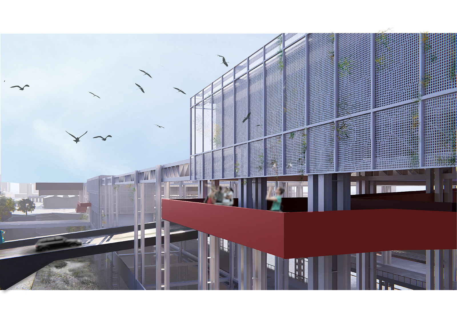
The architectural design choice adopts a "Bar Typology"—a longitudinal morphology designed to contain the platforms and adapt rationally to the geometric configuration of the site. Guided by the "Theory of the Void," the building's conception strategically fragments this bar both horizontally and vertically, understanding that these openings are not residual spaces but urban connectors that generate new pedestrian flows, ensure the continuity of the city fabric, and shelter covered spaces with activities beneath the station. In this regard, the structure weaves a remarkable dialogue with its surroundings by acting as a large-scale containment structure that absorbs a pre-existing road bridge that literally traverses its interior. In response to the historical context, the project establishes a relationship of absolute respect with the old railway station through a "Dry Plaza" that generates a fluid transition between the past and modernity, while an articulating vertical element called the "Circular Pavilion" reinterprets the former water tank, erecting a new visual landmark in the landscape. This entire proposal is stitched together through an "Urban and Programmatic Stitching Strategy" where, across a rigorous system of points, lines, and surfaces, the architecture establishes a rhythmic visual code that unifies the ground, the landscape, and the tectonic elements of the hub, under the premise that wherever color finds expression, a public activity awakens, opening a direct gateway toward the activation of collective space.
Technical information
The project is implemented through a topographic operation of excavation and containment, leveraging the natural depression of the railway terrain to consolidate a large public ground plane covered beneath the station. Structurally, the longitudinal "bar" morphology is resolved using a system of large high-strength structural steel Vierendeel beams, which allow for wide spans over the platforms and transportation hubs without the need for continuous intermediate supports. This tectonic logic of industrialized steel members facilitates dry assembly and establishes a material dialogue with the site’s railway and built heritage.
In terms of environmental and water engineering, the project functions as a resilient blue-green infrastructure. A sustainable urban drainage system (SUDS) is integrated into the landscape of the urban park, designed under a controlled flooding strategy.
Documentation


Copyright © 2026 INSPIRELI | All rights reserved. Use of this website signifies your agreement to the Terms of Use, Privacy Policy, and use of cookies.