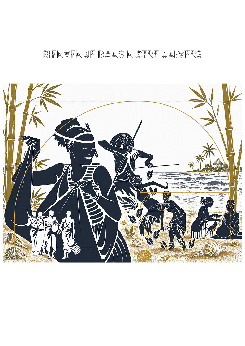
La baie des coquillages
Project idea
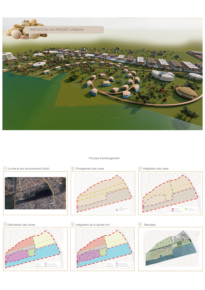
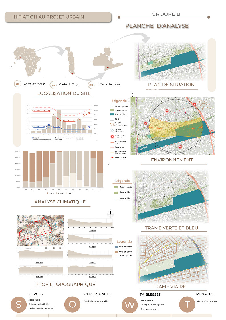
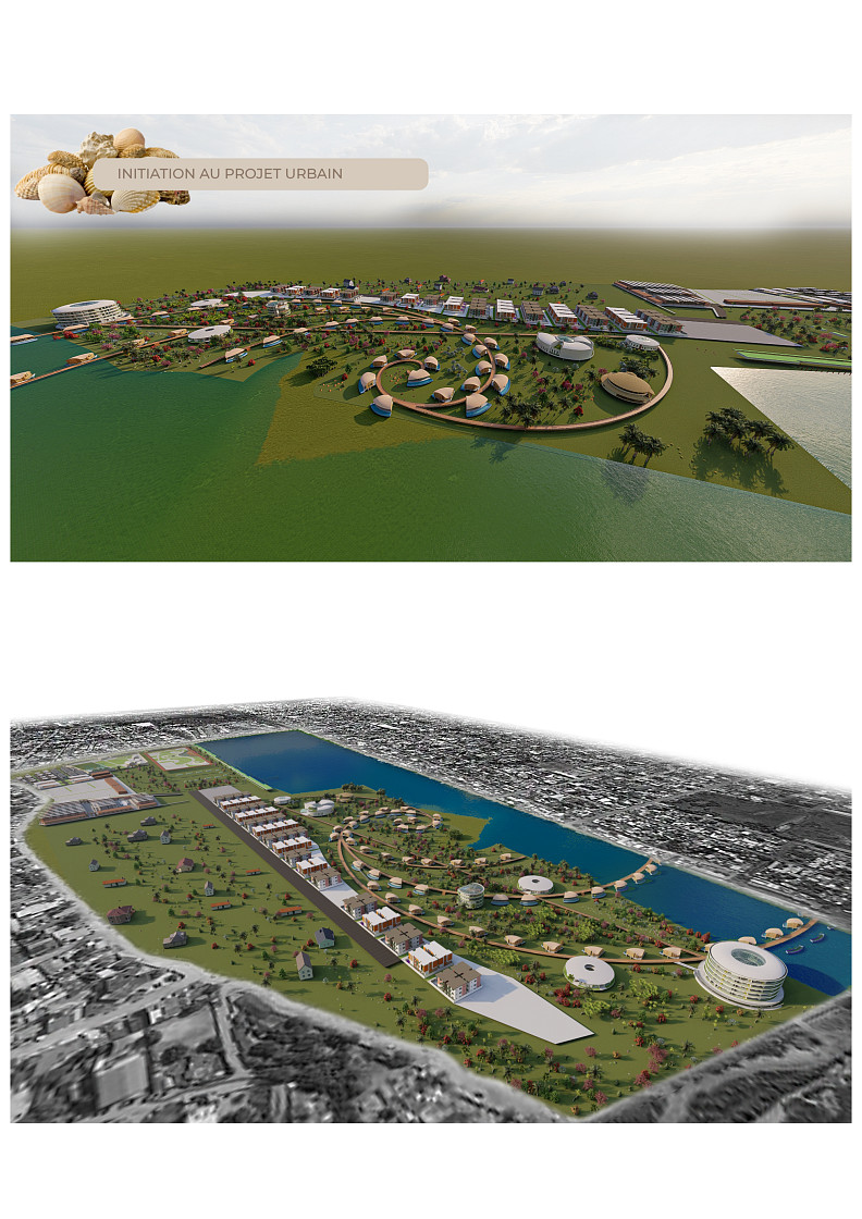
Located in the Boka (Kodomé) neighborhood, Golfe 4 Municipality, Lomé, Togo, bounded to the west by the Ghana border, to the east by Rue de la Libération, to the north by Rue Mayama, and to the south by Rue des Malvacées, this site hosts an underutilized retention basin subject to illegal dumping and devoid of functional amenities that nonetheless represents an exceptional urban and ecological potential. Faced with the rapid urbanization of Lomé and the growing challenges of water management, environmental resilience, and the quality of public spaces, this project proposes a radical transformation of the relationship between the city and water: the basin is no longer perceived as a mere residual hydraulic infrastructure, but is reinvented as the structuring ecological core of a new urban centrality, combining climate resilience, biodiversity, local economy, tourism, culture, and quality public spaces. The fundamental ambition is to demonstrate that a hydraulic brownfield can, through a rigorous and integrated approach, simultaneously become a flood prevention tool, a driver of local economic development, a space for social cohesion, and an exceptional living environment thus building an innovative model of sustainable development directly adapted to the realities of 21st-century African coastal cities.
Project description
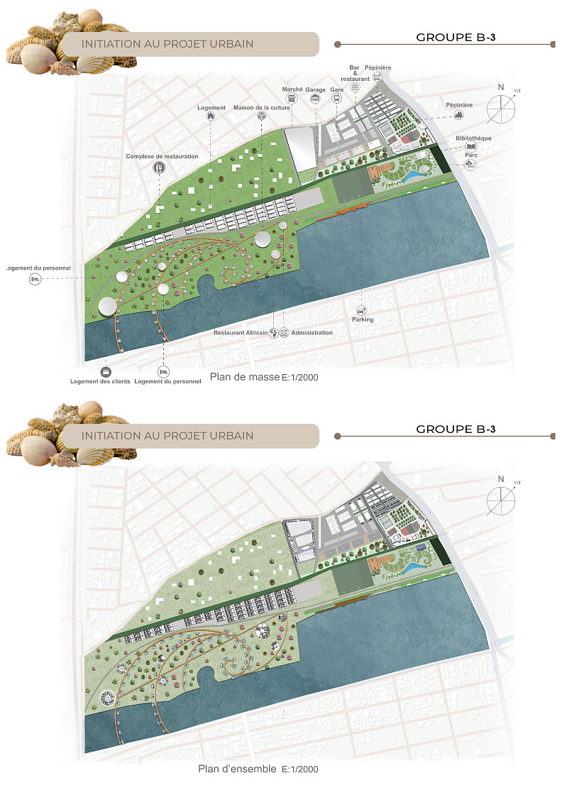
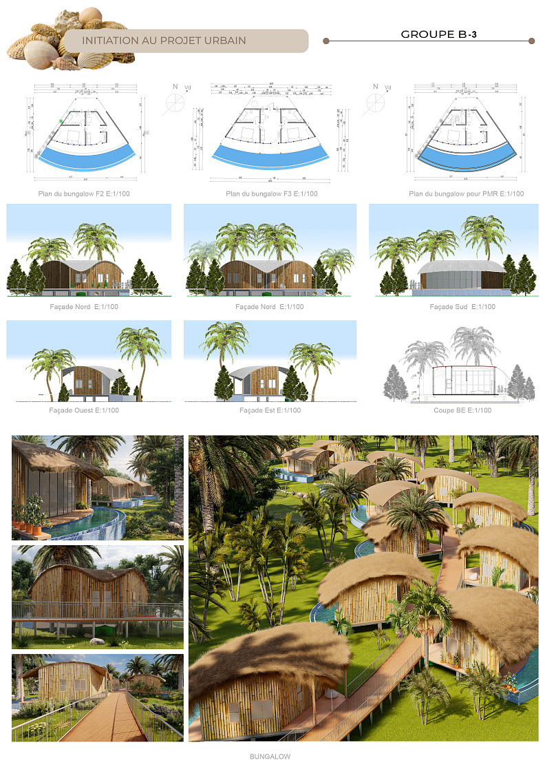
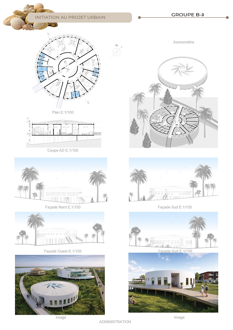
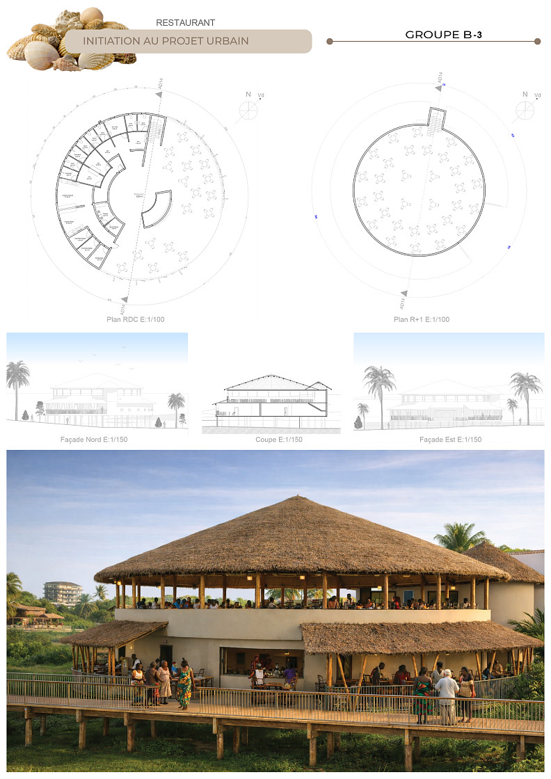
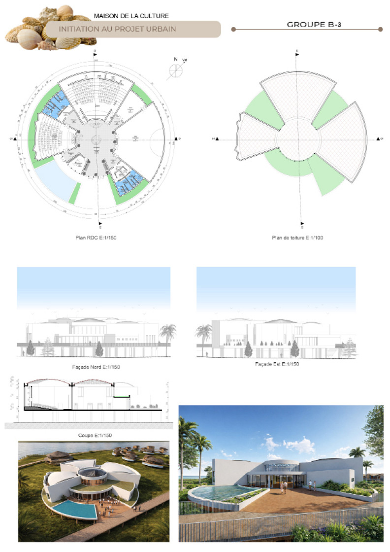
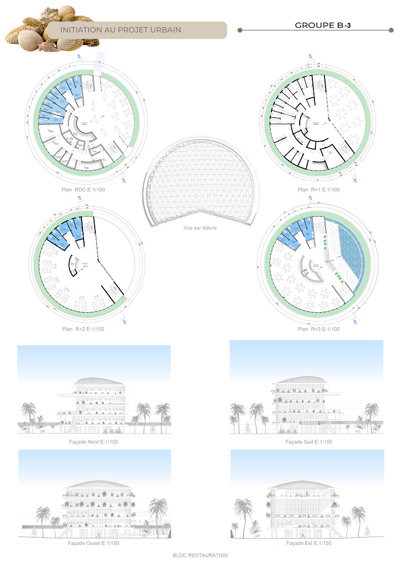
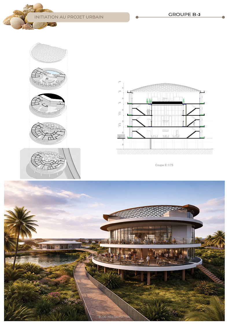
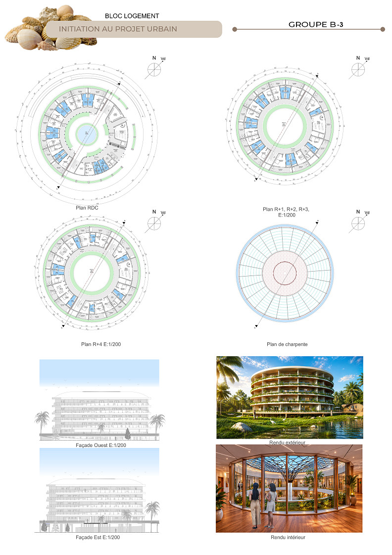
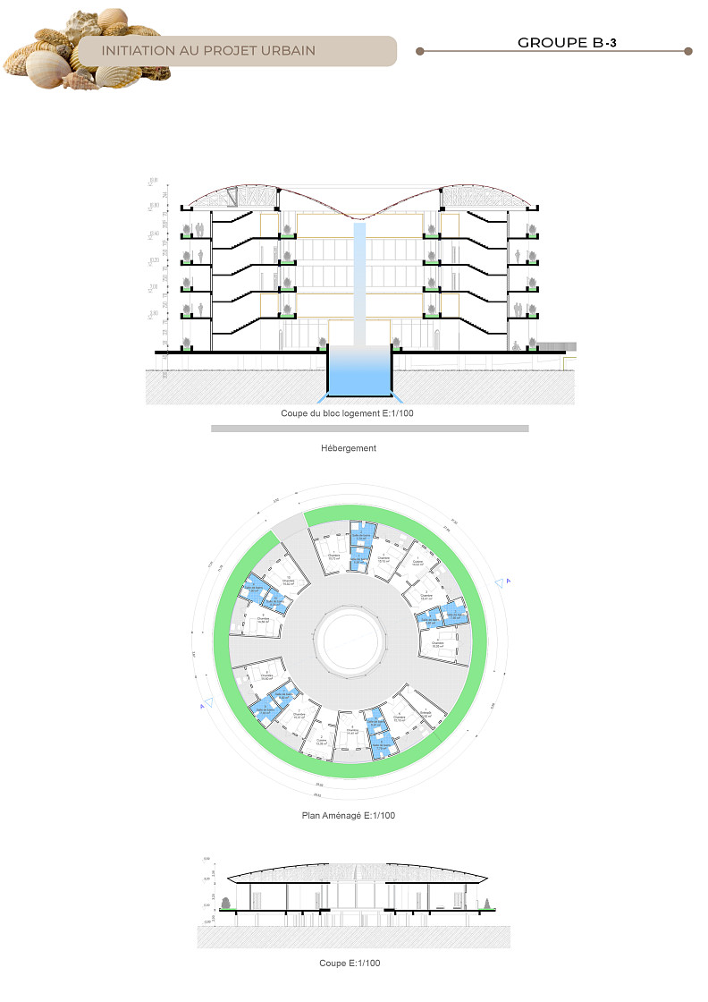
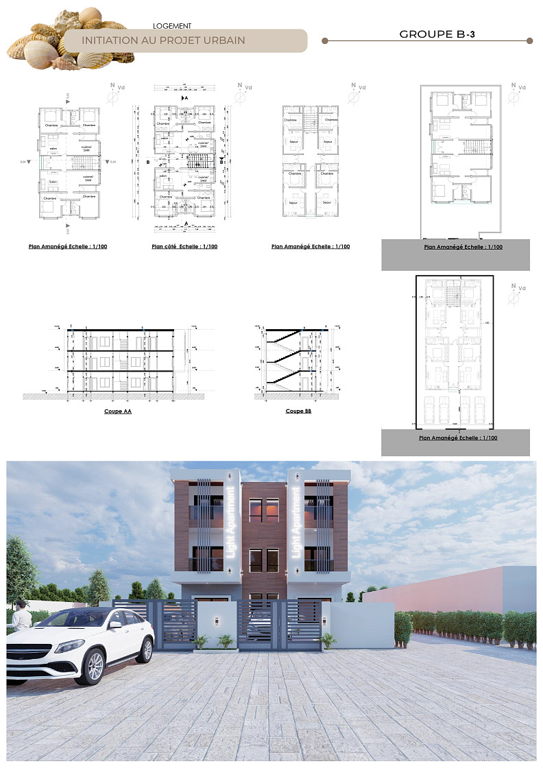
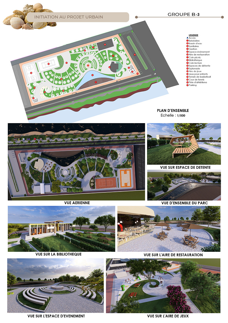
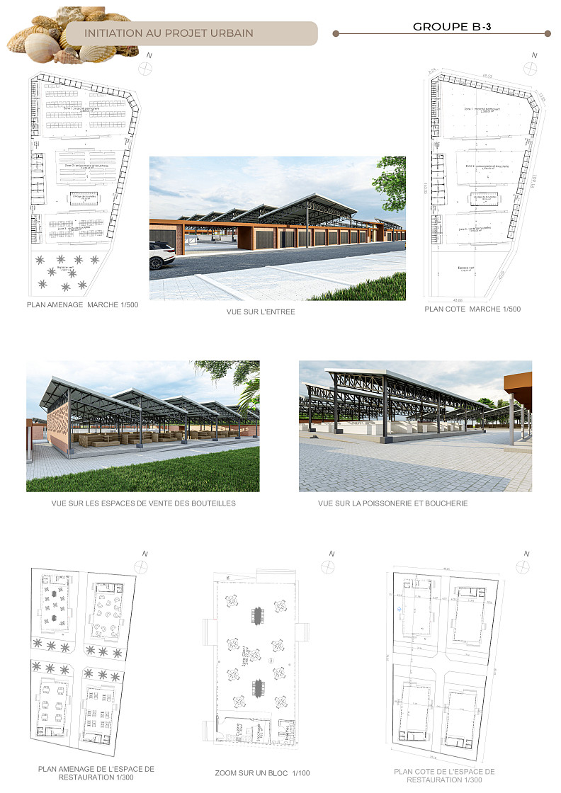
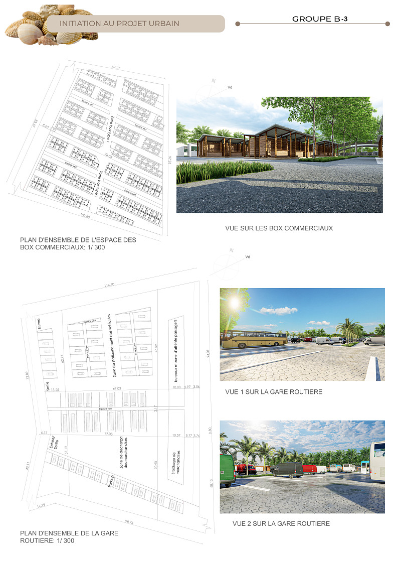
Located at the heart of the Boka neighborhood, at the intersection of Moyama, Méduses, Kouka streets and Avenue de la Victoire, the project benefits from a strategic location at the crossroads of strong urban dynamics, accessible from the bus station and in close proximity to the EPP Lomé Ouest school and the local market. The intervention is organized around three complementary functional bands: the ecological band, directly in contact with the water body, ensures the maintenance and optimization of the basin's hydraulic capacity through controlled rewilding of the banks, wetland-adapted plantings, preservation of ecological continuities and natural flows, complemented by a nautical pole with a landing stage, access quay, and water discovery activities, as well as stilt walkways offering an immersive experience of the lagoon landscape; the landscape band, developed on the site's natural slopes, enhances the topography through light terraces, natural viewpoints, and landscaped tiers, and hosts the urban park relaxation areas, landscaped gardens, children's playgrounds, public library as well as the environmental and educational pole comprising an urban nursery, an environmental awareness center, and demonstration gardens; the social uses band, on the periphery of the site, concentrates economic, residential, and tourism functions with a waterfront shopping gallery, a neighborhood market, local shops, a residential area, and the hotel and tourism complex the true engine of the project's attractiveness comprising family bungalows on stilts in F2 and F3 configurations, a collective hotel building, a restaurant showcasing local gastronomy, a cultural center, a dining building with a panoramic rooftop and rooftop swimming pool, an administrative building, maintenance services, dedicated staff accommodation, and parking areas. All facilities and spaces across the entire site are fully accessible to people with reduced mobility, through a continuous network of adapted-width pedestrian pathways, building access ramps, level stilt walkways over the water, and PRM sanitary facilities distributed throughout, ensuring fluid connections between all the project's atmospheres and the surrounding neighborhoods.
Technical information
The project is a mixed-use urban and ecological regeneration operation integrating the functions of stormwater management, housing, commerce, tourism, culture, leisure, environmental education, nautical services, and public spaces. The site diagnosis revealed hydromorphic soil requiring stilt foundations and permeable materials, a marked and irregular slope topography favoring rapid water runoff, dominant harmattan and monsoon winds harnessed for natural ventilation, and a SWOT analysis identifying accessibility and landscape potential as main strengths against flood risk and urban pressure as major threats. The environmental approach is based on the full preservation and optimization of the stormwater retention function, Nature-Based Solutions (NbS), Water Sensitive Urban Design (WSUD), Sponge City principles, controlled rewilding of the banks, preservation of ecological continuities, use of permeable surfaces to enhance water absorption, and urban heat island reduction through vegetation and water presence. The choice of materials reflects a strong commitment to local rootedness, sustainability, and adaptation to the site's hydrological and climatic constraints: timber is the dominant material of the project, used for roof frameworks, stilts, walkways over the water, bungalows, joinery and openings, pergolas, and the lightweight structures of public spaces, giving the entire project a warm, natural identity deeply rooted in local construction traditions; thatch and woven raffia clad the roofs and walls of the bungalows, reinforcing the landscape integration and vernacular identity of the tourism complex while providing natural thermal comfort adapted to the tropical coastal climate; reinforced concrete is used for structures requiring robustness and durability, including residential buildings, the administrative building, the restaurant, the rooftop dining building, and hydraulic infrastructures; finally, steel completes the material palette for long-span load-bearing structures in the most imposing buildings, such as the cultural center and the collective hotel building, enabling open, bright, and generous interior spaces. Architectural strategies prioritize stilt buildings to respect flood zones and preserve natural water flows, lightweight construction with demountable furniture and airy structures, cross natural ventilation, optimized natural lighting, and bioclimatic architecture fully adapted to Lomé's climatic conditions. Mobility is ensured through a main pathway network in stabilized laterite, universal PRM accessibility throughout all lanes and walkways, stilt walkways over the water surface, secondary paths connecting the different atmospheres of the site, and fluid connections with surrounding neighborhoods and existing public facilities, in strict compliance with flood zone regulations, environmental and social sustainability standards, and safety requirements for all users.
Thomas NENET, Alexis Carel TAKAM DONGMO, Clément GAMLONA DABIDJOUM, Loïce YANKIMADJI NGABA, Jean Dorgeles TAH BI
Ecole Africaine des Métiers d'Architecture et d'Urbanisme (EAMAU) a Lomé (Togo)
Gabon
Design urbano
Projeto submetido
25. 06. 2026Etiqueta
- Apartment
- Multi Unit Housing
- Private House
- Student Housing
Conselho a estudantes
Copyright © 2026 INSPIRELI | All rights reserved. Use of this website signifies your agreement to the Terms of Use, Privacy Policy, and use of cookies.
